Chest opened
+${chestReward.xp} XP
Explorer
NOUVEAU ×${chestReward.collectible.quantity}
tapez pour fermer
Chest locked

Open chests in the app

Around Us is built for your phone — chests unlock when you walk, explore and capture nearby places.

Enable Location

We need your location to show you interesting places around you

Discover nearby places

Find interesting locations and hidden gems around you

Precise directions

Get accurate directions and distances to places

Your location is never shared with other users. It's only used when you tap the location button.

Log in to your account

Start exploring — it's free

Trusted by 72,894 travelers worldwide

Continue with Google
Continue with Apple
or

We will send you a code to connect

By continuing, you accept our Terms and Conditions and our Privacy Policy

Check your inbox

We've sent a pincode in your inbox. Please enter the code below.

Hoffman Memorial State Wayside
Discussion Reviews Photo
1.6k Popularity

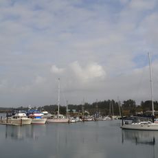
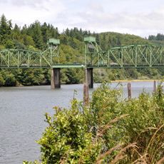
Hoffman Memorial State Wayside, State park and rest area in Coos County, Oregon, United States.

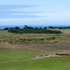
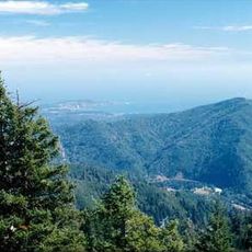
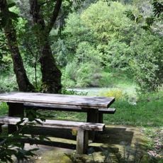
Hoffman Memorial State Wayside is a state park and rest stop near Coos Bay with shaded forest areas. The site features myrtlewood trees and open spaces designed for visitors to rest and enjoy outdoor surroundings without formal facilities.

The land was donated to Oregon in 1948 by the heirs of Henrietta Hoffman. This gift established the park as a permanent public space for the Coos County area.

The park's name honors a family that donated the land, showing how local individuals shaped public spaces. The shaded grove serves as a quiet gathering spot where visitors escape the busier coastal areas nearby.

Bring your own drinking water since none is available at the site. Visit on dry days to easily walk the shaded paths and rest areas without muddy conditions.

The myrtlewood trees here are relatives of bay laurel and their leaves can replace bay leaves in cooking. Most visitors overlook this practical use of a tree that grows naturally at this location.

The community of curious travelers

AroundUs brings together thousands of curated places, local tips, and hidden gems, enriched daily by 60,000 contributors worldwide.

Start exploring
Location
GPS coordinates
43.03620,-124.11800
Latest update
December 14, 2025 13:03
Around this place
Bandon Dunes Golf Resort
United States of America

Bandon Dunes Golf Resort

27.8 km
Face Rock State Scenic Viewpoint
United States of America

Face Rock State Scenic Viewpoint

26.9 km
Bullards Beach State Park
United States of America

Bullards Beach State Park

27.2 km
Coquille River Lighthouse
United States of America

Coquille River Lighthouse

26.7 km
West Coast Game Park Safari
United States of America

West Coast Game Park Safari

24.4 km
Grassy Knob Wilderness
United States of America

Grassy Knob Wilderness

37 km
Bandon Marsh National Wildlife Refuge
United States of America

Bandon Marsh National Wildlife Refuge

25.6 km
Bandon State Natural Area
United States of America

Bandon State Natural Area

25.9 km
Coquille Myrtle Grove State Natural Site
United States of America

Coquille Myrtle Grove State Natural Site

8.3 km
Face Rock Viewpoint
United States of America

Face Rock Viewpoint

26.8 km
Bullards Bridge
United States of America

Bullards Bridge

25.8 km
Bullards Beach State Park

Bullards Beach State Park

26.9 km
Cape Arago State Park
United States of America

Cape Arago State Park

37.4 km
Bandon Senior High School
United States of America

Bandon Senior High School

26.1 km
Sandy Creek Bridge
United States of America

Sandy Creek Bridge

18.7 km
Port of Bandon
United States of America

Port of Bandon

26 km
Coos County Logging Museum
United States of America

Coos County Logging Museum

3.6 km
St. James Episcopal Church
United States of America

St. James Episcopal Church

16.6 km
Devils Kitchen
United States of America

Devils Kitchen

26.2 km
Washed Ashore Gallery & Volunteer Workshop
United States of America

Washed Ashore Gallery & Volunteer Workshop

26 km
Bandon Beach
United States of America

Bandon Beach

26.7 km
Merchants Beach
United States of America

Merchants Beach

31.5 km
Bandon Historical Society Museum
United States of America

Bandon Historical Society Museum

25.4 km
Something Awesome
United States of America

Something Awesome

24.2 km
Whisky Run Beach
United States of America

Whisky Run Beach

29.8 km
Chandler Bridge
United States of America

Chandler Bridge

36.8 km
First National Bank of Bandon
United States of America

First National Bank of Bandon

25.8 km
Sacchi Beach
United States of America

Sacchi Beach

33.3 km
Show the full map
Reviews
Share your experience

No review yet

Discussions
Start a discussion...

No discussion yet

« Hoffman Memorial State Wayside - State park and rest area in Coos County, Oregon, United States » is provided by Around Us (aroundus.com). Images and texts are derived from Wikimedia project under a Creative Commons license. You are allowed to copy, distribute, and modify copies of this page, under the conditions set by the license, as long as this note is clearly visible.

Discover hidden gems everywhere you go!

From secret cafés to breathtaking viewpoints, skip the crowded tourist spots and find places that match your style. Our app makes it easy with voice search, smart filtering, route optimization, and insider tips from travelers worldwide. Download now for the complete mobile experience.

Around Us App Screenshot

A unique approach to discovering new places

Le Figaro

All the places worth exploring

France Info

A tailor-made excursion in just a few clicks

20 Minutes

Around Us
Travel Guide & Maps
Download

Send to your phone

QR Code
1

Open the camera app on your mobile.

2

Point at the QR code with your camera. A notification will appear.

3

Tap the notification to open the link.