Enable Location

We need your location to show you interesting places around you

Discover nearby places

Find interesting locations and hidden gems around you

Precise directions

Get accurate directions and distances to places

Your location is never shared with other users. It's only used when you tap the location button.

Kelley Point Park

Log in to your account

Start exploring — it's free

Trusted by 64,792 travelers worldwide

Continue with Google
Continue with Apple
or

We will send you a code to connect

By continuing, you accept our Terms and Conditions and our Privacy Policy

Check your inbox

We've sent a pincode in your inbox. Please enter the code below.

Kelley Point Park
Discussion Reviews 1 Photos
5k Popularity

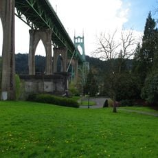
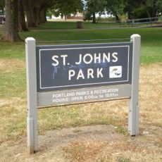
Kelley Point Park, Urban park at Columbia and Willamette Rivers confluence, Portland, US

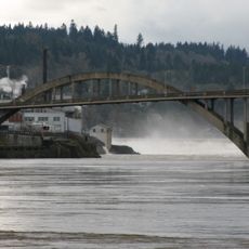
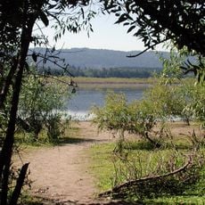
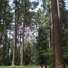
Kelley Point Park is an urban park at the northern tip of Portland, Oregon, located exactly where the Columbia River and the Willamette River meet. The grounds are covered with native black cottonwood trees, and several viewpoints along the bank give a clear view of the two rivers flowing together.

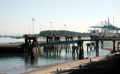
During the 20th century, the site was managed by the Port of Portland and used to deposit material dredged from the rivers. In 1984, the land was converted into a public park open to everyone.

The park takes its name from Hall Jackson Kelley, an early American promoter who campaigned for settlement in Oregon during the 19th century. Visitors today experience the place mostly through its natural setting, where the two rivers meeting at the edge of the city create a sense of arrival or departure that feels unlike any other spot in Portland.

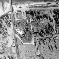
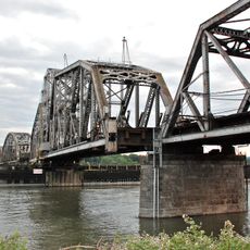
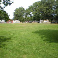
The park sits at the northern edge of Portland and is reached by driving through industrial areas, so arriving by car is the most practical option. Once inside, paved trails connect to Portland's 40-Mile Loop, and picnic areas with restroom facilities are spread across the grounds.

The precise point where the two rivers meet is actually located in the water, not on the shore, so what visitors see from the bank is an approximation of the true confluence. On calm days, the difference in color and speed between the two currents is visible on the surface of the water.

The community of curious travelers

AroundUs brings together thousands of curated places, local tips, and hidden gems, enriched daily by 60,000 contributors worldwide.

Start exploring
Location
Location
Inception
1984
GPS coordinates
45.64972,-122.76361
Latest update
March 3, 2026 08:15
Around this place
St. Johns Bridge
United States of America

St. Johns Bridge

7.2 km
Course of the Willamette River
United States of America

Course of the Willamette River

359 m
Jantzen Beach
United States of America

Jantzen Beach

7.6 km
Burlington Northern Railroad Bridge 9.6
United States of America

Burlington Northern Railroad Bridge 9.6

6.3 km
Smith and Bybee Wetlands Natural Area
United States of America

Smith and Bybee Wetlands Natural Area

3.8 km
Esther Short Park
United States of America

Esther Short Park

7.4 km
St. Johns Twin Cinemas & Pub
United States of America

St. Johns Twin Cinemas & Pub

6.6 km
Wapato Bridge
United States of America

Wapato Bridge

4.7 km
Cathedral Park
United States of America

Cathedral Park

7 km
National Cash Register Building
United States of America

National Cash Register Building

6.9 km
Oregon Slough Railroad Bridge
United States of America

Oregon Slough Railroad Bridge

6.2 km
Kiggins Theatre
United States of America

Kiggins Theatre

7.6 km
Clark County Historical Museum
United States of America

Clark County Historical Museum

7.4 km
Pier Park
United States of America

Pier Park

5.2 km
Slocum House
United States of America

Slocum House

7.2 km
Bybee–Howell House
United States of America

Bybee–Howell House

4.4 km
St. Johns City Hall
United States of America

St. Johns City Hall

6.8 km
The Pioneer Mother Memorial
United States of America

The Pioneer Mother Memorial

7.3 km
St. Johns Library
United States of America

St. Johns Library

6.7 km
Hidden Houses
United States of America

Hidden Houses

7.5 km
Salmon Run Bell Tower
United States of America

Salmon Run Bell Tower

7.4 km
Willamette River Light
United States of America

Willamette River Light

369 m
St. Johns Park
United States of America

St. Johns Park

6.4 km
George Park
United States of America

George Park

6.5 km
Vancouver Telephone Building
United States of America

Vancouver Telephone Building

7.5 km
Clark County Courthouse
United States of America

Clark County Courthouse

7 km
Schrunk Riverview Tower
United States of America

Schrunk Riverview Tower

6.6 km
St. Johns Library
United States of America

St. Johns Library

6.7 km
Show the full map
Reviews
Share your experience

No review yet

Discussions
Start a discussion...

No discussion yet

« Kelley Point Park - Urban park at Columbia and Willamette Rivers confluence, Portland, US » is provided by Around Us (aroundus.com). Images and texts are derived from Wikimedia project under a Creative Commons license. You are allowed to copy, distribute, and modify copies of this page, under the conditions set by the license, as long as this note is clearly visible.

Discover hidden gems everywhere you go!

From secret cafés to breathtaking viewpoints, skip the crowded tourist spots and find places that match your style. Our app makes it easy with voice search, smart filtering, route optimization, and insider tips from travelers worldwide. Download now for the complete mobile experience.

Around Us App Screenshot

A unique approach to discovering new places

Le Figaro

All the places worth exploring

France Info

A tailor-made excursion in just a few clicks

20 Minutes

Around Us
Travel Guide & Maps
Download

Send to your phone

QR Code
1

Open the camera app on your mobile.

2

Point at the QR code with your camera. A notification will appear.

3

Tap the notification to open the link.