Chest opened
+${chestReward.xp} XP
Explorer
NOUVEAU ×${chestReward.collectible.quantity}
tapez pour fermer
Chest locked

Open chests in the app

Around Us is built for your phone — chests unlock when you walk, explore and capture nearby places.

Enable Location

We need your location to show you interesting places around you

Discover nearby places

Find interesting locations and hidden gems around you

Precise directions

Get accurate directions and distances to places

Your location is never shared with other users. It's only used when you tap the location button.

Log in to your account

Start exploring — it's free

Trusted by 72,974 travelers worldwide

Continue with Google
Continue with Apple
or

We will send you a code to connect

By continuing, you accept our Terms and Conditions and our Privacy Policy

Check your inbox

We've sent a pincode in your inbox. Please enter the code below.

Willamette River Greenway
Discussion Reviews Photo
1.9k Popularity

Willamette River Greenway, Recreational greenway along Willamette River in Oregon, United States.

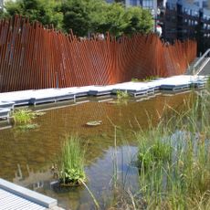
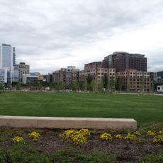
The Willamette River Greenway is a recreational protected corridor that stretches roughly 250 kilometers from the south to Portland, linking different habitats with many access points to the river. The corridor features varied landscapes including forests, meadows, and river banks where visitors can hike, fish, and paddle.

The idea for this corridor began in the 1960s when conservation efforts started to protect the river banks from development. These early efforts led to a broader protection program that shaped how the river and its surroundings are managed today.

The greenway links communities together through shared recreational spaces and walking paths along the river while protecting native plants and wildlife. These connections allow people from different areas to explore the landscape on the same route.

Multiple access points allow visitors to choose their activities based on location, since each point offers different options for hiking, fishing, or boating. The best time to explore is the milder weather in spring and fall, when conditions for outdoor activities are most comfortable.

The corridor manages hundreds of separate land parcels, making it a fragmented yet cohesive network of natural spaces. This structure means visitors alternate between dense forested areas and more open landscapes as they move along the route.

The community of curious travelers

AroundUs brings together thousands of curated places, local tips, and hidden gems, enriched daily by 60,000 contributors worldwide.

Start exploring
Location
GPS coordinates
45.53135,-122.67871
Latest update
December 14, 2025 11:22
Around this place
Veterans Memorial Coliseum
United States of America

Veterans Memorial Coliseum

729 m
Lan Su Chinese Garden
United States of America

Lan Su Chinese Garden

770 m
Broadway Bridge
United States of America

Broadway Bridge

384 m
Lovejoy Columns
United States of America

Lovejoy Columns

668 m
Tanner Springs Park
United States of America

Tanner Springs Park

257 m
Cosmopolitan on the Park
United States of America

Cosmopolitan on the Park

278 m
Albers Brothers Milling Company
United States of America

Albers Brothers Milling Company

198 m
Artwall
United States of America

Artwall

256 m
Oregon Jewish Museum
United States of America

Oregon Jewish Museum

782 m
Oven and Shaker
United States of America

Oven and Shaker

778 m
Natural Capital Center
United States of America

Natural Capital Center

354 m
NV
United States of America

NV

419 m
The Fields Park
United States of America

The Fields Park

316 m
Otis Elevator Company Building
United States of America

Otis Elevator Company Building

711 m
Dirty Duck
United States of America

Dirty Duck

664 m
Tikitotmoniki Totems
United States of America

Tikitotmoniki Totems

375 m
Portland Buddhist Church
United States of America

Portland Buddhist Church

649 m
Canopy by Hilton Portland Pearl District
United States of America

Canopy by Hilton Portland Pearl District

565 m
Cairns
United States of America

Cairns

387 m
Block 17
United States of America

Block 17

332 m
Portland Thirteenth Avenue Historic District
United States of America

Portland Thirteenth Avenue Historic District

635 m
Lombard Automobile Buildings
United States of America

Lombard Automobile Buildings

781 m
G. G. Gerber Building
United States of America

G. G. Gerber Building

751 m
Metropolitan Condos
United States of America

Metropolitan Condos

259 m
Ballou & Wright Company Building
United States of America

Ballou & Wright Company Building

671 m
Campbell Townhouses
United States of America

Campbell Townhouses

763 m
Oregon Jewish Museum and Center for Holocaust Education
United States of America

Oregon Jewish Museum and Center for Holocaust Education

781 m
Kalberer Building
United States of America

Kalberer Building

756 m
Show the full map
Reviews
Share your experience

No review yet

Discussions
Start a discussion...

No discussion yet

« Willamette River Greenway - Recreational greenway along Willamette River in Oregon, United States » is provided by Around Us (aroundus.com). Images and texts are derived from Wikimedia project under a Creative Commons license. You are allowed to copy, distribute, and modify copies of this page, under the conditions set by the license, as long as this note is clearly visible.

Discover hidden gems everywhere you go!

From secret cafés to breathtaking viewpoints, skip the crowded tourist spots and find places that match your style. Our app makes it easy with voice search, smart filtering, route optimization, and insider tips from travelers worldwide. Download now for the complete mobile experience.

Around Us App Screenshot

A unique approach to discovering new places

Le Figaro

All the places worth exploring

France Info

A tailor-made excursion in just a few clicks

20 Minutes

Around Us
Travel Guide & Maps
Download

Send to your phone

QR Code
1

Open the camera app on your mobile.

2

Point at the QR code with your camera. A notification will appear.

3

Tap the notification to open the link.