Chest opened
+${chestReward.xp} XP
Explorer
NOUVEAU ×${chestReward.collectible.quantity}
tapez pour fermer
Chest locked

Open chests in the app

Around Us is built for your phone — chests unlock when you walk, explore and capture nearby places.

Enable Location

We need your location to show you interesting places around you

Discover nearby places

Find interesting locations and hidden gems around you

Precise directions

Get accurate directions and distances to places

Your location is never shared with other users. It's only used when you tap the location button.

Chehalis River

Log in to your account

Start exploring — it's free

Trusted by 72,889 travelers worldwide

Continue with Google
Continue with Apple
or

We will send you a code to connect

By continuing, you accept our Terms and Conditions and our Privacy Policy

Check your inbox

We've sent a pincode in your inbox. Please enter the code below.

Chehalis River
Discussion Reviews 1 Photos
8.7k Popularity

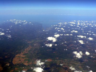
Chehalis River, River system in southwestern Washington, United States

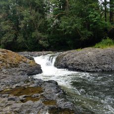
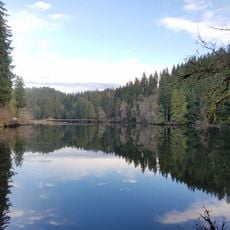
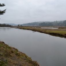
The Chehalis River is a river system in southwestern Washington that flows through forested hills and flat lowlands before reaching Grays Harbor on the Pacific coast. Several tributaries feed into it along the way, making it one of the larger river networks in the state.

Indigenous peoples, including the Chehalis tribe after whom the river is named, lived along its banks for centuries before European contact. When settlers arrived in the 19th century, they built towns and farms along the river, gradually changing how the land was used.

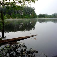
The river remains a place where local Native American tribes practice traditional fishing and hunting according to their treaty rights. These activities shape life along its banks and show how communities maintain their connection to the water.

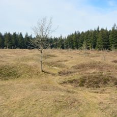
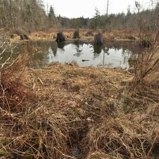
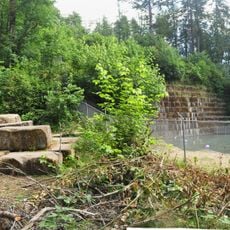
The river can be reached at several points along its course, making it easy to plan a visit around hiking, fishing, or bird watching. Water levels can rise quickly during the rainy season, so it is worth checking conditions before you go.

The Chehalis drains the largest self-contained watershed in Washington state, meaning all the water that falls within its basin stays within the system. This makes it hydrologically separate from neighboring river networks, which is unusual for a river of its size in the region.

The community of curious travelers

AroundUs brings together thousands of curated places, local tips, and hidden gems, enriched daily by 60,000 contributors worldwide.

Start exploring
GPS coordinates
46.81828,-123.25274
Latest update
March 3, 2026 08:19
Around this place
WNP-3 and WNP-5
United States of America

WNP-3 and WNP-5

22.7 km
Mima Mounds
United States of America

Mima Mounds

17.8 km
Millersylvania State Park
United States of America

Millersylvania State Park

27.8 km
Rainbow Falls State Park
United States of America

Rainbow Falls State Park

21.2 km
Capitol State Forest
United States of America

Capitol State Forest

15.4 km
Mima Mounds Natural Area Preserve
United States of America

Mima Mounds Natural Area Preserve

17.7 km
Lake Sylvia State Park
United States of America

Lake Sylvia State Park

32.7 km
United States of America

Summit Lake

28.8 km
Olympic Flight Museum
United States of America

Olympic Flight Museum

32.2 km
Claquato Church
United States of America

Claquato Church

26.3 km
Olympic Club Hotel
United States of America

Olympic Club Hotel

25.4 km
Northwest Cannabis Solutions Satsop facility
United States of America

Northwest Cannabis Solutions Satsop facility

23.2 km
Kennedy Creek Natural Area Preserve
United States of America

Kennedy Creek Natural Area Preserve

33.7 km
Capitol Peak
United States of America

Capitol Peak

19.2 km
Miller–Brewer House
United States of America

Miller–Brewer House

18.9 km
Scatter Creek Unit
United States of America

Scatter Creek Unit

18.8 km
Holy Cross Polish National Catholic Church
United States of America

Holy Cross Polish National Catholic Church

28.1 km
Mud Bay Indian Shaker Church
United States of America

Mud Bay Indian Shaker Church

32.4 km
Tenino Stone Company Quarry
United States of America

Tenino Stone Company Quarry

30.7 km
Tenino Downtown Historic District
United States of America

Tenino Downtown Historic District

30.8 km
Tumwater Methodist Church
United States of America

Tumwater Methodist Church

34.2 km
Gate School
United States of America

Gate School

9 km
Bear Track Landing Waterpark
United States of America

Bear Track Landing Waterpark

18.8 km
Satsop River Bridges
United States of America

Satsop River Bridges

27.3 km
Liberty Theater
United States of America

Liberty Theater

25.3 km
Elma Theater
United States of America

Elma Theater

23.8 km
Chehalis Theatre
United States of America

Chehalis Theatre

27.4 km
St. Helens Theatre
United States of America

St. Helens Theatre

27.5 km
Show the full map
Reviews
Share your experience

No review yet

Discussions
Start a discussion...

No discussion yet

« Chehalis River - River system in southwestern Washington, United States » is provided by Around Us (aroundus.com). Images and texts are derived from Wikimedia project under a Creative Commons license. You are allowed to copy, distribute, and modify copies of this page, under the conditions set by the license, as long as this note is clearly visible.

Discover hidden gems everywhere you go!

From secret cafés to breathtaking viewpoints, skip the crowded tourist spots and find places that match your style. Our app makes it easy with voice search, smart filtering, route optimization, and insider tips from travelers worldwide. Download now for the complete mobile experience.

Around Us App Screenshot

A unique approach to discovering new places

Le Figaro

All the places worth exploring

France Info

A tailor-made excursion in just a few clicks

20 Minutes

Around Us
Travel Guide & Maps
Download

Send to your phone

QR Code
1

Open the camera app on your mobile.

2

Point at the QR code with your camera. A notification will appear.

3

Tap the notification to open the link.