Enable Location

We need your location to show you interesting places around you

Discover nearby places

Find interesting locations and hidden gems around you

Precise directions

Get accurate directions and distances to places

Your location is never shared with other users. It's only used when you tap the location button.

Log in to your account

Start exploring — it's free

Trusted by 62,377 travelers worldwide

Continue with Google
Continue with Apple
or

We will send you a code to connect

By continuing, you accept our Terms and Conditions and our Privacy Policy

Check your inbox

We've sent a pincode in your inbox. Please enter the code below.

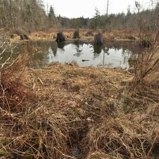
Summit Lake, lake in Thurston County, Washington state, United States of America

Summit Lake is a freshwater lake in Thurston County in northwestern Washington covering about 511 acres and reaching depths of up to 90 feet. The water is clean and clear, home to rainbow trout, kokanee salmon, largemouth bass, smallmouth bass, yellow perch, and coastal cutthroat trout.

The lake was named around 1900 after being known previously as Prays Lake and Crooked Lake. A significant event occurred in September 2025 when a U.S. Army MH-60 Black Hawk helicopter crashed near the area, resulting in the deaths of four soldiers.

The lake received its current name around 1900, replacing earlier names like Prays Lake and Crooked Lake. Today, the community uses it primarily for fishing, boating, and quiet recreation, reflecting how the water shapes local outdoor habits and leisure time.

A boat launch on the southwestern side is maintained by the Washington State Department of Fish and Wildlife and is accessible year-round for fishing and boating. The lake sits roughly 10 miles west of Olympia and is easy to reach for visitors throughout the region.

The lake's water is oligotrophic, meaning it is extremely clean with minimal nutrient buildup and naturally filters itself. This makes it a valuable drinking water reservoir for the local community and contributes to the exceptional clarity visitors notice.

The community of curious travelers

AroundUs brings together thousands of curated places, local tips, and hidden gems, enriched daily by 60,000 contributors worldwide.

Start exploring
Location
Location
Elevation above the sea
140 m
GPS coordinates
47.05583,-123.10333
Latest update
February 7, 2026 11:40
Around this place
Washington State Capitol
United States of America

Washington State Capitol

15.2 km
Washington Governor's Mansion
United States of America

Washington Governor's Mansion

15.1 km
Timberland Regional Library
United States of America

Timberland Regional Library

15.6 km
Capitol State Forest
United States of America

Capitol State Forest

13.4 km
Capitol Theater
United States of America

Capitol Theater

15.5 km
Temple of Justice
United States of America

Temple of Justice

15.2 km
Kennedy Creek Natural Area Preserve
United States of America

Kennedy Creek Natural Area Preserve

4.9 km
Percival Landing Park
United States of America

Percival Landing Park

15.2 km
Olympia Downtown Historic District
United States of America

Olympia Downtown Historic District

15.5 km
Capitol Peak
United States of America

Capitol Peak

9.6 km
Joel M. Pritchard Building
United States of America

Joel M. Pritchard Building

15.2 km
Washington State Capitol Conservatory
United States of America

Washington State Capitol Conservatory

15.3 km
Insurance Building
United States of America

Insurance Building

15.2 km
Crosby House
United States of America

Crosby House

15.5 km
Mud Bay Indian Shaker Church
United States of America

Mud Bay Indian Shaker Church

6.6 km
St. John's Episcopal Church
United States of America

St. John's Episcopal Church

15.6 km
Heritage Park
United States of America

Heritage Park

15.2 km
Thurston County Courthouse
United States of America

Thurston County Courthouse

15.6 km
Du Pen Fountain
United States of America

Du Pen Fountain

15.2 km
Tumwater Methodist Church
United States of America

Tumwater Methodist Church

15.7 km
Mottman Building
United States of America

Mottman Building

15.4 km
American Legion Hall
United States of America

American Legion Hall

15.3 km
Elks Building
United States of America

Elks Building

15.4 km
Vietnam Veterans Memorial
Vietnam

Vietnam Veterans Memorial

15.4 km
Old Capitol Building
United States of America

Old Capitol Building

15.5 km
Washington Center for the Performing Arts
United States of America

Washington Center for the Performing Arts

15.5 km
Washington State Capitol Historic District
United States of America

Washington State Capitol Historic District

15.2 km
State Theater
United States of America

State Theater

15.5 km
Show the full map
« Summit Lake - lake in Thurston County, Washington state, United States of America » is provided by Around Us (aroundus.com). Images and texts are derived from Wikimedia project under a Creative Commons license. You are allowed to copy, distribute, and modify copies of this page, under the conditions set by the license, as long as this note is clearly visible.

Discover hidden gems everywhere you go!

From secret cafés to breathtaking viewpoints, skip the crowded tourist spots and find places that match your style. Our app makes it easy with voice search, smart filtering, route optimization, and insider tips from travelers worldwide. Download now for the complete mobile experience.

Around Us App Screenshot

A unique approach to discovering new places

Le Figaro

All the places worth exploring

France Info

A tailor-made excursion in just a few clicks

20 Minutes

Around Us
Travel Guide & Maps
Download

Send to your phone

QR Code
1

Open the camera app on your mobile.

2

Point at the QR code with your camera. A notification will appear.

3

Tap the notification to open the link.