Enable Location

We need your location to show you interesting places around you

Discover nearby places

Find interesting locations and hidden gems around you

Precise directions

Get accurate directions and distances to places

Your location is never shared with other users. It's only used when you tap the location button.

Capitol State Forest

Log in to your account

Start exploring — it's free

Trusted by 62,375 travelers worldwide

Continue with Google
Continue with Apple
or

We will send you a code to connect

By continuing, you accept our Terms and Conditions and our Privacy Policy

Check your inbox

We've sent a pincode in your inbox. Please enter the code below.

Capitol State Forest

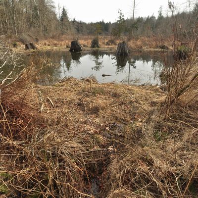
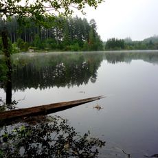
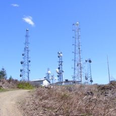
Capitol State Forest, Nature reserve in Thurston County, US.

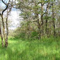
Capitol State Forest is a large nature reserve in Washington featuring diverse ecosystems across different elevations. The area offers over 150 miles of trails for hiking, mountain biking, horseback riding, and other outdoor activities.

The forest was established in the 1930s to balance sustainable timber production with natural resource management. Over the decades, this approach has developed to include recreational use alongside forestry operations.

The forest plays an important role for local communities by providing space for outdoor recreation and connection to nature. Visitors from nearby towns use these trails and areas as places to spend time with family and friends.

Visitors need to obtain a Discover Pass before exploring the forest to access all areas and trails. The best times to visit are spring through fall, when trails are passable and weather is stable for outdoor activities.

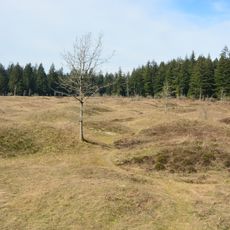
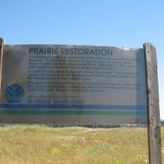
The area contains the Mima Mounds, a distinctive geological formation with hundreds of rounded earth mounds scattered across the landscape. These mounds formed through natural processes that scientists still debate, making this feature unusually striking.

The community of curious travelers

AroundUs brings together thousands of curated places, local tips, and hidden gems, enriched daily by 60,000 contributors worldwide.

Start exploring
Location
Operator
Washington State Department of Natural Resources
GPS coordinates
46.94457,-123.17126
Latest update
December 10, 2025 16:29
Around this place
Washington State Capitol
United States of America

Washington State Capitol

22.6 km
Mima Mounds
United States of America

Mima Mounds

10.5 km
Washington Governor's Mansion
United States of America

Washington Governor's Mansion

22.5 km
Millersylvania State Park
United States of America

Millersylvania State Park

20 km
Mima Mounds Natural Area Preserve
United States of America

Mima Mounds Natural Area Preserve

10.6 km
United States of America

Summit Lake

13.4 km
Tumwater Falls
United States of America

Tumwater Falls

21.7 km
Olympic Flight Museum
United States of America

Olympic Flight Museum

21.1 km
Temple of Justice
United States of America

Temple of Justice

22.7 km
Kennedy Creek Natural Area Preserve
United States of America

Kennedy Creek Natural Area Preserve

18.4 km
Capitol Peak
United States of America

Capitol Peak

4 km
Miller–Brewer House
United States of America

Miller–Brewer House

18.1 km
Joel M. Pritchard Building
United States of America

Joel M. Pritchard Building

22.6 km
Scatter Creek Unit
United States of America

Scatter Creek Unit

17.6 km
Washington State Capitol Conservatory
United States of America

Washington State Capitol Conservatory

22.8 km
Insurance Building
United States of America

Insurance Building

22.6 km
Crosby House
United States of America

Crosby House

21.9 km
Mud Bay Indian Shaker Church
United States of America

Mud Bay Indian Shaker Church

17.4 km
St. John's Episcopal Church
United States of America

St. John's Episcopal Church

22.7 km
Heritage Park
United States of America

Heritage Park

23 km
Thurston County Courthouse
United States of America

Thurston County Courthouse

23.1 km
Du Pen Fountain
United States of America

Du Pen Fountain

22.6 km
Tumwater Methodist Church
United States of America

Tumwater Methodist Church

21.6 km
American Legion Hall
United States of America

American Legion Hall

23.2 km
Vietnam Veterans Memorial
Vietnam

Vietnam Veterans Memorial

22.8 km
Elma Theater
United States of America

Elma Theater

19 km
Washington State Capitol Historic District
United States of America

Washington State Capitol Historic District

22.7 km
Tumwater Historic District
United States of America

Tumwater Historic District

22 km
Show the full map
« Capitol State Forest - Nature reserve in Thurston County, US » is provided by Around Us (aroundus.com). Images and texts are derived from Wikimedia project under a Creative Commons license. You are allowed to copy, distribute, and modify copies of this page, under the conditions set by the license, as long as this note is clearly visible.

Discover hidden gems everywhere you go!

From secret cafés to breathtaking viewpoints, skip the crowded tourist spots and find places that match your style. Our app makes it easy with voice search, smart filtering, route optimization, and insider tips from travelers worldwide. Download now for the complete mobile experience.

Around Us App Screenshot

A unique approach to discovering new places

Le Figaro

All the places worth exploring

France Info

A tailor-made excursion in just a few clicks

20 Minutes

Around Us
Travel Guide & Maps
Download

Send to your phone

QR Code
1

Open the camera app on your mobile.

2

Point at the QR code with your camera. A notification will appear.

3

Tap the notification to open the link.