Enable Location

We need your location to show you interesting places around you

Discover nearby places

Find interesting locations and hidden gems around you

Precise directions

Get accurate directions and distances to places

Your location is never shared with other users. It's only used when you tap the location button.

Point Wilson

Log in to your account

Start exploring — it's free

Trusted by 63,118 travelers worldwide

Continue with Google
Continue with Apple
or

We will send you a code to connect

By continuing, you accept our Terms and Conditions and our Privacy Policy

Check your inbox

We've sent a pincode in your inbox. Please enter the code below.

Point Wilson
Discussion Reviews 1 Photos
2.2k Popularity

Point Wilson, Coastal navigation point in Port Townsend, United States.

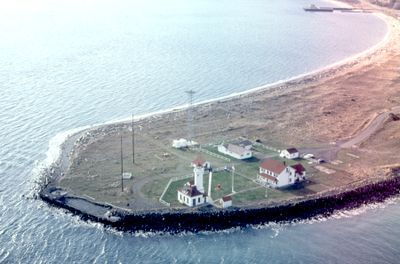
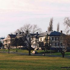
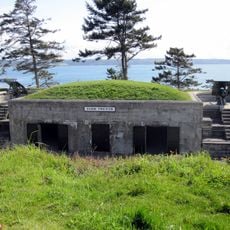
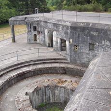
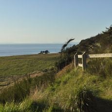
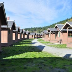
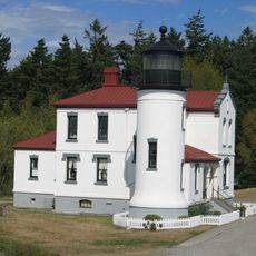
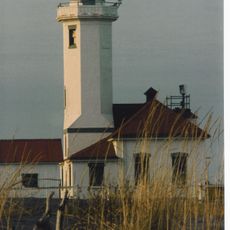
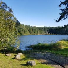
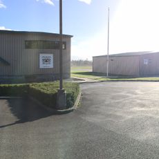
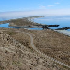
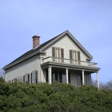
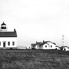
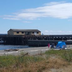
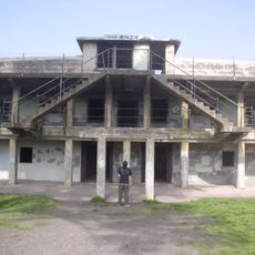
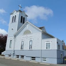
Point Wilson is a headland extending half a mile into the water at the junction of Admiralty Inlet and the Strait of Juan de Fuca. The site is now part of Fort Worden Historical State Park and features a 1913 lighthouse, historic military buildings, and interpretive displays covering maritime navigation and coastal ecology.

A lighthouse was first built here in 1879 to guide ships through this critical maritime passage. The United States Lighthouse Service replaced it with the current structure in 1913 to improve navigation safety for the expanding shipping traffic.

The indigenous Chimakum and S'Klallam peoples called this location Kam-kam-ho and Kam-Kum, names reflecting their ancestral ties to these coastal waters. Visitors can learn about this indigenous connection through displays and plaques throughout the park grounds.

The visitor areas are accessible and offer walking paths with views of the waterways and surrounding grounds. Weather can change quickly here, so wearing layers and preparing for wind gusts is recommended for any visit.

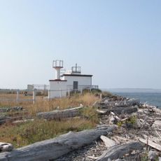
A weather station on the grounds continuously collects data that is crucial for ships navigating the sharp bend into Puget Sound's main shipping channel. This real-time information helps ensure safe passage for the many vessels that regularly pass through these waters.

The community of curious travelers

AroundUs brings together thousands of curated places, local tips, and hidden gems, enriched daily by 60,000 contributors worldwide.

Start exploring
GPS coordinates
48.14389,-122.75417
Latest update
December 13, 2025 12:41
Around this place
Fort Worden
United States of America

Fort Worden

983 m
Fort Casey
United States of America

Fort Casey

6.1 km
Fort Flagler Historical State Park
United States of America

Fort Flagler Historical State Park

6.8 km
Fort Ebey State Park
United States of America

Fort Ebey State Park

10 km
Cama Beach Historical State Park
United States of America

Cama Beach Historical State Park

17.8 km
Camano Island State Park
United States of America

Camano Island State Park

19 km
Fort Townsend State Park
United States of America

Fort Townsend State Park

8.2 km
Captain Whidbey Inn
United States of America

Captain Whidbey Inn

9 km
Tamanowas Rock
United States of America

Tamanowas Rock

13.9 km
Admiralty Head Light
United States of America

Admiralty Head Light

5.7 km
Point Wilson Light
United States of America

Point Wilson Light

53 m
Port Townsend Historic District
United States of America

Port Townsend Historic District

3 km
Anderson Lake State Park
United States of America

Anderson Lake State Park

14.4 km
Port Townsend Aero Museum
United States of America

Port Townsend Aero Museum

10.5 km
Protection Island National Wildlife Refuge
United States of America

Protection Island National Wildlife Refuge

13.4 km
Rothschild House
United States of America

Rothschild House

3.1 km
Ferry House
United States of America

Ferry House

6.4 km
Smith Island Light
United States of America

Smith Island Light

20.6 km
Marrowstone Point Light
United States of America

Marrowstone Point Light

6.8 km
St. Paul's Episcopal Church
United States of America

St. Paul's Episcopal Church

3.2 km
Capt. Enoch S. Fowler House
United States of America

Capt. Enoch S. Fowler House

3.4 km
Jefferson County Courthouse
United States of America

Jefferson County Courthouse

3.6 km
Methodist Episcopal Church of Port Hadlock
United States of America

Methodist Episcopal Church of Port Hadlock

12.3 km
South Whidbey State Park
United States of America

South Whidbey State Park

15.4 km
Port Townsend Marine Science Center
United States of America

Port Townsend Marine Science Center

1 km
Fort Worden State Park
United States of America

Fort Worden State Park

983 m
Port Townsend First Baptist Church
United States of America

Port Townsend First Baptist Church

3.1 km
Rose Theatre
United States of America

Rose Theatre

3.3 km
Show the full map
Reviews
Share your experience

No review yet

Discussions
Start a discussion...

No discussion yet

« Point Wilson - Coastal navigation point in Port Townsend, United States » is provided by Around Us (aroundus.com). Images and texts are derived from Wikimedia project under a Creative Commons license. You are allowed to copy, distribute, and modify copies of this page, under the conditions set by the license, as long as this note is clearly visible.

Discover hidden gems everywhere you go!

From secret cafés to breathtaking viewpoints, skip the crowded tourist spots and find places that match your style. Our app makes it easy with voice search, smart filtering, route optimization, and insider tips from travelers worldwide. Download now for the complete mobile experience.

Around Us App Screenshot

A unique approach to discovering new places

Le Figaro

All the places worth exploring

France Info

A tailor-made excursion in just a few clicks

20 Minutes

Around Us
Travel Guide & Maps
Download

Send to your phone

QR Code
1

Open the camera app on your mobile.

2

Point at the QR code with your camera. A notification will appear.

3

Tap the notification to open the link.