Enable Location

We need your location to show you interesting places around you

Discover nearby places

Find interesting locations and hidden gems around you

Precise directions

Get accurate directions and distances to places

Your location is never shared with other users. It's only used when you tap the location button.

Fort Casey

Log in to your account

Start exploring — it's free

Trusted by 62,873 travelers worldwide

Continue with Google
Continue with Apple
or

We will send you a code to connect

By continuing, you accept our Terms and Conditions and our Privacy Policy

Check your inbox

We've sent a pincode in your inbox. Please enter the code below.

Fort Casey

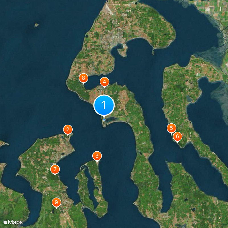
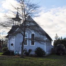
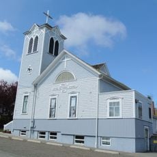
Fort Casey, Military fort and state park in Whidbey Island, United States

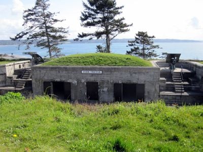
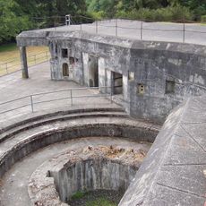
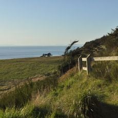
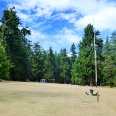
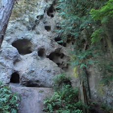
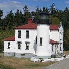
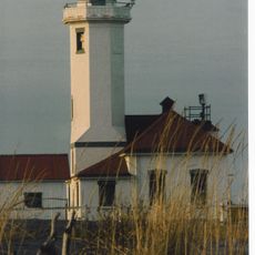
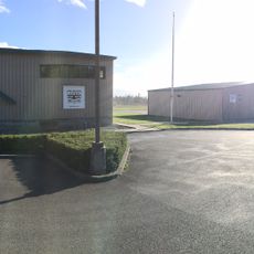
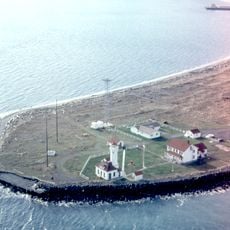
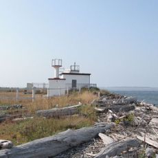
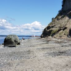
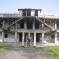
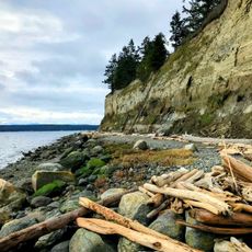
Fort Casey is a former military installation and state park on Whidbey Island in Washington, covering about 190 hectares with over three kilometers of shoreline along Puget Sound and Admiralty Inlet. The site includes concrete batteries, underground passages, a restored lighthouse, and open grass areas overlooking the waterway.

The fort was built in the 1890s as part of a defensive triangle with two other installations to guard Puget Sound against enemy ships. The army used the fortification until the end of World War Two, then moved the defense line farther outward.

The name Casey honors Thomas Lincoln Casey, a US Army engineer from the late 19th century. Visitors today see massive concrete bunkers and gun emplacements set into the coastal landscape, surrounded by grassy fields.

The park requires a ten-dollar day pass or a valid Discover Pass for entry. Walking trails lead through the grounds, and the shoreline is suitable for diving and beach activities.

Two original coastal guns remain on the grounds, though the fort never saw actual enemy contact. The cannons were brought back from the Philippines after World War Two and placed here as display pieces.

The community of curious travelers

AroundUs brings together thousands of curated places, local tips, and hidden gems, enriched daily by 60,000 contributors worldwide.

Start exploring
Location
GPS coordinates
48.16444,-122.67806
Latest update
December 20, 2025 15:57
Around this place
Fort Worden
United States of America

Fort Worden

7.1 km
Fort Flagler Historical State Park
United States of America

Fort Flagler Historical State Park

7.6 km
Fort Ebey State Park
United States of America

Fort Ebey State Park

5.9 km
Cama Beach Historical State Park
United States of America

Cama Beach Historical State Park

12.4 km
Camano Island State Park
United States of America

Camano Island State Park

13.8 km
Fort Townsend State Park
United States of America

Fort Townsend State Park

13.2 km
Captain Whidbey Inn
United States of America

Captain Whidbey Inn

7.5 km
Tamanowas Rock
United States of America

Tamanowas Rock

18 km
Admiralty Head Light
United States of America

Admiralty Head Light

462 m
Point Wilson Light
United States of America

Point Wilson Light

6.1 km
Port Townsend Historic District
United States of America

Port Townsend Historic District

8.1 km
Port Townsend Aero Museum
United States of America

Port Townsend Aero Museum

15.4 km
Point Wilson
United States of America

Point Wilson

6.1 km
Rothschild House
United States of America

Rothschild House

7.9 km
United States of America

Joseph Whidbey State Park

18.3 km
Ferry House
United States of America

Ferry House

3.6 km
Marrowstone Point Light
United States of America

Marrowstone Point Light

7 km
St. Paul's Episcopal Church
United States of America

St. Paul's Episcopal Church

8.1 km
North Beach
United States of America

North Beach

8.1 km
Capt. Enoch S. Fowler House
United States of America

Capt. Enoch S. Fowler House

8.3 km
Jefferson County Courthouse
United States of America

Jefferson County Courthouse

8.8 km
Methodist Episcopal Church of Port Hadlock
United States of America

Methodist Episcopal Church of Port Hadlock

16 km
South Whidbey State Park
United States of America

South Whidbey State Park

13.5 km
Port Townsend Marine Science Center
United States of America

Port Townsend Marine Science Center

6.9 km
Fort Worden State Park
United States of America

Fort Worden State Park

7.1 km
Port Townsend First Baptist Church
United States of America

Port Townsend First Baptist Church

8.3 km
Rose Theatre
United States of America

Rose Theatre

8.1 km
Monroe Landing
United States of America

Monroe Landing

8.2 km
Show the full map
« Fort Casey - Military fort and state park in Whidbey Island, United States » is provided by Around Us (aroundus.com). Images and texts are derived from Wikimedia project under a Creative Commons license. You are allowed to copy, distribute, and modify copies of this page, under the conditions set by the license, as long as this note is clearly visible.

Discover hidden gems everywhere you go!

From secret cafés to breathtaking viewpoints, skip the crowded tourist spots and find places that match your style. Our app makes it easy with voice search, smart filtering, route optimization, and insider tips from travelers worldwide. Download now for the complete mobile experience.

Around Us App Screenshot

A unique approach to discovering new places

Le Figaro

All the places worth exploring

France Info

A tailor-made excursion in just a few clicks

20 Minutes

Around Us
Travel Guide & Maps
Download

Send to your phone

QR Code
1

Open the camera app on your mobile.

2

Point at the QR code with your camera. A notification will appear.

3

Tap the notification to open the link.