Chest opened
+${chestReward.xp} XP
Explorer
NOUVEAU ×${chestReward.collectible.quantity}
tapez pour fermer
Chest locked

Open chests in the app

Around Us is built for your phone — chests unlock when you walk, explore and capture nearby places.

Enable Location

We need your location to show you interesting places around you

Discover nearby places

Find interesting locations and hidden gems around you

Precise directions

Get accurate directions and distances to places

Your location is never shared with other users. It's only used when you tap the location button.

Log in to your account

Start exploring — it's free

Trusted by 72,875 travelers worldwide

Continue with Google
Continue with Apple
or

We will send you a code to connect

By continuing, you accept our Terms and Conditions and our Privacy Policy

Check your inbox

We've sent a pincode in your inbox. Please enter the code below.

Rainier Valley
Discussion Reviews Photo
12k Popularity

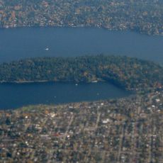
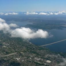
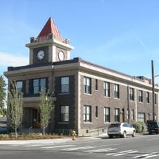
Rainier Valley, Residential neighborhood in southeastern Seattle, US

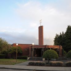
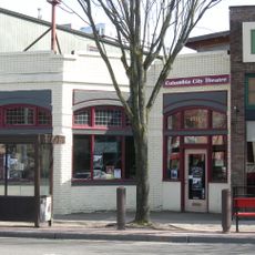
Rainier Valley is a residential neighborhood in southeastern Seattle with a mix of single-family homes, apartment buildings, and small local shops lining its streets. The area stretches between Beacon Hill and Mount Baker, with Martin Luther King Jr Way South and Rainier Avenue serving as its main commercial corridors.

The area evolved from Native American settlements through farmland in the 1850s into residential zones shaped by Italian and Japanese communities. These different population groups left lasting marks on the neighborhood's social and economic character.

Various ethnic communities operate food markets, restaurants, and shops along Martin Luther King Jr Way South and Rainier Avenue, bringing cuisines and traditions from many parts of the world. These businesses shape how the neighborhood looks and feels as you walk through it.

The neighborhood connects to downtown Seattle through multiple light rail stations, offering efficient public transportation for daily travel needs. This transit access makes the area easy to reach and reduces reliance on cars for getting around.

The basketball courts in the area have produced several players who made it to the National Basketball Association, creating a notable local connection to professional sports. This legacy makes the neighborhood known as a training ground for emerging talent from the region.

The community of curious travelers

AroundUs brings together thousands of curated places, local tips, and hidden gems, enriched daily by 60,000 contributors worldwide.

Start exploring
Location
GPS coordinates
47.55120,-122.28800
Latest update
March 5, 2026 21:06
Around this place
The Museum of Flight
United States of America

The Museum of Flight

3.7 km
Lacey V. Murrow Memorial Bridge
United States of America

Lacey V. Murrow Memorial Bridge

4.5 km
Sick's Stadium
United States of America

Sick's Stadium

3.2 km
East Duwamish Greenbelt
United States of America

East Duwamish Greenbelt

3.5 km
Seward Park (Seattle)
United States of America

Seward Park (Seattle)

2.8 km
Mount Baker Tunnel
United States of America

Mount Baker Tunnel

4.4 km
Northwest African American Museum
United States of America

Northwest African American Museum

4.4 km
El Centro de la Raza
United States of America

El Centro de la Raza

3.7 km
Sephardic Bikur Holim Congregation
United States of America

Sephardic Bikur Holim Congregation

1.8 km
Hat 'n' Boots
United States of America

Hat 'n' Boots

2.6 km
Georgetown Steam Plant
United States of America

Georgetown Steam Plant

2.3 km
Connections Museum
United States of America

Connections Museum

2.9 km
Lady Rainier
United States of America

Lady Rainier

3.7 km
First Avenue South Bridge
United States of America

First Avenue South Bridge

3.6 km
Dai Bai Zan Cho Bo Zen Ji
United States of America

Dai Bai Zan Cho Bo Zen Ji

3 km
South Park Bridge
United States of America

South Park Bridge

3.1 km
Oxbow Park
United States of America

Oxbow Park

2.6 km
Marra Farm
United States of America

Marra Farm

4.5 km
Center Park
United States of America

Center Park

3.8 km
Beacon Hill Branch Library
United States of America

Beacon Hill Branch Library

3.5 km
Old Georgetown City Hall
United States of America

Old Georgetown City Hall

2.1 km
Fifth Church of Christ, Scientist
United States of America

Fifth Church of Christ, Scientist

1 km
Columbia City Historic District
United States of America

Columbia City Historic District

903 m
T. Evans Wyckoff Memorial Bridge
United States of America

T. Evans Wyckoff Memorial Bridge

3.7 km
Space Gallery
United States of America

Space Gallery

3.7 km
Moon Bridge at Kubota Garden
United States of America

Moon Bridge at Kubota Garden

4.5 km
Columbia City Theater
United States of America

Columbia City Theater

739 m
Mount Baker Beach
United States of America

Mount Baker Beach

3.7 km
Show the full map
Reviews
Share your experience

No review yet

Discussions
Start a discussion...

No discussion yet

« Rainier Valley - Residential neighborhood in southeastern Seattle, US » is provided by Around Us (aroundus.com). Images and texts are derived from Wikimedia project under a Creative Commons license. You are allowed to copy, distribute, and modify copies of this page, under the conditions set by the license, as long as this note is clearly visible.

Discover hidden gems everywhere you go!

From secret cafés to breathtaking viewpoints, skip the crowded tourist spots and find places that match your style. Our app makes it easy with voice search, smart filtering, route optimization, and insider tips from travelers worldwide. Download now for the complete mobile experience.

Around Us App Screenshot

A unique approach to discovering new places

Le Figaro

All the places worth exploring

France Info

A tailor-made excursion in just a few clicks

20 Minutes

Around Us
Travel Guide & Maps
Download

Send to your phone

QR Code
1

Open the camera app on your mobile.

2

Point at the QR code with your camera. A notification will appear.

3

Tap the notification to open the link.