Enable Location

We need your location to show you interesting places around you

Discover nearby places

Find interesting locations and hidden gems around you

Precise directions

Get accurate directions and distances to places

Your location is never shared with other users. It's only used when you tap the location button.

Alaskan Way Viaduct

Log in to your account

Start exploring — it's free

Trusted by 62,067 travelers worldwide

Continue with Google
Continue with Apple
or

We will send you a code to connect

By continuing, you accept our Terms and Conditions and our Privacy Policy

Check your inbox

We've sent a pincode in your inbox. Please enter the code below.

Alaskan Way Viaduct

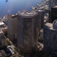
Alaskan Way Viaduct, Former elevated highway in downtown Seattle, United States

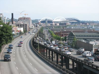
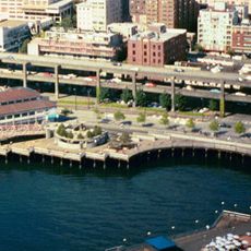
The Alaskan Way Viaduct was a double-deck concrete elevated highway that ran 2.2 miles (3.5 km) along the bay, connecting the southern neighborhoods to the northern downtown area. The upper deck carried northbound traffic while the lower deck served southbound vehicles, both running parallel to the waterfront and spanning above part of the city center.

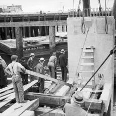
Construction began in 1949 and finished in 1959 as part of State Route 99 to relieve post-war traffic congestion. A major earthquake in 2001 damaged the structure significantly, leading the city to replace it with an underground tunnel that opened in 2019.

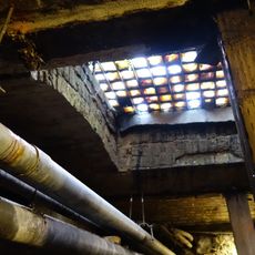
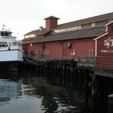
The name refers to the historic waterfront road along Elliott Bay that once formed the main connection between southern and northern neighborhoods. Today photographs and exhibits in nearby museums recall the time when the elevated roadway shaped the skyline and blocked views of the water.

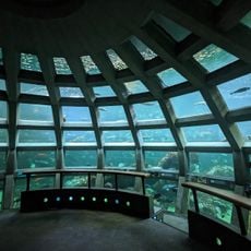
The elevated roadway has been closed since 2019, with all traffic now moving through the new tunnel below downtown. New public space is gradually opening along the former route, providing direct access to the waterfront area that was previously cut off.

Demolition crews recycled 240 million pounds (109 million kg) of concrete and 15 million pounds (6.8 million kg) of steel rebar during removal. Most materials were reused in other regional construction projects rather than sent to landfills.

The community of curious travelers

AroundUs brings together thousands of curated places, local tips, and hidden gems, enriched daily by 60,000 contributors worldwide.

Start exploring
Location
Inception
1953
GPS coordinates
47.60399,-122.33825
Latest update
December 14, 2025 19:15
« Alaskan Way Viaduct - Former elevated highway in downtown Seattle, United States » is provided by Around Us (aroundus.com). Images and texts are derived from Wikimedia project under a Creative Commons license. You are allowed to copy, distribute, and modify copies of this page, under the conditions set by the license, as long as this note is clearly visible.

Discover hidden gems everywhere you go!

From secret cafés to breathtaking viewpoints, skip the crowded tourist spots and find places that match your style. Our app makes it easy with voice search, smart filtering, route optimization, and insider tips from travelers worldwide. Download now for the complete mobile experience.

Around Us App Screenshot

A unique approach to discovering new places

Le Figaro

All the places worth exploring

France Info

A tailor-made excursion in just a few clicks

20 Minutes

Around Us
Travel Guide & Maps
Download

Send to your phone

QR Code
1

Open the camera app on your mobile.

2

Point at the QR code with your camera. A notification will appear.

3

Tap the notification to open the link.