Ferguson landslide

Log in to your account

AroundUs is a community-driven map of interesting places, built by curious explorers like you. It grows with every review, story, and photo you share.
Connect to save your favorite spots, contribute locations, and create personalized routes.
Continue with Google
Continue with Apple
Continue with X
Continue with Facebook
Continue with email
By continuing, you accept our Terms and Conditions and our Privacy Policy
Create an account

Ferguson landslide

Add to collection
Map
Suggest a change
Share

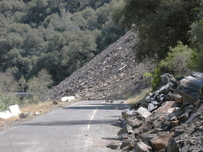
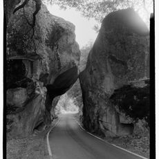
Ferguson landslide, Natural geological formation in Merced River Canyon, California, US.

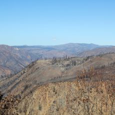
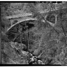
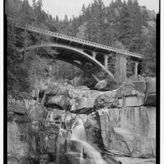
Ferguson landslide consists of massive rock and debris piled across the Merced River Canyon, blocking California State Route 140. The terrain is rocky and uneven, with huge boulders that slipped down from Ferguson Ridge.

A major rock collapse in 2006 blocked the highway and triggered a state emergency declaration in Mariposa County. This event forced authorities to clear the route and create new solutions quickly.

The area is important for protecting the Limestone Salamander, an endangered species living in the Merced River canyon. Managing the site requires care to keep this rare animal safe in its natural home.

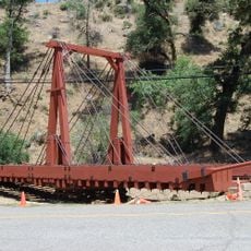
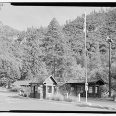
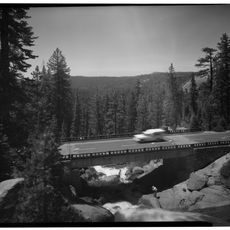
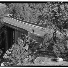
Temporary bridges with traffic signals manage one-way passage around the slide, with size limits for vehicles. Visitors should expect possible delays and follow all traffic instructions carefully.

The restoration project includes building a 675-foot concrete rock shed with special engineering design. This structure uses prefabricated pieces and many rock anchors to permanently protect passing vehicles and the roadway.

Location: California

GPS coordinates: 37.65670,-119.90100

Latest update: December 10, 2025 20:04

Photos
Around this place
Tunnel View
United States of America

Tunnel View

20.8 km
California State Mining and Mineral Museum
United States of America

California State Mining and Mineral Museum

21.8 km
Crane Flat Campground
United States of America

Crane Flat Campground

13.5 km
Silver Strand Falls
United States of America

Silver Strand Falls

21.1 km
Crane Flat Fire Lookout
United States of America

Crane Flat Fire Lookout

13.5 km
Hetch Hetchy Railroad 6
United States of America

Hetch Hetchy Railroad 6

10.3 km
Henness Ridge Fire Lookout
United States of America

Henness Ridge Fire Lookout

15.9 km
Tamarack Flat Campground
United States of America

Tamarack Flat Campground

17.9 km
McCauley and Meyer Barns
United States of America

McCauley and Meyer Barns

14.2 km
Merced Grove Ranger Station
United States of America

Merced Grove Ranger Station

11.6 km
Bagby Stationhouse, Water Tanks and Turntable
United States of America

Bagby Stationhouse, Water Tanks and Turntable

10.3 km
Mariposa County Courthouse
United States of America

Mariposa County Courthouse

20 km
Dead Giant Tunnel Tree
United States of America

Dead Giant Tunnel Tree

15 km
Crane Flat
United States of America

Crane Flat

12.9 km
Pohono Bridge
United States of America

Pohono Bridge

21.7 km
Tamarack Flat
United States of America

Tamarack Flat

17.8 km
South Fork Tuolumne River Bridge
United States of America

South Fork Tuolumne River Bridge

21.8 km
Bower Cave
United States of America

Bower Cave

15.6 km
Yosemite Valley Railroad Caboose No. 15
United States of America

Yosemite Valley Railroad Caboose No. 15

10.3 km
El Portal Old Schoolhouse
United States of America

El Portal Old Schoolhouse

10.3 km
Arch Rock
United States of America

Arch Rock

15.5 km
Arch Rock Entrance Station
United States of America

Arch Rock Entrance Station

15.3 km
Rim of the World Vista
United States of America

Rim of the World Vista

22.1 km
South Fork Tuolumne River Bridge
United States of America

South Fork Tuolumne River Bridge

21 km
Signal Peak Lookout
United States of America

Signal Peak Lookout

20 km
Wildcat Creek Bridge
United States of America

Wildcat Creek Bridge

17.8 km
Tamarack Creek Bridge
United States of America

Tamarack Creek Bridge

18.2 km
Cascade Creek Bridge
United States of America

Cascade Creek Bridge

18.3 km
Show the full map
Reviews

Visited this place? Tap the stars to rate it and share your experience / photos with the community! Try now! You can cancel it anytime.

« Ferguson landslide - Natural geological formation in Merced River Canyon, California, US » is provided by Around Us (aroundus.com). Images and texts are derived from Wikimedia project under a Creative Commons license. You are allowed to copy, distribute, and modify copies of this page, under the conditions set by the license, as long as this note is clearly visible.

Discover hidden gems everywhere you go!

From secret cafés to breathtaking viewpoints, skip the crowded tourist spots and find places that match your style. Our app makes it easy with voice search, smart filtering, route optimization, and insider tips from travelers worldwide. Download now for the complete mobile experience.

Around Us App Screenshot

A unique approach to discovering new places

Le Figaro

All the places worth exploring

France Info

A tailor-made excursion in just a few clicks

20 Minutes