Chest opened
+${chestReward.xp} XP
Explorer
NOUVEAU ×${chestReward.collectible.quantity}
tapez pour fermer
Chest locked

Open chests in the app

Around Us is built for your phone — chests unlock when you walk, explore and capture nearby places.

Enable Location

We need your location to show you interesting places around you

Discover nearby places

Find interesting locations and hidden gems around you

Precise directions

Get accurate directions and distances to places

Your location is never shared with other users. It's only used when you tap the location button.

Mina

Log in to your account

Start exploring — it's free

Trusted by 72,888 travelers worldwide

Continue with Google
Continue with Apple
or

We will send you a code to connect

By continuing, you accept our Terms and Conditions and our Privacy Policy

Check your inbox

We've sent a pincode in your inbox. Please enter the code below.

Discussion Reviews 1 Photos
10.5k Popularity

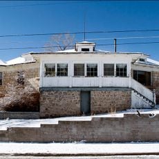
Mina, Census-designated place in Mineral County, Nevada, United States.

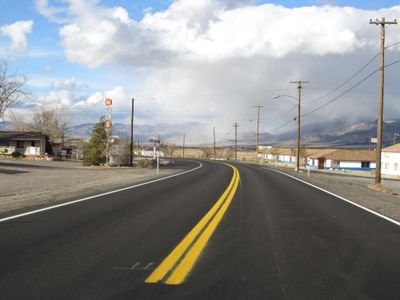
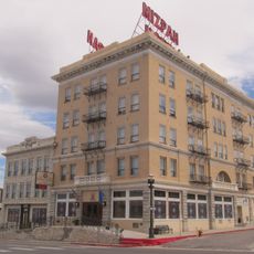
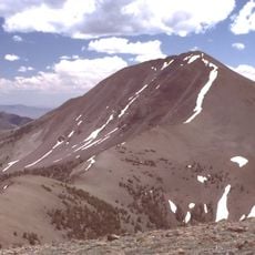
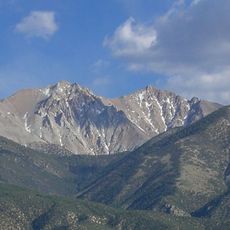
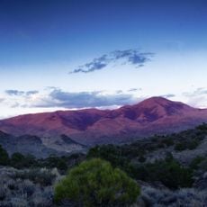
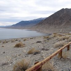
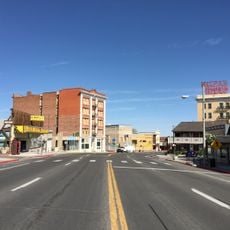
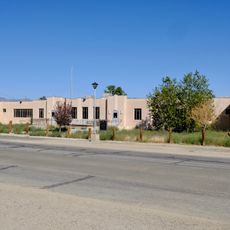
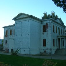
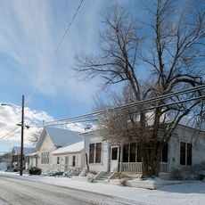
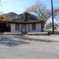
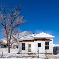
Mina is a small settlement in Nevada's desert landscape along U.S. Route 95, situated at an elevation of about 4,560 feet. The village covers roughly 2.41 square miles and consists today of a handful of remaining buildings and structures scattered across the arid terrain.

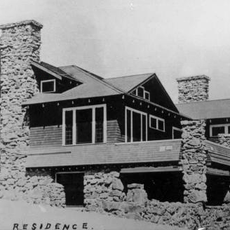
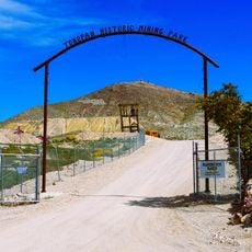
The settlement was established in 1905 by the Southern Pacific Railroad and named after a woman connected to copper mining in the area. For many decades, the railroad remained the lifeblood of the community, driving its growth and survival.

The place has deep connections to railroad history that shaped how people lived and moved through the region. Visitors can still sense these railway roots in the layout of the settlement and its relationship to the surrounding landscape.

The place is extremely small with minimal infrastructure, so bring supplies you might need for your visit. Few services operate here, and you should plan accordingly since gas stations and restaurants are not available in the area.

A significant historical event of dark importance took place here in 1924 that visitors often overlook. This chapter in the settlement's past shapes how the location is remembered in regional history.

The community of curious travelers

AroundUs brings together thousands of curated places, local tips, and hidden gems, enriched daily by 60,000 contributors worldwide.

Start exploring
Location
GPS coordinates
38.39056,-118.10861
Latest update
December 10, 2025 15:54
Around this place
Bodie
United States of America

Bodie

81.4 km
Hawthorne Army Depot
United States of America

Hawthorne Army Depot

48.8 km
Boundary Peak
United States of America

Boundary Peak

64.2 km
White Mountain Peak
United States of America

White Mountain Peak

85.2 km
Berlin Historic District
United States of America

Berlin Historic District

70 km
Mizpah Hotel
United States of America

Mizpah Hotel

84.8 km
Aurora
United States of America

Aurora

69.9 km
Berlin–Ichthyosaur State Park
United States of America

Berlin–Ichthyosaur State Park

70.3 km
Flying-M Ranch
United States of America

Flying-M Ranch

81.5 km
Arc Dome
United States of America

Arc Dome

82.1 km
Montgomery Peak
United States of America

Montgomery Peak

65.2 km
Arc Dome Wilderness
United States of America

Arc Dome Wilderness

82.4 km
Hawthorne Ordnance Museum
United States of America

Hawthorne Ordnance Museum

47.6 km
Walker Lake State Recreation Area
United States of America

Walker Lake State Recreation Area

66.7 km
George A. Bartlett House
United States of America

George A. Bartlett House

84.4 km
Nye County Courthouse
United States of America

Nye County Courthouse

85.2 km
Mineral County Museum
United States of America

Mineral County Museum

47.7 km
State Bank and Trust Company Building
United States of America

State Bank and Trust Company Building

84.7 km
Sixth Street School
United States of America

Sixth Street School

48 km
Tonopah Historic Mining Park
United States of America

Tonopah Historic Mining Park

84.8 km
St. Mark's Episcopal Church
United States of America

St. Mark's Episcopal Church

84.8 km
Mineral County Courthouse
United States of America

Mineral County Courthouse

47.3 km
E.R. Shields House
United States of America

E.R. Shields House

85 km
John Gregovich House
United States of America

John Gregovich House

84.6 km
Judge W.A. Sawle House
United States of America

Judge W.A. Sawle House

84.7 km
Uri B. Curtis House
United States of America

Uri B. Curtis House

84.7 km
Ichthyosaur Site
United States of America

Ichthyosaur Site

70.2 km
Sportsmans Beach
United States of America

Sportsmans Beach

66.5 km
Show the full map
Reviews
Share your experience

No review yet

Discussions
Start a discussion...

No discussion yet

« Mina - Census-designated place in Mineral County, Nevada, United States » is provided by Around Us (aroundus.com). Images and texts are derived from Wikimedia project under a Creative Commons license. You are allowed to copy, distribute, and modify copies of this page, under the conditions set by the license, as long as this note is clearly visible.

Discover hidden gems everywhere you go!

From secret cafés to breathtaking viewpoints, skip the crowded tourist spots and find places that match your style. Our app makes it easy with voice search, smart filtering, route optimization, and insider tips from travelers worldwide. Download now for the complete mobile experience.

Around Us App Screenshot

A unique approach to discovering new places

Le Figaro

All the places worth exploring

France Info

A tailor-made excursion in just a few clicks

20 Minutes

Around Us
Travel Guide & Maps
Download

Send to your phone

QR Code
1

Open the camera app on your mobile.

2

Point at the QR code with your camera. A notification will appear.

3

Tap the notification to open the link.