Enable Location

We need your location to show you interesting places around you

Discover nearby places

Find interesting locations and hidden gems around you

Precise directions

Get accurate directions and distances to places

Your location is never shared with other users. It's only used when you tap the location button.

Arc Dome

Log in to your account

Start exploring — it's free

Trusted by 62,836 travelers worldwide

Continue with Google
Continue with Apple
or

We will send you a code to connect

By continuing, you accept our Terms and Conditions and our Privacy Policy

Check your inbox

We've sent a pincode in your inbox. Please enter the code below.

Arc Dome

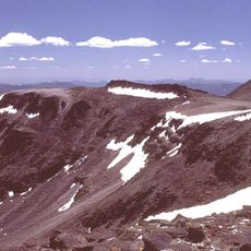
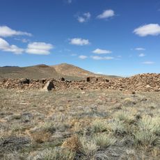
Arc Dome, Mountain summit in Nye County, Nevada

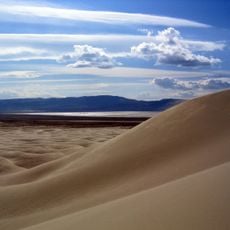
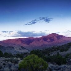
Arc Dome is the highest peak of the Toiyabe Range, reaching 11,780 feet in northwestern Nye County, Nevada. The mountain rises above desert vegetation and stands as a prominent landmark in the Great Basin landscape.

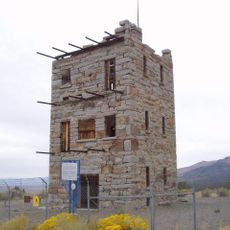
In the late 1800s, military forces built a heliograph station on the summit to send messages across Nevada territory. During World War II, a bomber aircraft crashed into the mountain slopes in 1945 while flying through adverse weather.

The North Ridge trail leads hikers through diverse ecological zones, from desert scrub to alpine environments typical of the Great Basin region.

The North Ridge Trail serves as the main access route starting from Columbine Campground and requires no specialized vehicles. Hikers pass through different elevation zones, from desert shrub to alpine terrain typical of this area.

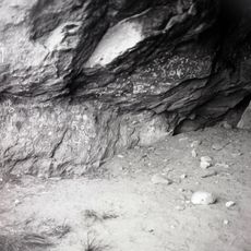
The wreckage from the 1945 bomber crash remains visible on the slopes and serves as a reminder of aviation history. Visitors hiking to the summit can encounter these remnants scattered across the mountainside.

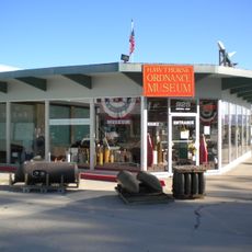
The community of curious travelers

AroundUs brings together thousands of curated places, local tips, and hidden gems, enriched daily by 60,000 contributors worldwide.

Start exploring
Location
GPS coordinates
38.83266,-117.35304
Latest update
December 11, 2025 18:11
Around this place
Berlin Historic District
United States of America

Berlin Historic District

22.7 km
Sand Mountain
United States of America

Sand Mountain

104.6 km
Berlin–Ichthyosaur State Park
United States of America

Berlin–Ichthyosaur State Park

21.6 km
Stokes Castle
United States of America

Stokes Castle

77.3 km
Arc Dome Wilderness
United States of America

Arc Dome Wilderness

4.2 km
Hawthorne Ordnance Museum
United States of America

Hawthorne Ordnance Museum

115.5 km
Belmont Courthouse State Historic Park
United States of America

Belmont Courthouse State Historic Park

49.1 km
Alta Toquima Wilderness
United States of America

Alta Toquima Wilderness

37.5 km
McGinness Hills Geothermal Complex
United States of America

McGinness Hills Geothermal Complex

92.4 km
Toquima Cave
United States of America

Toquima Cave

62.9 km
Cold Springs Pony Express Station Ruins
United States of America

Cold Springs Pony Express Station Ruins

75.7 km
George A. Bartlett House
United States of America

George A. Bartlett House

85.8 km
Nye County Courthouse
United States of America

Nye County Courthouse

86.1 km
Cold Springs Station Site
United States of America

Cold Springs Station Site

75.8 km
Mineral County Museum
United States of America

Mineral County Museum

115.5 km
State Bank and Trust Company Building
United States of America

State Bank and Trust Company Building

85.8 km
Sixth Street School
United States of America

Sixth Street School

115.2 km
Austin Masonic and Odd Fellows Hall
United States of America

Austin Masonic and Odd Fellows Hall

77.5 km
Lander County Courthouse
United States of America

Lander County Courthouse

77.3 km
Austin City Hall
United States of America

Austin City Hall

77.4 km
Tonopah Historic Mining Park
United States of America

Tonopah Historic Mining Park

85.7 km
St. Mark's Episcopal Church
United States of America

St. Mark's Episcopal Church

86.1 km
Mineral County Courthouse
United States of America

Mineral County Courthouse

115.5 km
Austin Historic District
United States of America

Austin Historic District

77.5 km
E.R. Shields House
United States of America

E.R. Shields House

86.1 km
John Gregovich House
United States of America

John Gregovich House

85.8 km
Judge W.A. Sawle House
United States of America

Judge W.A. Sawle House

85.9 km
Uri B. Curtis House
United States of America

Uri B. Curtis House

86.1 km
Show the full map
« Arc Dome - Mountain summit in Nye County, Nevada » is provided by Around Us (aroundus.com). Images and texts are derived from Wikimedia project under a Creative Commons license. You are allowed to copy, distribute, and modify copies of this page, under the conditions set by the license, as long as this note is clearly visible.

Discover hidden gems everywhere you go!

From secret cafés to breathtaking viewpoints, skip the crowded tourist spots and find places that match your style. Our app makes it easy with voice search, smart filtering, route optimization, and insider tips from travelers worldwide. Download now for the complete mobile experience.

Around Us App Screenshot

A unique approach to discovering new places

Le Figaro

All the places worth exploring

France Info

A tailor-made excursion in just a few clicks

20 Minutes

Around Us
Travel Guide & Maps
Download

Send to your phone

QR Code
1

Open the camera app on your mobile.

2

Point at the QR code with your camera. A notification will appear.

3

Tap the notification to open the link.