Chest opened
+${chestReward.xp} XP
Explorer
NOUVEAU ×${chestReward.collectible.quantity}
tapez pour fermer
Chest locked

Open chests in the app

Around Us is built for your phone — chests unlock when you walk, explore and capture nearby places.

Enable Location

We need your location to show you interesting places around you

Discover nearby places

Find interesting locations and hidden gems around you

Precise directions

Get accurate directions and distances to places

Your location is never shared with other users. It's only used when you tap the location button.

Wikieup

Log in to your account

Start exploring — it's free

Trusted by 72,885 travelers worldwide

Continue with Google
Continue with Apple
or

We will send you a code to connect

By continuing, you accept our Terms and Conditions and our Privacy Policy

Check your inbox

We've sent a pincode in your inbox. Please enter the code below.

Discussion Reviews 1 Photos
14.6k Popularity

Wikieup, Census-designated place in Mohave County, Arizona.

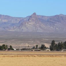
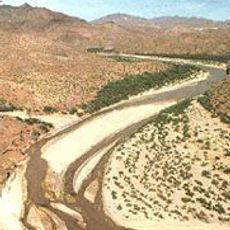
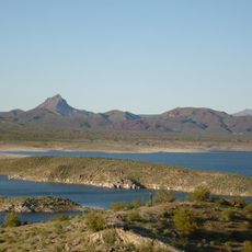
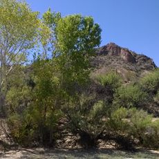
Wikieup is a small settlement in Mohave County, Arizona, nestled in a valley between mountain ranges in the region. The community sits in an area marked by desert terrain and sparse population.

The area became known from the 1500s onward when Spanish explorers passed through and documented the region. Later, researchers like Amiel W. Whipple arrived in the 1800s to map and study the terrain.

The McCrackin Mine, discovered in 1874, stands as evidence of the region's mining traditions, located 18 miles south of the settlement.

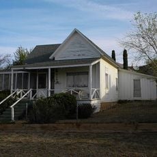
This settlement sits along a road that provides straightforward access through the area and connects to surrounding regions. The infrastructure is modest, typical of rural communities in this part of Arizona.

A well-known amateur astronomer made this place his home until recently and gained recognition through his comet discoveries. Such scientific connections are rare in small rural communities like this one.

The community of curious travelers

AroundUs brings together thousands of curated places, local tips, and hidden gems, enriched daily by 60,000 contributors worldwide.

Start exploring
Location
Elevation above the sea
609 m
GPS coordinates
34.70806,-113.61111
Latest update
December 7, 2025 20:21
Around this place
Central Arizona Project
United States of America

Central Arizona Project

65.2 km
Alamo Lake State Park
United States of America

Alamo Lake State Park

53 km
Cattail Cove State Park
United States of America

Cattail Cove State Park

64.9 km
Bill Williams River National Wildlife Refuge
United States of America

Bill Williams River National Wildlife Refuge

62.8 km
Warm Springs Wilderness
United States of America

Warm Springs Wilderness

67.1 km
Arrastra Mountain Wilderness
United States of America

Arrastra Mountain Wilderness

40.7 km
Ross H. Blakely House
United States of America

Ross H. Blakely House

67 km
Max J. Anderson House
United States of America

Max J. Anderson House

67.1 km
S. T. Elliott House
United States of America

S. T. Elliott House

67 km
Kingman Commercial Historic District
United States of America

Kingman Commercial Historic District

67 km
R. L. Anderson House
United States of America

R. L. Anderson House

66.7 km
Alamo Lake
United States of America

Alamo Lake

53 km
Masonic Temple
United States of America

Masonic Temple

67.1 km
Lovin and Withers Cottages
United States of America

Lovin and Withers Cottages

66.4 km
Raymond Carr House
United States of America

Raymond Carr House

66.7 km
Dr. Toler R. White House
United States of America

Dr. Toler R. White House

67.1 km
Lovin & Withers Investment House
United States of America

Lovin & Withers Investment House

66.5 km
Wegner Peak
United States of America

Wegner Peak

30.8 km
Hubbs House
United States of America

Hubbs House

66.7 km
W. A. Gruninger Building
United States of America

W. A. Gruninger Building

66.9 km
Foster S. Dennis House
United States of America

Foster S. Dennis House

67 km
George R. Kayser House
United States of America

George R. Kayser House

66.8 km
House at 527 Pine
United States of America

House at 527 Pine

67.1 km
Van Marter Building
United States of America

Van Marter Building

67 km
Duff T. Brown House
United States of America

Duff T. Brown House

66.9 km
Little Red School
United States of America

Little Red School

67.1 km
William G. Blakeley House
United States of America

William G. Blakeley House

67.1 km
Lefever House
United States of America

Lefever House

67 km
Show the full map
Reviews
Share your experience

No review yet

Discussions
Start a discussion...

No discussion yet

« Wikieup - Census-designated place in Mohave County, Arizona » is provided by Around Us (aroundus.com). Images and texts are derived from Wikimedia project under a Creative Commons license. You are allowed to copy, distribute, and modify copies of this page, under the conditions set by the license, as long as this note is clearly visible.

Discover hidden gems everywhere you go!

From secret cafés to breathtaking viewpoints, skip the crowded tourist spots and find places that match your style. Our app makes it easy with voice search, smart filtering, route optimization, and insider tips from travelers worldwide. Download now for the complete mobile experience.

Around Us App Screenshot

A unique approach to discovering new places

Le Figaro

All the places worth exploring

France Info

A tailor-made excursion in just a few clicks

20 Minutes

Around Us
Travel Guide & Maps
Download

Send to your phone

QR Code
1

Open the camera app on your mobile.

2

Point at the QR code with your camera. A notification will appear.

3

Tap the notification to open the link.