Chest opened
+${chestReward.xp} XP
Explorer
NOUVEAU ×${chestReward.collectible.quantity}
tapez pour fermer
Chest locked

Open chests in the app

Around Us is built for your phone — chests unlock when you walk, explore and capture nearby places.

Enable Location

We need your location to show you interesting places around you

Discover nearby places

Find interesting locations and hidden gems around you

Precise directions

Get accurate directions and distances to places

Your location is never shared with other users. It's only used when you tap the location button.

Ash Fork

Log in to your account

Start exploring — it's free

Trusted by 72,876 travelers worldwide

Continue with Google
Continue with Apple
or

We will send you a code to connect

By continuing, you accept our Terms and Conditions and our Privacy Policy

Check your inbox

We've sent a pincode in your inbox. Please enter the code below.

Discussion Reviews 1 Photos
19.8k Popularity

Ash Fork, Census-designated place in Yavapai County, Arizona.

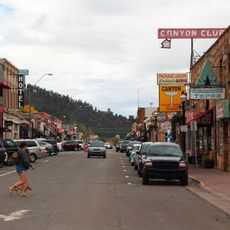
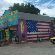
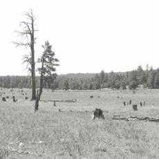
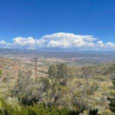
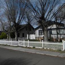
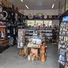
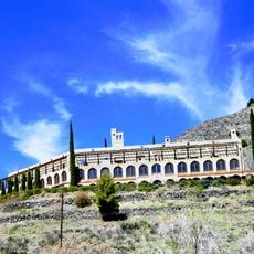
Ash Fork is a settlement in the high plateau region of Arizona situated at 1,573 meters above sea level near the town of Flagstaff. It spreads across a modest area with residential streets, local businesses, and several stone quarry operations.

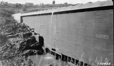
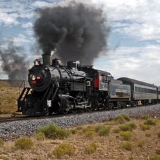
The settlement began in 1882 as a railroad siding and relocated after a fire destroyed much of it in 1885. A major shift came in 1960 when the Santa Fe Railroad moved its main line away, changing the town's economic foundation.

The town earned the title of Flagstone Capital of the World thanks to its numerous stone quarries and production facilities that have defined the place for generations. Stone extraction remains a key part of the local identity and shapes how people see the community.

The area sits along historic transportation routes and is easy to reach via the main highway, formerly Route 66. Visitors should prepare for cold winters and the high elevation at nearly 1,600 meters, which affects how the place feels and moves through the seasons.

The population has shrunk significantly since 2010, reflecting the challenges that many small communities in the region face over time. This shift reveals the difficult economic conditions that took hold after major railroad operations departed.

The community of curious travelers

AroundUs brings together thousands of curated places, local tips, and hidden gems, enriched daily by 60,000 contributors worldwide.

Start exploring
Location
Elevation above the sea
1,573 m
GPS coordinates
35.22111,-112.48722
Latest update
December 7, 2025 10:07
Around this place
Grand Canyon Railway
United States of America

Grand Canyon Railway

58.3 km
Bedrock City
United States of America

Bedrock City

57.6 km
Delgadillo's Snow Cap Drive-In
United States of America

Delgadillo's Snow Cap Drive-In

37 km
Lava River Cave
United States of America

Lava River Cave

60.7 km
Kendrick Peak
United States of America

Kendrick Peak

61.4 km
Jerome Historic District
United States of America

Jerome Historic District

62.3 km
Sycamore Canyon Wilderness
United States of America

Sycamore Canyon Wilderness

52.3 km
Urban Route 66, Williams
United States of America

Urban Route 66, Williams

27 km
Seligman Commercial Historic District
United States of America

Seligman Commercial Historic District

37.1 km
Woodchute Wilderness
United States of America

Woodchute Wilderness

59.3 km
Canyon Coaster Adventure Park
United States of America

Canyon Coaster Adventure Park

28.2 km

Barney Flat Historic Railroad Logging Landscape
United States of America

Barney Flat Historic Railroad Logging Landscape

31.7 km
Perkinsville Bridge
United States of America

Perkinsville Bridge

44.5 km
Camp Clover Ranger Station
United States of America

Camp Clover Ranger Station

24.5 km
First Methodist Episcopal Church and Parsonage
United States of America

First Methodist Episcopal Church and Parsonage

29.8 km
Jerome State Historical Mine Park Museum
United States of America

Jerome State Historical Mine Park Museum

62.3 km
Williams Residential Historic District
United States of America

Williams Residential Historic District

27.5 km
Sycamore Falls
United States of America

Sycamore Falls

43 km
Route 66 Museum And Gift Shop
United States of America

Route 66 Museum And Gift Shop

26.7 km
Audrey Headframe Park
United States of America

Audrey Headframe Park

62.2 km
Volunteer Lookout Cabin
United States of America

Volunteer Lookout Cabin

53.8 km
Kendrick Mountain Fire Lookout Cabin
United States of America

Kendrick Mountain Fire Lookout Cabin

61.8 km
Historic Angel's Barber Shop Museum
United States of America

Historic Angel's Barber Shop Museum

37 km
Bill Williams Lookout Tower
United States of America

Bill Williams Lookout Tower

25.8 km
Volunteer Lookout Tower
United States of America

Volunteer Lookout Tower

53.8 km
Big Hell Canyon Railroad Bridge
United States of America

Big Hell Canyon Railroad Bridge

28.7 km
Little Hell Canyon Bridge
United States of America

Little Hell Canyon Bridge

17.4 km
Show the full map
Reviews
Share your experience

No review yet

Discussions
Start a discussion...

No discussion yet

« Ash Fork - Census-designated place in Yavapai County, Arizona » is provided by Around Us (aroundus.com). Images and texts are derived from Wikimedia project under a Creative Commons license. You are allowed to copy, distribute, and modify copies of this page, under the conditions set by the license, as long as this note is clearly visible.

Discover hidden gems everywhere you go!

From secret cafés to breathtaking viewpoints, skip the crowded tourist spots and find places that match your style. Our app makes it easy with voice search, smart filtering, route optimization, and insider tips from travelers worldwide. Download now for the complete mobile experience.

Around Us App Screenshot

A unique approach to discovering new places

Le Figaro

All the places worth exploring

France Info

A tailor-made excursion in just a few clicks

20 Minutes

Around Us
Travel Guide & Maps
Download

Send to your phone

QR Code
1

Open the camera app on your mobile.

2

Point at the QR code with your camera. A notification will appear.

3

Tap the notification to open the link.