Chest opened
+${chestReward.xp} XP
Explorer
NOUVEAU ×${chestReward.collectible.quantity}
tapez pour fermer
Chest locked

Open chests in the app

Around Us is built for your phone — chests unlock when you walk, explore and capture nearby places.

Enable Location

We need your location to show you interesting places around you

Discover nearby places

Find interesting locations and hidden gems around you

Precise directions

Get accurate directions and distances to places

Your location is never shared with other users. It's only used when you tap the location button.

Carson Sink

Log in to your account

Start exploring — it's free

Trusted by 72,874 travelers worldwide

Continue with Google
Continue with Apple
or

We will send you a code to connect

By continuing, you accept our Terms and Conditions and our Privacy Policy

Check your inbox

We've sent a pincode in your inbox. Please enter the code below.

Carson Sink
Discussion Reviews 1 Photos
11.4k Popularity

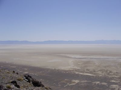
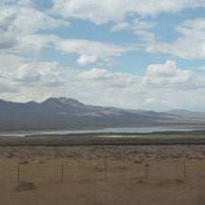
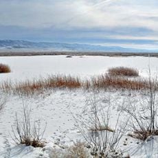
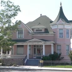
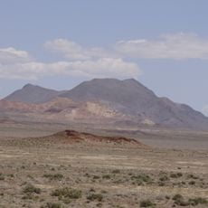
Carson Sink, Dry lake in Churchill County, US.

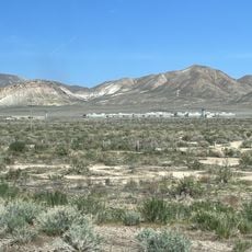
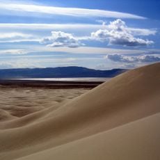
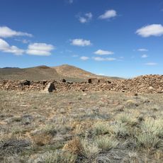
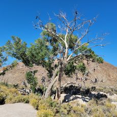
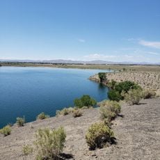
Carson Sink is a dry lake basin covering roughly 300 square miles in Nevada's Carson Desert. The landscape consists of wide salt flats interrupted by scattered rock formations and surrounded by low mountain ranges.

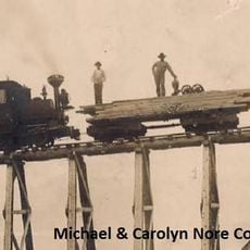
Gold Rush emigrants crossed through this area as a dangerous passage to reach the Carson River. The route through the adjacent Forty Mile Desert posed significant hardships for travelers seeking water.

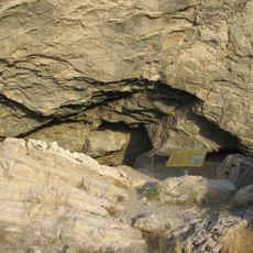
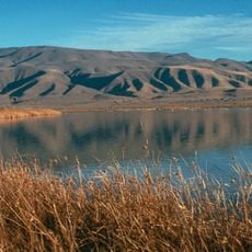
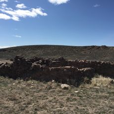
The Northern Paiute people maintain spiritual connections to Lone Rock, a prominent stone formation rising from the basin floor. This landmark holds deep significance as a place of meditation and gathering for the community.

Access to the area is available from roads near Fallon, with cooler months offering the best visiting conditions. The open salt flats provide little shade, so plan accordingly for sun exposure and heat.

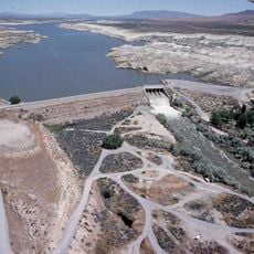
An artificial channel connecting this basin to Humboldt Sink was constructed in the mid-1980s to manage flood risk. This brief engineering intervention tried to redirect water flow across the desert floor.

The community of curious travelers

AroundUs brings together thousands of curated places, local tips, and hidden gems, enriched daily by 60,000 contributors worldwide.

Start exploring
Location
GPS coordinates
39.87780,-118.34700
Latest update
December 8, 2025 13:41
Around this place
Lovelock Correctional Center
United States of America

Lovelock Correctional Center

38.6 km
Lovelock Cave
United States of America

Lovelock Cave

20.3 km
Sand Mountain
United States of America

Sand Mountain

63.5 km
Rye Patch Reservoir
United States of America

Rye Patch Reservoir

66.1 km
Rye Patch State Recreation Area
United States of America

Rye Patch State Recreation Area

66.1 km
Humboldt Cave
United States of America

Humboldt Cave

32.1 km
Stillwater National Wildlife Refuge
United States of America

Stillwater National Wildlife Refuge

32.5 km
Fallon National Wildlife Refuge
United States of America

Fallon National Wildlife Refuge

27 km
Cold Springs Pony Express Station Ruins
United States of America

Cold Springs Pony Express Station Ruins

68.8 km
Salmon Creek Railroad
United States of America

Salmon Creek Railroad

55.2 km
Pershing County Courthouse
United States of America

Pershing County Courthouse

32.4 km
Cold Springs Station Site
United States of America

Cold Springs Station Site

68.7 km
Marzen House
United States of America

Marzen House

34.6 km
Oats Park Grammar School
United States of America

Oats Park Grammar School

57.6 km
Harmon School
United States of America

Harmon School

52.1 km
Holy Trinity Episcopal Church
United States of America

Holy Trinity Episcopal Church

58.4 km
Churchill County Jail
United States of America

Churchill County Jail

58 km
Churchill County Courthouse
United States of America

Churchill County Courthouse

58.3 km
Fallon City Hall
United States of America

Fallon City Hall

58.1 km
Robert L. Douglass House
United States of America

Robert L. Douglass House

58 km
The Cottage Schools
United States of America

The Cottage Schools

58.1 km
Topog Peak
United States of America

Topog Peak

26.5 km
Ragged Top Mountain
United States of America

Ragged Top Mountain

41.1 km
Vocational-Agriculture Building
United States of America

Vocational-Agriculture Building

44.5 km
U.S. Post Office-Lovelock Main
United States of America

U.S. Post Office-Lovelock Main

35.4 km
Maine Street Historic District
United States of America

Maine Street Historic District

58.2 km
Shoe Tree
United States of America

Shoe Tree

71.9 km
Soda Lake Beach
United States of America

Soda Lake Beach

60.8 km
Show the full map
Reviews
Share your experience

No review yet

Discussions
Start a discussion...

No discussion yet

« Carson Sink - Dry lake in Churchill County, US » is provided by Around Us (aroundus.com). Images and texts are derived from Wikimedia project under a Creative Commons license. You are allowed to copy, distribute, and modify copies of this page, under the conditions set by the license, as long as this note is clearly visible.

Discover hidden gems everywhere you go!

From secret cafés to breathtaking viewpoints, skip the crowded tourist spots and find places that match your style. Our app makes it easy with voice search, smart filtering, route optimization, and insider tips from travelers worldwide. Download now for the complete mobile experience.

Around Us App Screenshot

A unique approach to discovering new places

Le Figaro

All the places worth exploring

France Info

A tailor-made excursion in just a few clicks

20 Minutes

Around Us
Travel Guide & Maps
Download

Send to your phone

QR Code
1

Open the camera app on your mobile.

2

Point at the QR code with your camera. A notification will appear.

3

Tap the notification to open the link.