Chest opened
+${chestReward.xp} XP
Explorer
NOUVEAU ×${chestReward.collectible.quantity}
tapez pour fermer
Chest locked

Open chests in the app

Around Us is built for your phone — chests unlock when you walk, explore and capture nearby places.

Enable Location

We need your location to show you interesting places around you

Discover nearby places

Find interesting locations and hidden gems around you

Precise directions

Get accurate directions and distances to places

Your location is never shared with other users. It's only used when you tap the location button.

Log in to your account

Start exploring — it's free

Trusted by 72,888 travelers worldwide

Continue with Google
Continue with Apple
or

We will send you a code to connect

By continuing, you accept our Terms and Conditions and our Privacy Policy

Check your inbox

We've sent a pincode in your inbox. Please enter the code below.

Project 56
Discussion Reviews Photo
17.3k Popularity

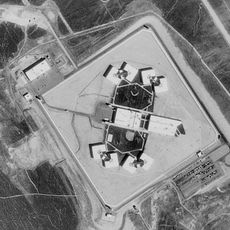
Project 56, series of 1950s American nuclear tests

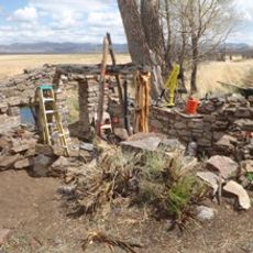
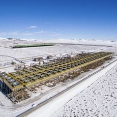
Project 56 was a series of nuclear tests conducted in the mid-1950s at the Nevada Test Site, primarily in the Yucca Flat region. The tests involved placing small devices in sealed pits and on the surface to check how nuclear weapons would respond to accidents and physical damage.

The tests took place over two years and included four detonations that examined how nuclear weapons behaved under stress conditions. The findings led to improved safety standards and weapon designs that reduced the risk of accidental explosions in damaged devices.

The site represents a period when nuclear safety was being carefully studied through controlled experiments. The tests helped establish safety protocols and awareness about radioactive hazards that influenced public understanding of nuclear risks in the surrounding region.

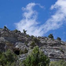
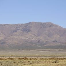
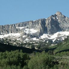
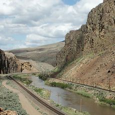
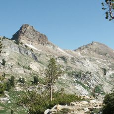
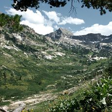
The site is located in Nevada's dry desert region at elevated terrain with clear skies. The area can contain small amounts of radioactive materials from past tests, particularly in former contaminated zones known as Plutonium Valley, so caution and awareness of surroundings is recommended.

Notably, some tests failed to produce nuclear explosions, which was actually the desired outcome demonstrating that safety mechanisms worked as intended. These successful failures proved that weapons would not detonate accidentally and provided confidence in weapon design reliability.

The community of curious travelers

AroundUs brings together thousands of curated places, local tips, and hidden gems, enriched daily by 60,000 contributors worldwide.

Start exploring
Location
GPS coordinates
39.93600,-115.89700
Latest update
February 17, 2026 01:00
Around this place
U.S. Route 50 in Nevada
United States of America

U.S. Route 50 in Nevada

364.3 km
Ruby Mountains
United States of America

Ruby Mountains

84.3 km
Ely State Prison
United States of America

Ely State Prison

102.5 km
Ruby Dome
United States of America

Ruby Dome

84.3 km
Ruby Lake National Wildlife Refuge
United States of America

Ruby Lake National Wildlife Refuge

45.4 km
Fort Ruby
United States of America

Fort Ruby

34.6 km
Ruby Mountains Wilderness
United States of America

Ruby Mountains Wilderness

83.5 km
Ruby Crest National Recreation Trail
United States of America

Ruby Crest National Recreation Trail

79.9 km
South Fork State Recreation Area
United States of America

South Fork State Recreation Area

81.3 km
McGinness Hills Geothermal Complex
United States of America

McGinness Hills Geothermal Complex

95 km
Goshute Canyon Wilderness
United States of America

Goshute Canyon Wilderness

88.7 km
Diamond Peak
United States of America

Diamond Peak

39.6 km
United States of America

Carlin Canyon

89.1 km
Verdi Peaks
United States of America

Verdi Peaks

91.2 km
Mount Fitzgerald
United States of America

Mount Fitzgerald

85.2 km
Palisade Canyon
United States of America

Palisade Canyon

80.3 km
Elko County Courthouse
United States of America

Elko County Courthouse

100.6 km
Snow Lake Peak
United States of America

Snow Lake Peak

85.8 km
Mount Gilbert
United States of America

Mount Gilbert

85.7 km
Austin Masonic and Odd Fellows Hall
United States of America

Austin Masonic and Odd Fellows Hall

111.9 km
Seitz Canyon
United States of America

Seitz Canyon

87.8 km
Eureka Historic District
United States of America

Eureka Historic District

47.4 km
Lander County Courthouse
United States of America

Lander County Courthouse

112 km
Right Fork Canyon
United States of America

Right Fork Canyon

87.1 km
Austin Historic District
United States of America

Austin Historic District

111.9 km
California Trail Interpretive Center, Free Museum
United States of America

California Trail Interpretive Center, Free Museum

92 km
UEC Elko Cinema 6
United States of America

UEC Elko Cinema 6

100.5 km
UEC Crystal 5
United States of America

UEC Crystal 5

100.5 km
Show the full map
Reviews
Share your experience

No review yet

Discussions
Start a discussion...

No discussion yet

« Project 56 - series of 1950s American nuclear tests » is provided by Around Us (aroundus.com). Images and texts are derived from Wikimedia project under a Creative Commons license. You are allowed to copy, distribute, and modify copies of this page, under the conditions set by the license, as long as this note is clearly visible.

Discover hidden gems everywhere you go!

From secret cafés to breathtaking viewpoints, skip the crowded tourist spots and find places that match your style. Our app makes it easy with voice search, smart filtering, route optimization, and insider tips from travelers worldwide. Download now for the complete mobile experience.

Around Us App Screenshot

A unique approach to discovering new places

Le Figaro

All the places worth exploring

France Info

A tailor-made excursion in just a few clicks

20 Minutes

Around Us
Travel Guide & Maps
Download

Send to your phone

QR Code
1

Open the camera app on your mobile.

2

Point at the QR code with your camera. A notification will appear.

3

Tap the notification to open the link.