Chest opened
+${chestReward.xp} XP
Explorer
NOUVEAU ×${chestReward.collectible.quantity}
tapez pour fermer
Chest locked

Open chests in the app

Around Us is built for your phone — chests unlock when you walk, explore and capture nearby places.

Enable Location

We need your location to show you interesting places around you

Discover nearby places

Find interesting locations and hidden gems around you

Precise directions

Get accurate directions and distances to places

Your location is never shared with other users. It's only used when you tap the location button.

Jarbidge

Log in to your account

Start exploring — it's free

Trusted by 72,889 travelers worldwide

Continue with Google
Continue with Apple
or

We will send you a code to connect

By continuing, you accept our Terms and Conditions and our Privacy Policy

Check your inbox

We've sent a pincode in your inbox. Please enter the code below.

Discussion Reviews 1 Photos
22.3k Popularity

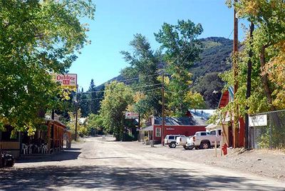
Jarbidge, unincorporated community in Elko County, Nevada, United States

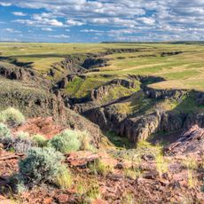
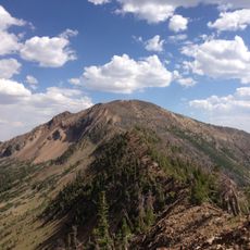
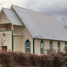
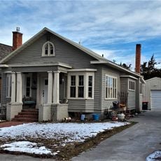
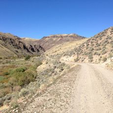
Jarbidge is an unincorporated community sitting in a remote mountain valley in northeastern Nevada along a creek. Rocky ridges and pine forests surround the handful of scattered buildings that make up this settlement.

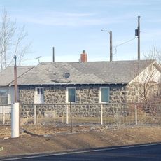
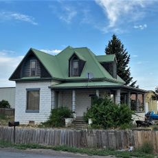
The settlement was founded in the 1870s during a regional gold rush when miners established a camp here. Mining activity declined sharply in the early 1900s, causing residents to leave and the community to become nearly abandoned.

The name comes from the Shoshone language and reflects the indigenous heritage of this remote region. Visitors can see how the few remaining structures tell stories of both Native American presence and early pioneer settlement.

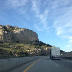
The location is only accessible by a long unpaved road, so a sturdy vehicle is required to reach it. Visitors should bring supplies and water with them, as services are nearly nonexistent in this remote area.

The community ranks among the most difficult places to reach in Nevada and is home to only a few residents. This extreme isolation has preserved much of its original appearance from the mining era.

The community of curious travelers

AroundUs brings together thousands of curated places, local tips, and hidden gems, enriched daily by 60,000 contributors worldwide.

Start exploring
Location
Elevation above the sea
1,932 m
GPS coordinates
41.87361,-115.43194
Latest update
March 2, 2026 22:16
Around this place
Perrine Bridge
United States of America

Perrine Bridge

114.2 km
Bruneau Dunes State Park
United States of America

Bruneau Dunes State Park

115.6 km
Hagerman Fossil Beds National Monument
United States of America

Hagerman Fossil Beds National Monument

109.9 km
Jarbidge Wilderness
United States of America

Jarbidge Wilderness

15.6 km
Twin Falls Idaho Temple
United States of America

Twin Falls Idaho Temple

113.8 km
Owyhee River Wilderness
United States of America

Owyhee River Wilderness

102.9 km
Pillar Falls
United States of America

Pillar Falls

115.4 km
Wild Horse State Recreation Area
United States of America

Wild Horse State Recreation Area

38 km
Bruneau – Jarbidge Rivers Wilderness
United States of America

Bruneau – Jarbidge Rivers Wilderness

60.3 km
Pole Creek Wilderness
United States of America

Pole Creek Wilderness

114.6 km
Big Jacks Creek Wilderness
United States of America

Big Jacks Creek Wilderness

84.5 km
Little Jacks Creek Wilderness
United States of America

Little Jacks Creek Wilderness

112.6 km
United States of America

Gold Creek Ranger Station

24.3 km
Owsley Bridge
United States of America

Owsley Bridge

108.8 km
Canyonside School
United States of America

Canyonside School

116 km
Maverick Canyon
United States of America

Maverick Canyon

113.3 km
Marys River Peak
United States of America

Marys River Peak

14 km
Buhl IOOF Building
United States of America

Buhl IOOF Building

97.9 km
Ramona Theatre
United States of America

Ramona Theatre

97.9 km
O. J. Daniels House
United States of America

O. J. Daniels House

115 km
Bruneau Episcopal Church
United States of America

Bruneau Episcopal Church

116.1 km
Burton Morse House
United States of America

Burton Morse House

110.8 km
Achille Duquesne House
United States of America

Achille Duquesne House

102.9 km
Lincoln Elementary School
United States of America

Lincoln Elementary School

109.9 km
Twin Falls City Park Historic District
United States of America

Twin Falls City Park Historic District

110.3 km
Hagerman Fossil Beds National Monument Visitor Center
United States of America

Hagerman Fossil Beds National Monument Visitor Center

113.9 km
Twin Falls Milling and Elevator Company Warehouse
United States of America

Twin Falls Milling and Elevator Company Warehouse

109.3 km
Bruneau Canyon
United States of America

Bruneau Canyon

103.9 km
Show the full map
Reviews
Share your experience

No review yet

Discussions
Start a discussion...

No discussion yet

« Jarbidge - unincorporated community in Elko County, Nevada, United States » is provided by Around Us (aroundus.com). Images and texts are derived from Wikimedia project under a Creative Commons license. You are allowed to copy, distribute, and modify copies of this page, under the conditions set by the license, as long as this note is clearly visible.

Discover hidden gems everywhere you go!

From secret cafés to breathtaking viewpoints, skip the crowded tourist spots and find places that match your style. Our app makes it easy with voice search, smart filtering, route optimization, and insider tips from travelers worldwide. Download now for the complete mobile experience.

Around Us App Screenshot

A unique approach to discovering new places

Le Figaro

All the places worth exploring

France Info

A tailor-made excursion in just a few clicks

20 Minutes

Around Us
Travel Guide & Maps
Download

Send to your phone

QR Code
1

Open the camera app on your mobile.

2

Point at the QR code with your camera. A notification will appear.

3

Tap the notification to open the link.