Chest opened
+${chestReward.xp} XP
Explorer
NOUVEAU ×${chestReward.collectible.quantity}
tapez pour fermer
Chest locked

Open chests in the app

Around Us is built for your phone — chests unlock when you walk, explore and capture nearby places.

Enable Location

We need your location to show you interesting places around you

Discover nearby places

Find interesting locations and hidden gems around you

Precise directions

Get accurate directions and distances to places

Your location is never shared with other users. It's only used when you tap the location button.

Mount Elden

Log in to your account

Start exploring — it's free

Trusted by 72,887 travelers worldwide

Continue with Google
Continue with Apple
or

We will send you a code to connect

By continuing, you accept our Terms and Conditions and our Privacy Policy

Check your inbox

We've sent a pincode in your inbox. Please enter the code below.

Mount Elden
Discussion Reviews 1 Photos
10.5k Popularity

Mount Elden, Mountain peak in Coconino County, Arizona, US.

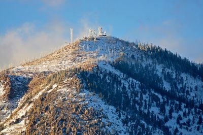
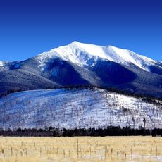
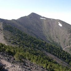
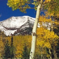
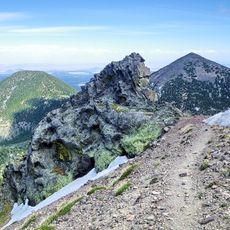
Mount Elden is a volcanic peak on the eastern edge of Flagstaff, in northern Arizona, rising to about 9,300 feet (2,840 m). Its slopes are covered in Ponderosa pine, broken by rocky outcrops and open clearings that become more sparse as you gain elevation.

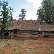
The peak takes its name from John Elden, a sheep rancher who settled near a natural spring at the base of the mountain in 1877. His presence in the area was brief, but the name stayed and became part of the local geography from that point forward.

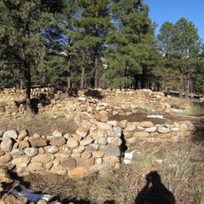
The Sinagua people lived around this peak centuries ago and left petroglyphs that can still be spotted along certain trails today. Seeing these marks carved into the rock gives the hike a different feeling than a simple walk through the forest.

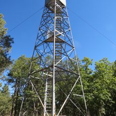
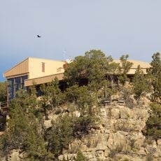
Several trails reach the summit and various viewpoints, ranging from easy walks to more demanding climbs, so it is worth choosing a route that matches your fitness level. The mountain is right next to Flagstaff, which makes it easy to visit for a few hours without needing much preparation beyond good shoes and water.

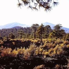
A forest fire in 1977 swept across the southern slopes and left behind a landscape that has been slowly recovering ever since. Walking those slopes today, you can see patches of young growth next to older trees, which makes the plant life there more varied than on the untouched sides of the mountain.

The community of curious travelers

AroundUs brings together thousands of curated places, local tips, and hidden gems, enriched daily by 60,000 contributors worldwide.

Start exploring
Location
GPS coordinates
35.24111,-111.59667
Latest update
March 3, 2026 08:21
Around this place
Humphreys Peak
United States of America

Humphreys Peak

13.9 km
San Francisco Peaks
United States of America

San Francisco Peaks

12.4 km
Lowell Observatory
United States of America

Lowell Observatory

7.5 km
Riordan Mansion State Historic Park
United States of America

Riordan Mansion State Historic Park

8.1 km
Museum of Northern Arizona
United States of America

Museum of Northern Arizona

6.3 km
Agassiz Peak
United States of America

Agassiz Peak

12 km
Kachina Peaks Wilderness
United States of America

Kachina Peaks Wilderness

12.4 km
Elden Pueblo
United States of America

Elden Pueblo

2.6 km
Fremont Peak
United States of America

Fremont Peak

10.8 km
Orpheum Theater
United States of America

Orpheum Theater

6.7 km
The Arboretum at Flagstaff
United States of America

The Arboretum at Flagstaff

15.2 km
Doyle Peak
United States of America

Doyle Peak

10.8 km
Railroad Addition Historic District
United States of America

Railroad Addition Historic District

6.7 km
Lenox Crater
United States of America

Lenox Crater

14.6 km
Our Lady of Guadaloupe Church
United States of America

Our Lady of Guadaloupe Church

7.2 km
Presbyterian Church Parsonage
United States of America

Presbyterian Church Parsonage

6.5 km
Brannen-Devine House
United States of America

Brannen-Devine House

6.9 km
Cliffs Ranger Station
United States of America

Cliffs Ranger Station

10.2 km
Riordan Mansion
United States of America

Riordan Mansion

8.3 km
Flagstaff Armory
United States of America

Flagstaff Armory

7.4 km
Pioneer Museum--Arizona Historical Society
United States of America

Pioneer Museum--Arizona Historical Society

5.7 km
Flagstaff Southside Historic District
United States of America

Flagstaff Southside Historic District

7.1 km
Woody Mountain Lookout Tower
United States of America

Woody Mountain Lookout Tower

17.9 km
Walnut Canyon Visitor Center
United States of America

Walnut Canyon Visitor Center

11.1 km
Flagstaff Federated Community Church
United States of America

Flagstaff Federated Community Church

6.9 km
Flagstaff City-coconino County Public Library
United States of America

Flagstaff City-coconino County Public Library

6.9 km
Northern Arizona Normal School Historic District
United States of America

Northern Arizona Normal School Historic District

7.5 km
Winona Bridge
United States of America

Winona Bridge

16.3 km
Show the full map
Reviews
Share your experience

No review yet

Discussions
Start a discussion...

No discussion yet

« Mount Elden - Mountain peak in Coconino County, Arizona, US » is provided by Around Us (aroundus.com). Images and texts are derived from Wikimedia project under a Creative Commons license. You are allowed to copy, distribute, and modify copies of this page, under the conditions set by the license, as long as this note is clearly visible.

Discover hidden gems everywhere you go!

From secret cafés to breathtaking viewpoints, skip the crowded tourist spots and find places that match your style. Our app makes it easy with voice search, smart filtering, route optimization, and insider tips from travelers worldwide. Download now for the complete mobile experience.

Around Us App Screenshot

A unique approach to discovering new places

Le Figaro

All the places worth exploring

France Info

A tailor-made excursion in just a few clicks

20 Minutes

Around Us
Travel Guide & Maps
Download

Send to your phone

QR Code
1

Open the camera app on your mobile.

2

Point at the QR code with your camera. A notification will appear.

3

Tap the notification to open the link.