Enable Location

We need your location to show you interesting places around you

Discover nearby places

Find interesting locations and hidden gems around you

Precise directions

Get accurate directions and distances to places

Your location is never shared with other users. It's only used when you tap the location button.

Pueblo Bonito

Log in to your account

Start exploring — it's free

Trusted by 62,021 travelers worldwide

Continue with Google
Continue with Apple
or

We will send you a code to connect

By continuing, you accept our Terms and Conditions and our Privacy Policy

Check your inbox

We've sent a pincode in your inbox. Please enter the code below.

Pueblo Bonito

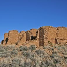
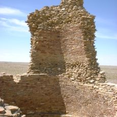
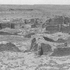
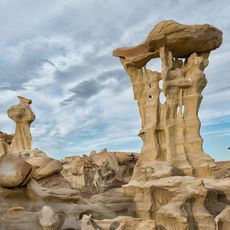
Pueblo Bonito, Archaeological site in San Juan County, United States.

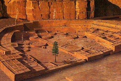
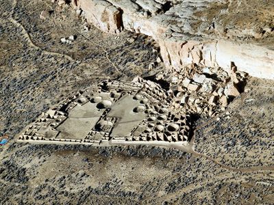
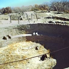
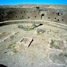
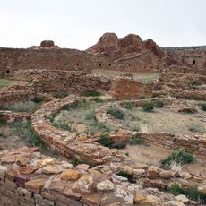
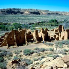
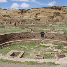
Pueblo Bonito is an excavated settlement in New Mexico spanning several acres with hundreds of stone rooms arranged in a distinctive D-shaped pattern. The structures display multiple stories and central chambers used for ceremonies and community gatherings.

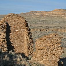
The settlement was constructed between the 9th and 12th centuries by Ancestral Puebloan peoples in multiple building phases representing a peak of their architectural achievement. The structure was later abandoned and lay hidden under desert sand for centuries until modern excavation efforts exposed it.

Spanish conquistadors named it "Beautiful Village" when they encountered the ruins centuries after its abandonment. The layout and room arrangement reveal how residents organized both daily life and spiritual practices.

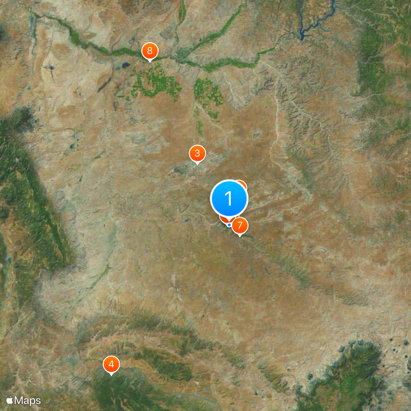
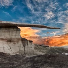
Visitors reach the ruins via a short, well-marked trail starting from a nearby visitor center with some elevation changes along the way. Early morning or late afternoon visits work best since sun exposure is less intense and walking is easier.

Archaeologists found cacao remains in pottery fragments, revealing that residents tapped into trade networks stretching over a thousand kilometers. This discovery shows unexpected connections and exchange with distant communities long before European contact.

The community of curious travelers

AroundUs brings together thousands of curated places, local tips, and hidden gems, enriched daily by 60,000 contributors worldwide.

Start exploring
Location
GPS coordinates
36.06060,-107.96200
Latest update
December 17, 2025 08:33
Around this place
Chaco Culture National Historical Park
United States of America

Chaco Culture National Historical Park

723 m
Bisti/De-Na-Zin Wilderness
United States of America

Bisti/De-Na-Zin Wilderness

30.5 km
Fort Wingate
United States of America

Fort Wingate

84.2 km
United States of America

Chetro Ketl

720 m
Trail of the Ancients Scenic Byway
United States of America

Trail of the Ancients Scenic Byway

723 m
Fajada Butte
United States of America

Fajada Butte

6.6 km
Kirtland Formation
United States of America

Kirtland Formation

80 km
Ah-shi-sle-pah Wilderness
United States of America

Ah-shi-sle-pah Wilderness

12.5 km
Salmon Ruins
United States of America

Salmon Ruins

71.6 km
Casa Rinconada
United States of America

Casa Rinconada

670 m
Angel Peak Scenic Area
United States of America

Angel Peak Scenic Area

55 km
Una Vida
United States of America

Una Vida

5.4 km
Pueblo Alto
United States of America

Pueblo Alto

1.1 km
Pueblo del Arroyo
United States of America

Pueblo del Arroyo

366 m
Crow Canyon Archaeological District
United States of America

Crow Canyon Archaeological District

62.4 km
Kin Kletso
United States of America

Kin Kletso

883 m
Farmington Public Library
United States of America

Farmington Public Library

79.2 km
Kin Ya-ah
United States of America

Kin Ya-ah

44.9 km
Farmington Historic Downtown Commercial District
United States of America

Farmington Historic Downtown Commercial District

77.5 km
Kin Bineola
United States of America

Kin Bineola

17.3 km
American Hotel
United States of America

American Hotel

84.4 km
Aztec Main Street Historic District
United States of America

Aztec Main Street Historic District

84.8 km
Aztec Motor Company Building
United States of America

Aztec Motor Company Building

84.6 km
Engleman-Thomas Building
United States of America

Engleman-Thomas Building

84.7 km
Church Avenue-Lovers Lane Historic District
United States of America

Church Avenue-Lovers Lane Historic District

84.9 km
Valley of Dreams
United States of America

Valley of Dreams

10 km
King of Wings
United States of America

King of Wings

12.3 km
Chaco Culture National Historical Park - Contiguous unit
United States of America

Chaco Culture National Historical Park - Contiguous unit

868 m
Show the full map
« Pueblo Bonito - Archaeological site in San Juan County, United States » is provided by Around Us (aroundus.com). Images and texts are derived from Wikimedia project under a Creative Commons license. You are allowed to copy, distribute, and modify copies of this page, under the conditions set by the license, as long as this note is clearly visible.

Discover hidden gems everywhere you go!

From secret cafés to breathtaking viewpoints, skip the crowded tourist spots and find places that match your style. Our app makes it easy with voice search, smart filtering, route optimization, and insider tips from travelers worldwide. Download now for the complete mobile experience.

Around Us App Screenshot

A unique approach to discovering new places

Le Figaro

All the places worth exploring

France Info

A tailor-made excursion in just a few clicks

20 Minutes

Around Us
Travel Guide & Maps
Download

Send to your phone

QR Code
1

Open the camera app on your mobile.

2

Point at the QR code with your camera. A notification will appear.

3

Tap the notification to open the link.