Enable Location

We need your location to show you interesting places around you

Discover nearby places

Find interesting locations and hidden gems around you

Precise directions

Get accurate directions and distances to places

Your location is never shared with other users. It's only used when you tap the location button.

Fajada Butte

Log in to your account

Start exploring — it's free

Trusted by 62,021 travelers worldwide

Continue with Google
Continue with Apple
or

We will send you a code to connect

By continuing, you accept our Terms and Conditions and our Privacy Policy

Check your inbox

We've sent a pincode in your inbox. Please enter the code below.

Fajada Butte

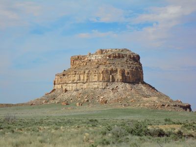
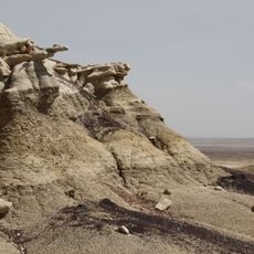
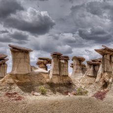
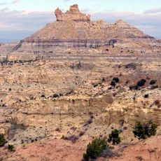
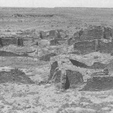
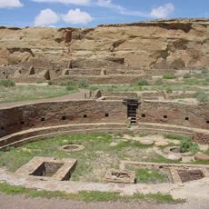
Fajada Butte, Sandstone butte in Chaco Culture National Historical Park, New Mexico, United States

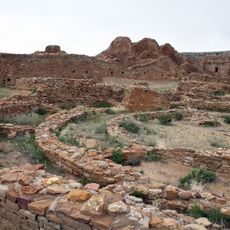
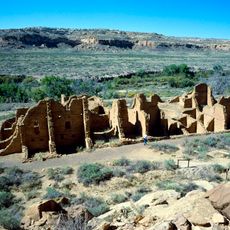
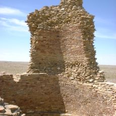
Fajada Butte is a sandstone formation rising approximately 135 meters within a national park in New Mexico. The rock face includes ancient dwellings and a ceremonial ramp structure stretching about 230 meters along its southwestern side.

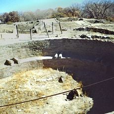
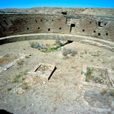
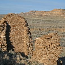
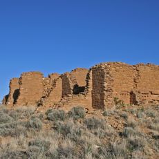
The butte was inhabited by the Ancestral Puebloans around 1000 years ago. The people who lived here eventually abandoned the region, leaving behind structures that reveal their sophisticated understanding of timekeeping.

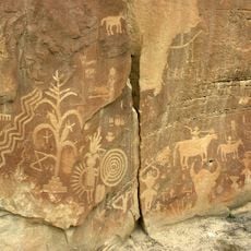
This butte served as an astronomical observatory for the people who lived in the region centuries ago. Sunlight patterns on the rock face helped them track the seasons and plan their ceremonies.

This site is closed to public access to protect the archaeological features and prevent damage to the rock. You can observe the formation from designated viewing areas near the park's facilities.

This formation gained widespread scientific attention when researchers in the 1970s discovered how precisely the petroglyphs aligned with astronomical events. The sun's path creates measurable light and shadow patterns that ancient inhabitants used to track important dates without modern instruments.

The community of curious travelers

AroundUs brings together thousands of curated places, local tips, and hidden gems, enriched daily by 60,000 contributors worldwide.

Start exploring
Location
GPS coordinates
36.01889,-107.90972
Latest update
December 7, 2025 20:44
Around this place
Chaco Culture National Historical Park
United States of America

Chaco Culture National Historical Park

7.1 km
Pueblo Bonito
United States of America

Pueblo Bonito

6.6 km
Bisti/De-Na-Zin Wilderness
United States of America

Bisti/De-Na-Zin Wilderness

36.9 km
Fort Wingate
United States of America

Fort Wingate

83.7 km
United States of America

Chetro Ketl

6.1 km
Trail of the Ancients Scenic Byway
United States of America

Trail of the Ancients Scenic Byway

7.1 km
Kirtland Formation
United States of America

Kirtland Formation

86.3 km
Ah-shi-sle-pah Wilderness
United States of America

Ah-shi-sle-pah Wilderness

16.5 km
Salmon Ruins
United States of America

Salmon Ruins

76.7 km
Bluewater Lake State Park
United States of America

Bluewater Lake State Park

82.7 km
Casa Rinconada
United States of America

Casa Rinconada

6 km
Angel Peak Scenic Area
United States of America

Angel Peak Scenic Area

59.1 km
Una Vida
United States of America

Una Vida

1.7 km
Pueblo Alto
United States of America

Pueblo Alto

7.1 km
Pueblo del Arroyo
United States of America

Pueblo del Arroyo

6.9 km
United States of America

Apache Nugget Casino

59.9 km
Crow Canyon Archaeological District
United States of America

Crow Canyon Archaeological District

64.4 km
Kin Kletso
United States of America

Kin Kletso

7.5 km
Farmington Public Library
United States of America

Farmington Public Library

84.9 km
Kin Ya-ah
United States of America

Kin Ya-ah

42.4 km
Bowlin's Old Crater Trading Post
United States of America

Bowlin's Old Crater Trading Post

82.1 km
Farmington Historic Downtown Commercial District
United States of America

Farmington Historic Downtown Commercial District

83.4 km
Kin Bineola
United States of America

Kin Bineola

20.9 km
Roy T. Herman's Garage and Service Station
United States of America

Roy T. Herman's Garage and Service Station

74.8 km
American Hotel
United States of America

American Hotel

89.4 km
Valley of Dreams
United States of America

Valley of Dreams

15.8 km
King of Wings
United States of America

King of Wings

17.9 km
Chaco Culture National Historical Park - Contiguous unit
United States of America

Chaco Culture National Historical Park - Contiguous unit

7.4 km
Show the full map
« Fajada Butte - Sandstone butte in Chaco Culture National Historical Park, New Mexico, United States » is provided by Around Us (aroundus.com). Images and texts are derived from Wikimedia project under a Creative Commons license. You are allowed to copy, distribute, and modify copies of this page, under the conditions set by the license, as long as this note is clearly visible.

Discover hidden gems everywhere you go!

From secret cafés to breathtaking viewpoints, skip the crowded tourist spots and find places that match your style. Our app makes it easy with voice search, smart filtering, route optimization, and insider tips from travelers worldwide. Download now for the complete mobile experience.

Around Us App Screenshot

A unique approach to discovering new places

Le Figaro

All the places worth exploring

France Info

A tailor-made excursion in just a few clicks

20 Minutes

Around Us
Travel Guide & Maps
Download

Send to your phone

QR Code
1

Open the camera app on your mobile.

2

Point at the QR code with your camera. A notification will appear.

3

Tap the notification to open the link.