Ah-shi-sle-pah Wilderness

Log in to your account

AroundUs is a community-driven map of interesting places, built by curious explorers like you. It grows with every review, story, and photo you share.
Connect to save your favorite spots, contribute locations, and create personalized routes.
By continuing, you accept our Terms and Conditions and our Privacy Policy

Ah-shi-sle-pah Wilderness, Wilderness area in northwestern New Mexico, United States
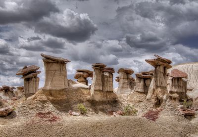
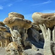
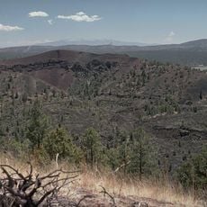
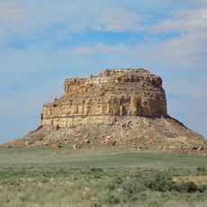
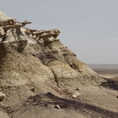
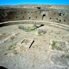
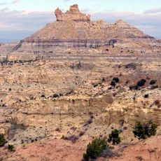
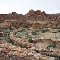
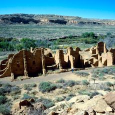
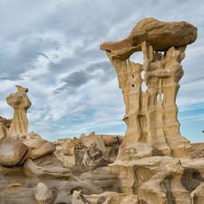
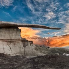
The Ah-shi-sle-pah Wilderness features water-carved clay hills, sandstone formations, and geological structures across a remote desert landscape spanning several miles.

The federal government designated this area as a protected Wilderness Study Area in 2019 to preserve its geological and paleontological resources.

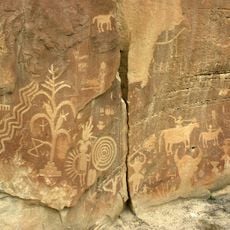
Native American tribes have long considered this land sacred, with its formations and fossil deposits telling stories of ancient ecosystems and prehistoric life.

Access requires driving 13.5 miles on NM 57 from US Highway 550, with no marked trails or facilities available within the wilderness boundaries.

Visitors discover petrified wood, dinosaur fossils, and mineral deposits among rock formations shaped by millions of years of erosion in varying shades.

Location: New Mexico

Inception: 2019

GPS coordinates: 36.14793,-107.92027

Latest update: May 14, 2025 15:09

Geological formations and natural wonders on Earth

The selection presents geological formations from basalt columns in Northern Ireland to salt flats in Bolivia. It includes glaciers, volcanoes, canyons, waterfalls, and coral reefs. These geological structures were shaped by natural forces such as erosion, tectonic movements, and volcanic activities over millions of years.

Natural sites and historic places in New Mexico

New Mexico combines natural formations and historical sites. The region includes caves, desert landscapes, volcanic areas, pueblo settlements, and military forts. The territory features geological structures, archaeological sites, hot springs, and museums.

Rock formations and hoodoos for Instagram photos

Rock pillars and spires shaped by erosion stand as natural monuments across various locations worldwide. These geological structures, known as hoodoos, display different colors and shapes based on their mineral composition and environmental conditions. From the red rocks of Utah to the limestone formations of Turkey, these sites present geological formations created over millions of years through wind and water erosion.

Around this place
Show the full map
Chaco Culture National Historical Park
United States of America

Chaco Culture National Historical Park

10.8 km
Pueblo Bonito
United States of America

Pueblo Bonito

10.4 km
Bisti/De-Na-Zin Wilderness
United States of America

Bisti/De-Na-Zin Wilderness

24.9 km
Chetro Ketl
United States of America

Chetro Ketl

10.2 km
Trail of the Ancients Scenic Byway
United States of America

Trail of the Ancients Scenic Byway

11153.3 km
Fajada Butte
United States of America

Fajada Butte

14.4 km
Kirtland Formation
United States of America

Kirtland Formation

73.3 km
Salmon Ruins
United States of America

Salmon Ruins

62.3 km
Casa Rinconada
United States of America

Casa Rinconada

11 km
Angel Peak Scenic Area
United States of America

Angel Peak Scenic Area

44.8 km
Una Vida
United States of America

Una Vida

12.7 km
Pueblo Alto
United States of America

Pueblo Alto

9.3 km
Pueblo del Arroyo
United States of America

Pueblo del Arroyo

10.5 km
Crow Canyon Archaeological District
United States of America

Crow Canyon Archaeological District

52.1 km
Kin Kletso
United States of America

Kin Kletso

10.2 km
Farmington Public Library
United States of America

Farmington Public Library

70.9 km
Kin Ya-ah
United States of America

Kin Ya-ah

55.4 km
Farmington Historic Downtown Commercial District
United States of America

Farmington Historic Downtown Commercial District

69.5 km
Kin Bineola
United States of America

Kin Bineola

25.6 km
American Hotel
United States of America

American Hotel

75 km
Aztec Main Street Historic District
United States of America

Aztec Main Street Historic District

75.4 km
Aztec Motor Company Building
United States of America

Aztec Motor Company Building

75.2 km
Engleman-Thomas Building
United States of America

Engleman-Thomas Building

75.3 km
Church Avenue-Lovers Lane Historic District
United States of America

Church Avenue-Lovers Lane Historic District

75.4 km
Valley of Dreams
United States of America

Valley of Dreams

5.4 km
King of Wings
United States of America

King of Wings

5.4 km
Aztec Museum
United States of America

Aztec Museum

75.5 km
Chaco Culture National Historical Park - Contiguous unit
United States of America

Chaco Culture National Historical Park - Contiguous unit

10.4 km
Show the full map

Reviews

Visited this place? Tap the stars to rate it and share your experience / photos with the community! Try now! You can cancel it anytime.

« Ah-shi-sle-pah Wilderness - Wilderness area in northwestern New Mexico, United States » is provided by Around Us (aroundus.com). Images and texts are derived from Wikimedia project under a Creative Commons license. You are allowed to copy, distribute, and modify copies of this page, under the conditions set by the license, as long as this note is clearly visible.

Discover hidden gems everywhere you go!

From secret cafés to breathtaking viewpoints, skip the crowded tourist spots and find places that match your style. Our app makes it easy with voice search, smart filtering, route optimization, and insider tips from travelers worldwide. Download now for the complete mobile experience.

Around Us App Screenshot

A unique approach to discovering new places

Le Figaro

All the places worth exploring

France Info

A tailor-made excursion in just a few clicks

20 Minutes