Enable Location

We need your location to show you interesting places around you

Discover nearby places

Find interesting locations and hidden gems around you

Precise directions

Get accurate directions and distances to places

Your location is never shared with other users. It's only used when you tap the location button.

Bisti/De-Na-Zin Wilderness

Log in to your account

Start exploring — it's free

Trusted by 62,270 travelers worldwide

Continue with Google
Continue with Apple
or

We will send you a code to connect

By continuing, you accept our Terms and Conditions and our Privacy Policy

Check your inbox

We've sent a pincode in your inbox. Please enter the code below.

Bisti/De-Na-Zin Wilderness

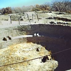
Bisti/De-Na-Zin Wilderness, Wilderness area in San Juan County, United States

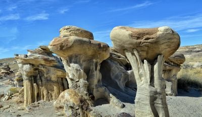
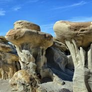
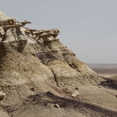
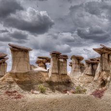
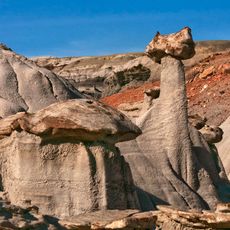
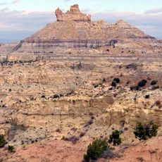
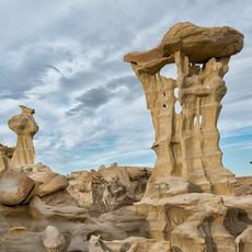
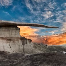
Bisti/De-Na-Zin Wilderness is a protected area in San Juan County, New Mexico, spanning roughly 45,000 acres of badlands formed from layered rock. The terrain displays towers, pillars, and mushroom-shaped hoodoos created by erosion of sandstone, shale, siltstone, and fossilized coal seams.

The area gained protection in 1984 and is managed by the Bureau of Land Management. The rock layers date back 70 million years to a time when swamps and rivers moved across the basin.

The place carries a name from the Navajo language: Bistahí describes the clay formations, while Dééł Náázíní refers to standing cranes in nearby rock carvings. Visitors walk through a landscape that has held meaning and navigation points for indigenous communities for centuries.

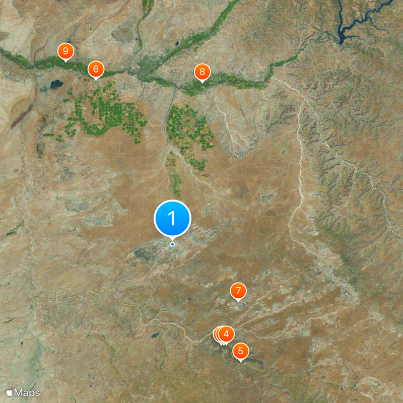
The wilderness is reached via unpaved roads south of Farmington; a vehicle with clearance makes the approach easier. There are no marked trails, so visitors should be ready to navigate with map and GPS and carry enough water.

The sediments have yielded over 200 species of plant and animal fossils, including the so-called Bisti Beast, a tyrannosaur skeleton from 1997. Photographers often arrive at dawn or dusk when the rock colors appear more intense.

The community of curious travelers

AroundUs brings together thousands of curated places, local tips, and hidden gems, enriched daily by 60,000 contributors worldwide.

Start exploring
Location
Inception
October 30, 1984
GPS coordinates
36.30440,-108.11800
Latest update
December 19, 2025 22:52
Natural sites and historic places in New Mexico

New Mexico combines geological formations with historical sites spanning multiple periods. The region includes cave systems such as Carlsbad Caverns, extensive gypsum fields at White Sands, volcanic landscapes at El Malpais National Monument, and unusual rock formations in the Bisti/De-Na-Zin...

Rock formations and hoodoos for Instagram photos

Rock pillars and spires shaped by erosion stand as natural monuments across various locations worldwide. These geological structures, known as hoodoos, display different colors and shapes based on their mineral composition and environmental conditions. From the red rocks of Utah to the limestone...

Around this place
Chaco Culture National Historical Park
United States of America

Chaco Culture National Historical Park

30.3 km
Pueblo Bonito
United States of America

Pueblo Bonito

30.5 km
United States of America

Chetro Ketl

30.9 km
Fajada Butte
United States of America

Fajada Butte

36.9 km
Kirtland Formation
United States of America

Kirtland Formation

49.5 km
Ah-shi-sle-pah Wilderness
United States of America

Ah-shi-sle-pah Wilderness

23.7 km
Salmon Ruins
United States of America

Salmon Ruins

44.9 km
Fruitland Formation
United States of America

Fruitland Formation

57.6 km
Casa Rinconada
United States of America

Casa Rinconada

31.2 km
Angel Peak Scenic Area
United States of America

Angel Peak Scenic Area

35.6 km
Una Vida
United States of America

Una Vida

35.4 km
Pueblo Alto
United States of America

Pueblo Alto

29.9 km
Pueblo del Arroyo
United States of America

Pueblo del Arroyo

30.3 km
Crow Canyon Archaeological District
United States of America

Crow Canyon Archaeological District

52.4 km
Kin Kletso
United States of America

Kin Kletso

29.8 km
Farmington Public Library
United States of America

Farmington Public Library

49.9 km
Farmington Historic Downtown Commercial District
United States of America

Farmington Historic Downtown Commercial District

47.9 km
Kin Bineola
United States of America

Kin Bineola

33.6 km
American Hotel
United States of America

American Hotel

58.2 km
Aztec Main Street Historic District
United States of America

Aztec Main Street Historic District

58.6 km
D.C. Ball House
United States of America

D.C. Ball House

59 km
Aztec Motor Company Building
United States of America

Aztec Motor Company Building

58.5 km
Engleman-Thomas Building
United States of America

Engleman-Thomas Building

58.4 km
Church Avenue-Lovers Lane Historic District
United States of America

Church Avenue-Lovers Lane Historic District

58.7 km
Valley of Dreams
United States of America

Valley of Dreams

21.3 km
King of Wings
United States of America

King of Wings

19.8 km
Aztec Museum
United States of America

Aztec Museum

58.8 km
Chaco Culture National Historical Park - Contiguous unit
United States of America

Chaco Culture National Historical Park - Contiguous unit

29.9 km
Show the full map
« Bisti/De-Na-Zin Wilderness - Wilderness area in San Juan County, United States » is provided by Around Us (aroundus.com). Images and texts are derived from Wikimedia project under a Creative Commons license. You are allowed to copy, distribute, and modify copies of this page, under the conditions set by the license, as long as this note is clearly visible.

Discover hidden gems everywhere you go!

From secret cafés to breathtaking viewpoints, skip the crowded tourist spots and find places that match your style. Our app makes it easy with voice search, smart filtering, route optimization, and insider tips from travelers worldwide. Download now for the complete mobile experience.

Around Us App Screenshot

A unique approach to discovering new places

Le Figaro

All the places worth exploring

France Info

A tailor-made excursion in just a few clicks

20 Minutes

Around Us
Travel Guide & Maps
Download

Send to your phone

QR Code
1

Open the camera app on your mobile.

2

Point at the QR code with your camera. A notification will appear.

3

Tap the notification to open the link.