Chest opened
+${chestReward.xp} XP
Explorer
NOUVEAU ×${chestReward.collectible.quantity}
tapez pour fermer
Chest locked

Open chests in the app

Around Us is built for your phone — chests unlock when you walk, explore and capture nearby places.

Enable Location

We need your location to show you interesting places around you

Discover nearby places

Find interesting locations and hidden gems around you

Precise directions

Get accurate directions and distances to places

Your location is never shared with other users. It's only used when you tap the location button.

Log in to your account

Start exploring — it's free

Trusted by 72,878 travelers worldwide

Continue with Google
Continue with Apple
or

We will send you a code to connect

By continuing, you accept our Terms and Conditions and our Privacy Policy

Check your inbox

We've sent a pincode in your inbox. Please enter the code below.

High Desert
Discussion Reviews Photo
4k Popularity

High Desert, Desert ecosystem in Albuquerque, United States.

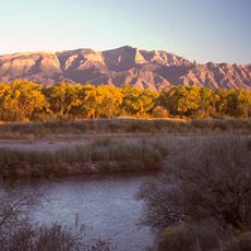
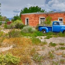
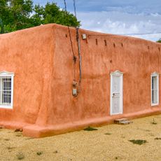
High Desert is a dry, high-elevation area in northeast Albuquerque, New Mexico, sitting at the base of the Sandia Mountains and covered with sandy soil, sagebrush, and scattered juniper trees. The elevation gives it a climate of its own, with hot summers, cool nights, and occasional snow in winter.

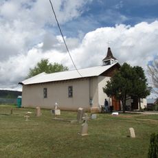
The area has been home to Pueblo peoples for centuries, who built settlements here and developed ways to manage water in an environment with little rain. Spanish colonization in the 17th century brought new land use patterns and reshaped how communities were organized across the region.

For many Pueblo peoples, this land holds deep meaning, and traces of their presence appear in rock art, pottery styles, and place names still in use today. Walking through the area, visitors occasionally come across these marks scattered across the terrain.

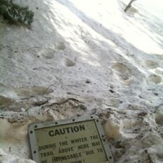
Trails in this area are often unmarked, so bringing a map or a GPS app before heading out is a good idea. The sun is strong at this elevation at any time of day, making a hat and plenty of water essential.

The Sandia Mountains that frame this area turn from pink to orange at sunset, which is how they got their name, since "Sandia" means watermelon in Spanish. This color shift lasts only a few minutes and is easy to catch from the trails.

The community of curious travelers

AroundUs brings together thousands of curated places, local tips, and hidden gems, enriched daily by 60,000 contributors worldwide.

Start exploring
Location
GPS coordinates
35.15280,-106.48600
Latest update
March 3, 2026 14:03
Around this place
Sandia Mountains
United States of America

Sandia Mountains

7.2 km
Sandia Peak Tramway
United States of America

Sandia Peak Tramway

4.2 km
La Luz Trail
United States of America

La Luz Trail

6.7 km
United States of America

Albuquerque Basin

11.9 km
Sandia Cave
United States of America

Sandia Cave

13.5 km
Cliff's Amusement Park
United States of America

Cliff's Amusement Park

9.4 km
Congregation Albert
United States of America

Congregation Albert

7.9 km
United States of America

Tijeras Canyon

12.1 km
New Mexico Rattler
United States of America

New Mexico Rattler

9.4 km
Albuquerque New Mexico Temple
United States of America

Albuquerque New Mexico Temple

3.9 km
Bank of the West Tower
United States of America

Bank of the West Tower

12.3 km
Anderson-Abruzzo Albuquerque International Balloon Museum
United States of America

Anderson-Abruzzo Albuquerque International Balloon Museum

11 km
Aztec Motel
United States of America

Aztec Motel

13.3 km
De Anza Motor Lodge
United States of America

De Anza Motor Lodge

12.9 km
Solar Building
United States of America

Solar Building

12.3 km
Hinkle Family Fun Center
United States of America

Hinkle Family Fun Center

6.5 km
Tewa Lodge
United States of America

Tewa Lodge

12.1 km
Our Lady of Mt. Carmel Church
United States of America

Our Lady of Mt. Carmel Church

12.1 km
United States of America

Hoffmantown Baptist Church

7.5 km
Tinkertown Museum
United States of America

Tinkertown Museum

10.9 km
Luna Lodge
United States of America

Luna Lodge

10.3 km
Juan Antonio Garcia House
United States of America

Juan Antonio Garcia House

12.1 km
Congregation B'nai Israel
United States of America

Congregation B'nai Israel

11.4 km
San Antonito Church and Cemetery
United States of America

San Antonito Church and Cemetery

12.7 km
Barela–Bledsoe House
United States of America

Barela–Bledsoe House

12.3 km
La Puerta Lodge
United States of America

La Puerta Lodge

10.2 km
Felipe Romero House
United States of America

Felipe Romero House

12 km
Rumaldo Chavez House
United States of America

Rumaldo Chavez House

11.6 km
Show the full map
Reviews
Share your experience

No review yet

Discussions
Start a discussion...

No discussion yet

« High Desert - Desert ecosystem in Albuquerque, United States » is provided by Around Us (aroundus.com). Images and texts are derived from Wikimedia project under a Creative Commons license. You are allowed to copy, distribute, and modify copies of this page, under the conditions set by the license, as long as this note is clearly visible.

Discover hidden gems everywhere you go!

From secret cafés to breathtaking viewpoints, skip the crowded tourist spots and find places that match your style. Our app makes it easy with voice search, smart filtering, route optimization, and insider tips from travelers worldwide. Download now for the complete mobile experience.

Around Us App Screenshot

A unique approach to discovering new places

Le Figaro

All the places worth exploring

France Info

A tailor-made excursion in just a few clicks

20 Minutes

Around Us
Travel Guide & Maps
Download

Send to your phone

QR Code
1

Open the camera app on your mobile.

2

Point at the QR code with your camera. A notification will appear.

3

Tap the notification to open the link.