Sandia Mountains, Mountain range in Bernalillo County, New Mexico, US
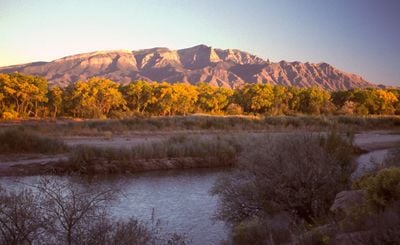
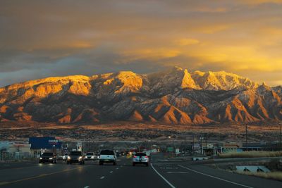
The Sandia Mountains form a north-south ridge east of Albuquerque with two main summits, the highest reaching 3,254 meters (10,678 feet). The ridge separates the Rio Grande valley from the high plateau and presents steep western walls of pink granite.
Archaeological findings in Sandia Cave show that people lived in this mountain region more than 10,000 years ago. Spanish settlers from the Rio Grande valley gave the range its current name in the 17th century.
The Spanish name refers to the pink granite faces that glow reddish at sunset, recalling a sliced watermelon. Hikers regularly encounter mule deer along the slopes and may spot Steller's jays moving through the ponderosa forests.
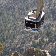
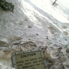
The Sandia Peak Tramway carries visitors more than 1,200 meters (4,000 feet) up to the ridge and provides access to hiking trails of different difficulty levels. Temperatures at the summit are often 10 to 15 degrees Celsius (20 to 30 degrees Fahrenheit) cooler than in the city, so bring warm layers even in summer.
The different elevations create separate climate zones, so within a few kilometers you ascend from desert grassland through piñon-juniper woodlands to subalpine meadows with Engelmann spruce. This vertical diversity allows encounters with plant and animal species that otherwise live hundreds of kilometers apart.
The community of curious travelers
AroundUs brings together thousands of curated places, local tips, and hidden gems, enriched daily by 60,000 contributors worldwide.