Chest opened
+${chestReward.xp} XP
Explorer
NOUVEAU ×${chestReward.collectible.quantity}
tapez pour fermer
Chest locked

Open chests in the app

Around Us is built for your phone — chests unlock when you walk, explore and capture nearby places.

Enable Location

We need your location to show you interesting places around you

Discover nearby places

Find interesting locations and hidden gems around you

Precise directions

Get accurate directions and distances to places

Your location is never shared with other users. It's only used when you tap the location button.

Log in to your account

Start exploring — it's free

Trusted by 72,993 travelers worldwide

Continue with Google
Continue with Apple
or

We will send you a code to connect

By continuing, you accept our Terms and Conditions and our Privacy Policy

Check your inbox

We've sent a pincode in your inbox. Please enter the code below.

Manzano Mountains State Park
Discussion Reviews Photo
2.3k Popularity

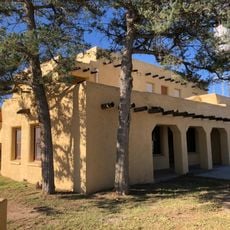
Manzano Mountains State Park, Public recreation area in Torrance County, United States.

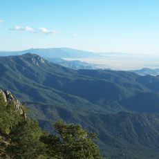
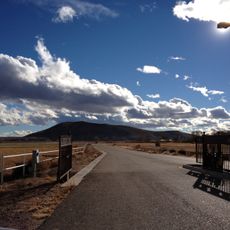
Manzano Mountains State Park is a recreation area in the foothills of the Manzano Mountains at about 7,250 feet elevation with extensive woodland coverage. The grounds contain more than 3.5 miles of marked trails that pass through different forest types and open spaces.

The area was established as a state park in 1973 by the New Mexico government to protect the natural mountain landscape. The creation was part of a broader effort to preserve the ecological character of the region for future generations.

The name Manzano comes from the Spanish word for apple, reflecting the orchard-growing tradition that once shaped the nearby communities in this mountain region.

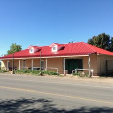
The park offers 23 developed campsites, with nine having electrical hookups and water access, plus portable toilet facilities throughout. It helps to explore the trails early in the day and bring weather-resistant clothing, as conditions at this elevation can change quickly.

The higher elevation creates conditions that support varying plant communities, with each season showing different diversity across the landscape. Visitors often overlook how dramatically the vegetation changes as you move up the mountain slopes.

The community of curious travelers

AroundUs brings together thousands of curated places, local tips, and hidden gems, enriched daily by 60,000 contributors worldwide.

Start exploring
Location
Inception
1973
GPS coordinates
34.60330,-106.36100
Latest update
December 13, 2025 12:25
Around this place
Sandia Base
United States of America

Sandia Base

51.6 km
Abo
United States of America

Abo

17.1 km
United States of America

Tijeras Canyon

53.2 km
Quarai
United States of America

Quarai

6.1 km
Hinkle Family Fun Center
United States of America

Hinkle Family Fun Center

56.3 km
National Solar Thermal Test Facility
United States of America

National Solar Thermal Test Facility

42.6 km
Gutiérrez-Hubbell House
United States of America

Gutiérrez-Hubbell House

52.8 km
Wildlife West Nature Park
United States of America

Wildlife West Nature Park

54.2 km
Manzano Wilderness
United States of America

Manzano Wilderness

12.1 km
Space Development and Test Wing
United States of America

Space Development and Test Wing

54.8 km
United States of America

Pottery Mound

40.8 km
Moriarty Eclipse Windmill
United States of America

Moriarty Eclipse Windmill

50.7 km
Belen Harvey House
United States of America

Belen Harvey House

37.7 km
United States of America

Las Humanas

45.6 km
Albuquerque Veterans Administration Medical Center
United States of America

Albuquerque Veterans Administration Medical Center

54.2 km
Luna Lodge
United States of America

Luna Lodge

55 km
Rancho Bonito
United States of America

Rancho Bonito

15.5 km
Gran Quivera Historic District
United States of America

Gran Quivera Historic District

44.5 km
Davis House
United States of America

Davis House

56.4 km
Tome Jail
United States of America

Tome Jail

37.1 km
La Puerta Lodge
United States of America

La Puerta Lodge

54.7 km
Belen City Hall
United States of America

Belen City Hall

38.3 km
Miguel E. Baca House
United States of America

Miguel E. Baca House

35.9 km
El Cerro Tome Site
United States of America

El Cerro Tome Site

35.8 km
Otero's 66 Service
United States of America

Otero's 66 Service

41.2 km
Mountainair Municipal Auditorium
United States of America

Mountainair Municipal Auditorium

14.2 km
Felipe Chaves House
United States of America

Felipe Chaves House

38.7 km
Los Lunas Museum of Heritage & Arts
United States of America

Los Lunas Museum of Heritage & Arts

41 km
Show the full map
Reviews
Share your experience

No review yet

Discussions
Start a discussion...

No discussion yet

« Manzano Mountains State Park - Public recreation area in Torrance County, United States » is provided by Around Us (aroundus.com). Images and texts are derived from Wikimedia project under a Creative Commons license. You are allowed to copy, distribute, and modify copies of this page, under the conditions set by the license, as long as this note is clearly visible.

Discover hidden gems everywhere you go!

From secret cafés to breathtaking viewpoints, skip the crowded tourist spots and find places that match your style. Our app makes it easy with voice search, smart filtering, route optimization, and insider tips from travelers worldwide. Download now for the complete mobile experience.

Around Us App Screenshot

A unique approach to discovering new places

Le Figaro

All the places worth exploring

France Info

A tailor-made excursion in just a few clicks

20 Minutes

Around Us
Travel Guide & Maps
Download

Send to your phone

QR Code
1

Open the camera app on your mobile.

2

Point at the QR code with your camera. A notification will appear.

3

Tap the notification to open the link.