Chest opened
+${chestReward.xp} XP
Explorer
NOUVEAU ×${chestReward.collectible.quantity}
tapez pour fermer
Chest locked

Open chests in the app

Around Us is built for your phone — chests unlock when you walk, explore and capture nearby places.

Enable Location

We need your location to show you interesting places around you

Discover nearby places

Find interesting locations and hidden gems around you

Precise directions

Get accurate directions and distances to places

Your location is never shared with other users. It's only used when you tap the location button.

Log in to your account

Start exploring — it's free

Trusted by 72,995 travelers worldwide

Continue with Google
Continue with Apple
or

We will send you a code to connect

By continuing, you accept our Terms and Conditions and our Privacy Policy

Check your inbox

We've sent a pincode in your inbox. Please enter the code below.

Discussion Reviews Photo
10.5k Popularity

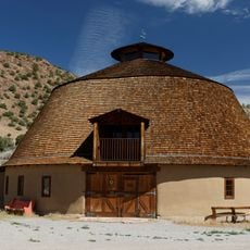
Truchas, Census-designated place in Rio Arriba County, United States

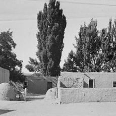
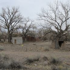
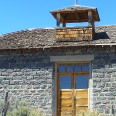
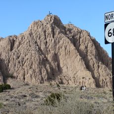
Truchas is a settlement in Rio Arriba County located at about 8,000 feet (2,400 m) elevation, situated between Santa Fe and Taos. The community follows traditional Spanish land grant rules where residents share roads with livestock and maintain communal areas together.

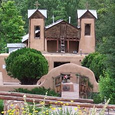
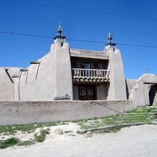
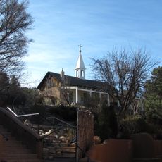
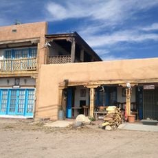
The settlement grew from a Spanish land grant called Nuestra Señora del Rosario, San Fernando y Santiago del Rio de las Truchas, awarded in 1754. This land grant continues to shape how the community is organized and how people live there today.

The Nuestra Señora del Rosario church houses altar screens painted by Pedro Antonio Fresquis in the early 1800s, reflecting local religious artistic traditions. These works show the skilled craftsmanship that community members have maintained across generations.

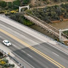
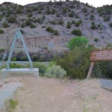
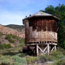
The village sits at a high elevation that creates significant elevation changes and requires steep access roads. Visitors should expect unpaved or narrow routes and simple infrastructure typical of rural mountain communities.

Until the 1970s, the area had no paved road connection to the outside world, keeping it isolated from surrounding regions. This extended separation allowed traditional ways of living and local crafts to remain largely unchanged.

The community of curious travelers

AroundUs brings together thousands of curated places, local tips, and hidden gems, enriched daily by 60,000 contributors worldwide.

Start exploring
GPS coordinates
36.04361,-105.81111
Latest update
December 10, 2025 15:54
Around this place
El Santuario de Chimayo
United States of America

El Santuario de Chimayo

12.5 km
Puye Cliff Dwellings
United States of America

Puye Cliff Dwellings

38.3 km
Truchas Peak
United States of America

Truchas Peak

17.5 km
Ojo Caliente Mineral Springs Resort & Spa
United States of America

Ojo Caliente Mineral Springs Resort & Spa

36.5 km
Poeh Museum
United States of America

Poeh Museum

25.5 km
San Gabriel de Yungue-Ouinge
United States of America

San Gabriel de Yungue-Ouinge

24.6 km
San José de Gracia Church
United States of America

San José de Gracia Church

10.9 km
Hyde Memorial State Park
United States of America

Hyde Memorial State Park

34.2 km
Pot Creek Cultural Site
United States of America

Pot Creek Cultural Site

33.7 km
Ojo Caliente Hot Springs Round Barn
United States of America

Ojo Caliente Hot Springs Round Barn

36.5 km
Otowi Historic District
United States of America

Otowi Historic District

35.2 km
Posi-ouinge
United States of America

Posi-ouinge

36.3 km
Otowi Suspension Bridge
United States of America

Otowi Suspension Bridge

35.2 km
Archbishop Lamy's Chapel
United States of America

Archbishop Lamy's Chapel

36 km
Santa Fe Opera
United States of America

Santa Fe Opera

33.4 km
Embudo Stream Gauging Station
United States of America

Embudo Stream Gauging Station

22.6 km
Poeh Center
United States of America

Poeh Center

25.5 km
Rio Grande Bridge at San Juan Pueblo
United States of America

Rio Grande Bridge at San Juan Pueblo

24.5 km
Carson School
United States of America

Carson School

36 km
Frank Bond House
United States of America

Frank Bond House

25.1 km
Chimayo Trading Post and E.D. Trujillo House
United States of America

Chimayo Trading Post and E.D. Trujillo House

23.9 km
Classical Gas Museum
United States of America

Classical Gas Museum

22.3 km
Crosby Theatre
United States of America

Crosby Theatre

33.5 km
Arroyo de la Cañada Ancha
United States of America

Arroyo de la Cañada Ancha

12.9 km
Camel Rock
United States of America

Camel Rock

28.7 km
Nambe Falls Reservoir
United States of America

Nambe Falls Reservoir

23.2 km
Barrancos Blancos
United States of America

Barrancos Blancos

20.9 km
Embudo Historic District
United States of America

Embudo Historic District

22.7 km
Show the full map
Reviews
Share your experience

No review yet

Discussions
Start a discussion...

No discussion yet

« Truchas - Census-designated place in Rio Arriba County, United States » is provided by Around Us (aroundus.com). Images and texts are derived from Wikimedia project under a Creative Commons license. You are allowed to copy, distribute, and modify copies of this page, under the conditions set by the license, as long as this note is clearly visible.

Discover hidden gems everywhere you go!

From secret cafés to breathtaking viewpoints, skip the crowded tourist spots and find places that match your style. Our app makes it easy with voice search, smart filtering, route optimization, and insider tips from travelers worldwide. Download now for the complete mobile experience.

Around Us App Screenshot

A unique approach to discovering new places

Le Figaro

All the places worth exploring

France Info

A tailor-made excursion in just a few clicks

20 Minutes

Around Us
Travel Guide & Maps
Download

Send to your phone

QR Code
1

Open the camera app on your mobile.

2

Point at the QR code with your camera. A notification will appear.

3

Tap the notification to open the link.