Chest opened
+${chestReward.xp} XP
Explorer
NOUVEAU ×${chestReward.collectible.quantity}
tapez pour fermer
Chest locked

Open chests in the app

Around Us is built for your phone — chests unlock when you walk, explore and capture nearby places.

Enable Location

We need your location to show you interesting places around you

Discover nearby places

Find interesting locations and hidden gems around you

Precise directions

Get accurate directions and distances to places

Your location is never shared with other users. It's only used when you tap the location button.

Mora

Log in to your account

Start exploring — it's free

Trusted by 72,878 travelers worldwide

Continue with Google
Continue with Apple
or

We will send you a code to connect

By continuing, you accept our Terms and Conditions and our Privacy Policy

Check your inbox

We've sent a pincode in your inbox. Please enter the code below.

Discussion Reviews 1 Photos
15.2k Popularity

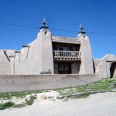
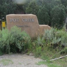
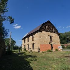
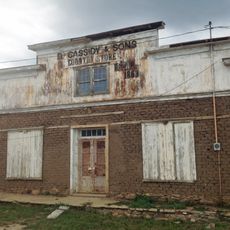
Mora, Census-designated place in Mora County, New Mexico

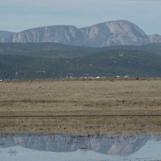
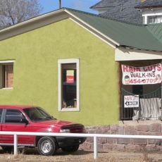
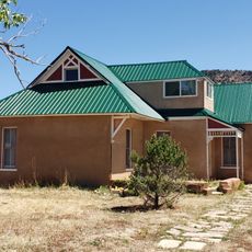
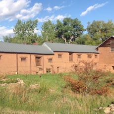
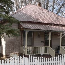
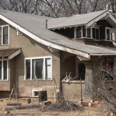
Mora is an unincorporated administrative center in Mora County located in mountainous terrain at an elevation of about 2,186 meters. The settlement spreads across hilly land with typical rural structures and is surrounded by forested mountain landscape.

The settlement was founded in 1835 when Mexican Governor Albino Pérez granted over 800,000 acres of land to families from neighboring communities. In 1851, the establishment of a military fort significantly changed the valley's role and influenced the region's economic development.

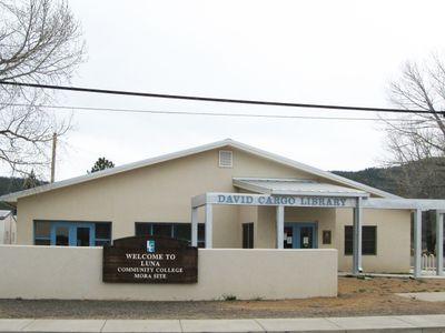
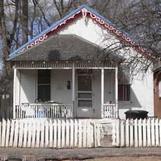
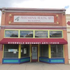
The community preserves traditional farming practices and shapes regional life through local celebrations where music and crafts play central roles. Visitors experience the everyday culture of rural communities that has passed through generations.

The rural location is accessible by local highways and offers limited visitor services. The best time to visit is during drier months when mountain roads are more easily accessible.

A military fort established in 1851 occupied valley lands without compensating the original land grant community. This event shaped the lasting relationship between federal authority and local communities.

The community of curious travelers

AroundUs brings together thousands of curated places, local tips, and hidden gems, enriched daily by 60,000 contributors worldwide.

Start exploring
Location
Inception
1835
Elevation above the sea
2,186 m
GPS coordinates
35.97417,-105.33000
Latest update
December 7, 2025 19:31
Around this place
Montezuma Castle
United States of America

Montezuma Castle

35.7 km
Truchas Peak
United States of America

Truchas Peak

28.4 km
Plaza Hotel
United States of America

Plaza Hotel

43.4 km
Hermit Peak
United States of America

Hermit Peak

26.7 km
San José de Gracia Church
United States of America

San José de Gracia Church

42.3 km
Pot Creek Cultural Site
United States of America

Pot Creek Cultural Site

40.5 km
Ocate Peak
United States of America

Ocate Peak

33.8 km
Watrous
United States of America

Watrous

35.4 km
St. Paul's Memorial Episcopal Church and Guild Hall
United States of America

St. Paul's Memorial Episcopal Church and Guild Hall

43.3 km
House at 913 2nd
United States of America

House at 913 2nd

42.9 km
Adele Ilfeld Auditorium
United States of America

Adele Ilfeld Auditorium

43.4 km
Narciso Valdez House
United States of America

Narciso Valdez House

33.9 km
Bridge Street Historic District
United States of America

Bridge Street Historic District

43.5 km
St. Vrain's Mill
United States of America

St. Vrain's Mill

190 m
Bean-Newlee House
United States of America

Bean-Newlee House

42.7 km
Daniel Cassidy and Sons General Merchandise Store
United States of America

Daniel Cassidy and Sons General Merchandise Store

4.4 km
Library Park Historic District
United States of America

Library Park Historic District

43.2 km
La Cueva Historic District
United States of America

La Cueva Historic District

8.2 km
House at 919 2nd
United States of America

House at 919 2nd

42.9 km
Lowery Clevenger House
United States of America

Lowery Clevenger House

42.8 km
House at 1116 Columbia
United States of America

House at 1116 Columbia

43.2 km
James Cook House
United States of America

James Cook House

43.1 km
Cassidy Mill
United States of America

Cassidy Mill

2.8 km
House at 915 2nd
United States of America

House at 915 2nd

42.9 km
North New Town Historic District
United States of America

North New Town Historic District

42.9 km
House at 1513 8th
United States of America

House at 1513 8th

42.1 km
Building at 1214 Bridge
United States of America

Building at 1214 Bridge

43.3 km
Las Vegas Carnegie Public Library
United States of America

Las Vegas Carnegie Public Library

43.2 km
Show the full map
Reviews
Share your experience

No review yet

Discussions
Start a discussion...

No discussion yet

« Mora - Census-designated place in Mora County, New Mexico » is provided by Around Us (aroundus.com). Images and texts are derived from Wikimedia project under a Creative Commons license. You are allowed to copy, distribute, and modify copies of this page, under the conditions set by the license, as long as this note is clearly visible.

Discover hidden gems everywhere you go!

From secret cafés to breathtaking viewpoints, skip the crowded tourist spots and find places that match your style. Our app makes it easy with voice search, smart filtering, route optimization, and insider tips from travelers worldwide. Download now for the complete mobile experience.

Around Us App Screenshot

A unique approach to discovering new places

Le Figaro

All the places worth exploring

France Info

A tailor-made excursion in just a few clicks

20 Minutes

Around Us
Travel Guide & Maps
Download

Send to your phone

QR Code
1

Open the camera app on your mobile.

2

Point at the QR code with your camera. A notification will appear.

3

Tap the notification to open the link.