Chest opened
+${chestReward.xp} XP
Explorer
NOUVEAU ×${chestReward.collectible.quantity}
tapez pour fermer
Chest locked

Open chests in the app

Around Us is built for your phone — chests unlock when you walk, explore and capture nearby places.

Enable Location

We need your location to show you interesting places around you

Discover nearby places

Find interesting locations and hidden gems around you

Precise directions

Get accurate directions and distances to places

Your location is never shared with other users. It's only used when you tap the location button.

Log in to your account

Start exploring — it's free

Trusted by 72,955 travelers worldwide

Continue with Google
Continue with Apple
or

We will send you a code to connect

By continuing, you accept our Terms and Conditions and our Privacy Policy

Check your inbox

We've sent a pincode in your inbox. Please enter the code below.

Mountain County, Jefferson Territory
Discussion Reviews Photo
1k Popularity

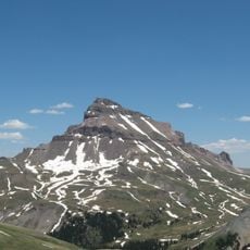
Mountain County, Jefferson Territory, Historic county in Jefferson Territory, US

Mountain County was an administrative division in Jefferson Territory covering a large area across the modern Rocky Mountain region of the United States. The territory later split into multiple separate counties, including Gilpin County and Clear Creek County, as well as portions of southwestern Colorado.

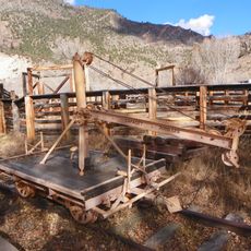
The Jefferson Territory established Mountain County in November 1859 as one of twelve administrative divisions to organize rapidly growing settlement during the Pike's Peak Gold Rush. This creation reflected early westward expansion, though it operated without federal recognition until February 1861.

The county represented early American westward expansion during the Pike's Peak Gold Rush, when settlers sought independence from Kansas and Nebraska territories.

Those interested in exploring this region's history should understand that this is a historical territory that no longer exists as a political entity. Key information about its boundaries and structure can be found in historical documents and mapping materials from the period between 1859 and 1861.

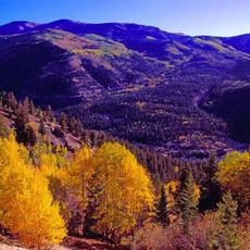
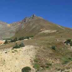
Its boundaries extended south of the 40th parallel and deliberately excluded areas that would later become separate counties of their own. This irregular boundary pattern reflected the early territorial challenges in organizing settlement during the gold rush era.

The community of curious travelers

AroundUs brings together thousands of curated places, local tips, and hidden gems, enriched daily by 60,000 contributors worldwide.

Start exploring
GPS coordinates
38.33333,-107.00000
Latest update
December 14, 2025 20:04
Around this place
Blue Mesa Reservoir
United States of America

Blue Mesa Reservoir

24.5 km
Uncompahgre Peak
United States of America

Uncompahgre Peak

49.8 km
Morrow Point Dam
United States of America

Morrow Point Dam

48.8 km
Slumgullion Earthflow
United States of America

Slumgullion Earthflow

44.2 km
Uncompahgre Wilderness
United States of America

Uncompahgre Wilderness

49 km
D & RG Narrow Gauge Trestle
United States of America

D & RG Narrow Gauge Trestle

49.7 km
La Garita Wilderness
United States of America

La Garita Wilderness

38.5 km
Penny Hot Springs
United States of America

Penny Hot Springs

23.8 km
Curecanti Needle
United States of America

Curecanti Needle

38.4 km
Morrow Point Reservoir
United States of America

Morrow Point Reservoir

48.7 km
Powderhorn Wilderness
United States of America

Powderhorn Wilderness

30.5 km
West Elk Wilderness
United States of America

West Elk Wilderness

49 km
Crystal Reservoir
United States of America

Crystal Reservoir

53.3 km
Matterhorn Peak
United States of America

Matterhorn Peak

52.7 km
United States of America

Cannibal Plateau

32.3 km
Baldy Cinco
United States of America

Baldy Cinco

43 km
Blue Creek Canyon
United States of America

Blue Creek Canyon

36.5 km
Middle Bridge
United States of America

Middle Bridge

26.8 km
Rio Grande Southern Railroad Derrick Car
United States of America

Rio Grande Southern Railroad Derrick Car

50 km
Edgerton House
United States of America

Edgerton House

24 km
Fisher-Zugelder House and Smith Cottage
United States of America

Fisher-Zugelder House and Smith Cottage

24.9 km
Denver & Rio Grande Western Railroad 278
United States of America

Denver & Rio Grande Western Railroad 278

49.7 km
Denver & Rio Grande Western Railroad Caboose No. 0577
United States of America

Denver & Rio Grande Western Railroad Caboose No. 0577

49.7 km
Denver & Rio Grande Western Railroad Stock Car No. 5620
United States of America

Denver & Rio Grande Western Railroad Stock Car No. 5620

50 km
Denver & Rio Grande Western Railroad Boxcar No. 3132
United States of America

Denver & Rio Grande Western Railroad Boxcar No. 3132

49.7 km
Denver & Rio Grande Railroad Box Outfit Car No. 04414
United States of America

Denver & Rio Grande Railroad Box Outfit Car No. 04414

50 km
Denver & Rio Grande Western Railroad Stock Car No. 5679D
United States of America

Denver & Rio Grande Western Railroad Stock Car No. 5679D

50 km
Cimarron Visitor Center
United States of America

Cimarron Visitor Center

49.9 km
Show the full map
Reviews
Share your experience

No review yet

Discussions
Start a discussion...

No discussion yet

« Mountain County, Jefferson Territory - Historic county in Jefferson Territory, US » is provided by Around Us (aroundus.com). Images and texts are derived from Wikimedia project under a Creative Commons license. You are allowed to copy, distribute, and modify copies of this page, under the conditions set by the license, as long as this note is clearly visible.

Discover hidden gems everywhere you go!

From secret cafés to breathtaking viewpoints, skip the crowded tourist spots and find places that match your style. Our app makes it easy with voice search, smart filtering, route optimization, and insider tips from travelers worldwide. Download now for the complete mobile experience.

Around Us App Screenshot

A unique approach to discovering new places

Le Figaro

All the places worth exploring

France Info

A tailor-made excursion in just a few clicks

20 Minutes

Around Us
Travel Guide & Maps
Download

Send to your phone

QR Code
1

Open the camera app on your mobile.

2

Point at the QR code with your camera. A notification will appear.

3

Tap the notification to open the link.