Enable Location

We need your location to show you interesting places around you

Discover nearby places

Find interesting locations and hidden gems around you

Precise directions

Get accurate directions and distances to places

Your location is never shared with other users. It's only used when you tap the location button.

West Elk Wilderness

Log in to your account

Start exploring — it's free

Trusted by 63,019 travelers worldwide

Continue with Google
Continue with Apple
or

We will send you a code to connect

By continuing, you accept our Terms and Conditions and our Privacy Policy

Check your inbox

We've sent a pincode in your inbox. Please enter the code below.

West Elk Wilderness
Discussion Reviews 1 Photos
2.8k Popularity

West Elk Wilderness, Wilderness area in Gunnison National Forest, Colorado

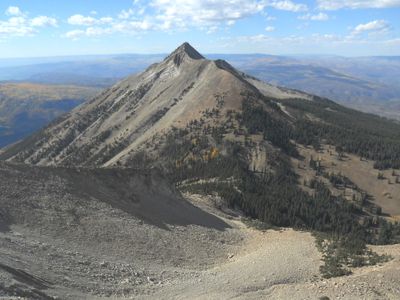
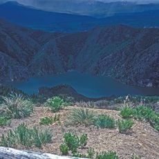
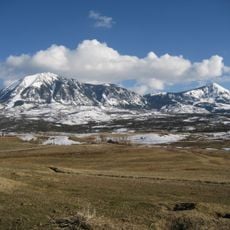
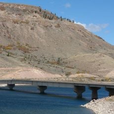
West Elk Wilderness covers about 176,000 acres of protected land with mountain peaks, deep valleys, and numerous beaver ponds spread across the terrain. The area features varied elevations and plant zones that shift from dense forests to high alpine meadows.

The land received federal protection in 1964 through the Wilderness Act, followed by additional 133,000 acres that gained protection in 1980. These two milestone protections ensured the area would remain undeveloped as natural terrain.

Native American communities used this mountain region for seasonal hunting and gathering plants as they moved through the valleys following established routes.

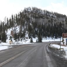
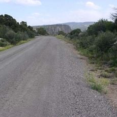
The terrain is accessible through multiple entry points connected by about 200 miles of hiking trails, including popular routes like the Mill Castle Trail. Visitors should be prepared for alpine conditions and allow flexible time, as weather can change quickly in the mountains.

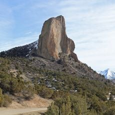
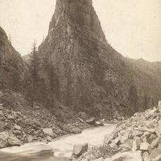
Natural erosion has shaped rocks into distinct towers and pinnacles, leading to geographic names like Castle Pass and Castle Creek. These characteristic formations developed as water and wind worked the stone over millions of years.

The community of curious travelers

AroundUs brings together thousands of curated places, local tips, and hidden gems, enriched daily by 60,000 contributors worldwide.

Start exploring
Location
GPS coordinates
38.72150,-107.26500
Latest update
December 12, 2025 14:26
Around this place
Blue Mesa Reservoir
United States of America

Blue Mesa Reservoir

28.2 km
Morrow Point Dam
United States of America

Morrow Point Dam

38.3 km
Crawford State Park
United States of America

Crawford State Park

29 km
Needle Rock Natural Area
United States of America

Needle Rock Natural Area

24.7 km
D & RG Narrow Gauge Trestle
United States of America

D & RG Narrow Gauge Trestle

38.9 km
Crystal Dam
United States of America

Crystal Dam

39.1 km
Curecanti Needle
United States of America

Curecanti Needle

33 km
Morrow Point Reservoir
United States of America

Morrow Point Reservoir

38.2 km
Mount Lamborn
United States of America

Mount Lamborn

24.2 km
Crystal Reservoir
United States of America

Crystal Reservoir

38.4 km
Marble Community Church
United States of America

Marble Community Church

39.5 km
Blue Creek Canyon
United States of America

Blue Creek Canyon

37.4 km
North Rim Road, Black Canyon of the Gunnison National Park
United States of America

North Rim Road, Black Canyon of the Gunnison National Park

40.6 km
Marble High School
United States of America

Marble High School

39.5 km
Middle Bridge
United States of America

Middle Bridge

28.2 km
Rio Grande Southern Railroad Derrick Car
United States of America

Rio Grande Southern Railroad Derrick Car

39.9 km
Paonia First Christian Church
United States of America

Paonia First Christian Church

32.9 km
Hotchkiss Methodist Episcopal Church
United States of America

Hotchkiss Methodist Episcopal Church

40.3 km
North Rim Road
United States of America

North Rim Road

40.1 km
Edgerton House
United States of America

Edgerton House

35.1 km
Fisher-Zugelder House and Smith Cottage
United States of America

Fisher-Zugelder House and Smith Cottage

35 km
Denver & Rio Grande Western Railroad 278
United States of America

Denver & Rio Grande Western Railroad 278

38.9 km
Denver & Rio Grande Western Railroad Caboose No. 0577
United States of America

Denver & Rio Grande Western Railroad Caboose No. 0577

38.9 km
Denver & Rio Grande Western Railroad Stock Car No. 5620
United States of America

Denver & Rio Grande Western Railroad Stock Car No. 5620

40 km
Denver & Rio Grande Western Railroad Boxcar No. 3132
United States of America

Denver & Rio Grande Western Railroad Boxcar No. 3132

38.9 km
Denver & Rio Grande Railroad Box Outfit Car No. 04414
United States of America

Denver & Rio Grande Railroad Box Outfit Car No. 04414

40 km
Denver & Rio Grande Western Railroad Stock Car No. 5679D
United States of America

Denver & Rio Grande Western Railroad Stock Car No. 5679D

40 km
Cimarron Visitor Center
United States of America

Cimarron Visitor Center

40 km
Show the full map
Reviews
Share your experience

No review yet

Discussions
Start a discussion...

No discussion yet

« West Elk Wilderness - Wilderness area in Gunnison National Forest, Colorado » is provided by Around Us (aroundus.com). Images and texts are derived from Wikimedia project under a Creative Commons license. You are allowed to copy, distribute, and modify copies of this page, under the conditions set by the license, as long as this note is clearly visible.

Discover hidden gems everywhere you go!

From secret cafés to breathtaking viewpoints, skip the crowded tourist spots and find places that match your style. Our app makes it easy with voice search, smart filtering, route optimization, and insider tips from travelers worldwide. Download now for the complete mobile experience.

Around Us App Screenshot

A unique approach to discovering new places

Le Figaro

All the places worth exploring

France Info

A tailor-made excursion in just a few clicks

20 Minutes

Around Us
Travel Guide & Maps
Download

Send to your phone

QR Code
1

Open the camera app on your mobile.

2

Point at the QR code with your camera. A notification will appear.

3

Tap the notification to open the link.