Enable Location

We need your location to show you interesting places around you

Discover nearby places

Find interesting locations and hidden gems around you

Precise directions

Get accurate directions and distances to places

Your location is never shared with other users. It's only used when you tap the location button.

Mount Lamborn

Log in to your account

Start exploring — it's free

Trusted by 63,019 travelers worldwide

Continue with Google
Continue with Apple
or

We will send you a code to connect

By continuing, you accept our Terms and Conditions and our Privacy Policy

Check your inbox

We've sent a pincode in your inbox. Please enter the code below.

Mount Lamborn
Discussion Reviews 1 Photos
2.8k Popularity

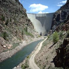
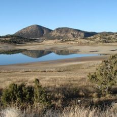
Mount Lamborn, Mountain summit in Gunnison National Forest, Colorado, United States

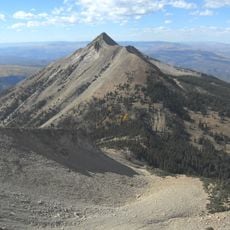
Mount Lamborn is a summit in the West Elk Mountains within Gunnison National Forest, rising to 11,402 feet above sea level. The peak stands as part of the broader Rocky Mountain range that defines this section of Colorado.

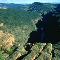
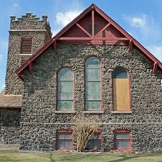
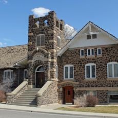
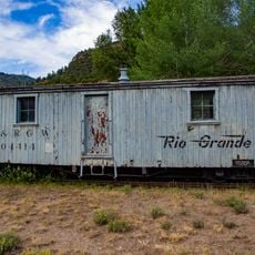
The peak became an important landmark for settlers moving through Delta County during the 1800s. Its position marked a natural boundary at the western edge of the West Elk region.

The slopes around this peak once served as hunting grounds for Native American tribes in the region. Visitors today walk through landscapes that shaped the lives of people who came before.

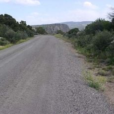
The route to the peak runs through Bell Canyon, with a rough forest road leading to the trailheads. The best times to visit are during warmer months when road conditions are more stable.

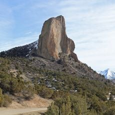
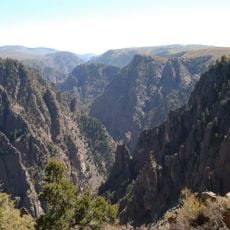
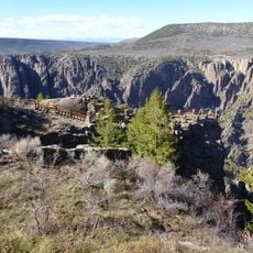
The mountain's geology is a laccolith formation, created when molten rock was forced into the surrounding rock layers and then solidified. This unusual geological origin makes the peak notably different from other summits in the range.

The community of curious travelers

AroundUs brings together thousands of curated places, local tips, and hidden gems, enriched daily by 60,000 contributors worldwide.

Start exploring
Location
GPS coordinates
38.80304,-107.52283
Latest update
December 12, 2025 14:26
Around this place
Morrow Point Dam
United States of America

Morrow Point Dam

39.1 km
Crawford State Park
United States of America

Crawford State Park

14.4 km
Needle Rock Natural Area
United States of America

Needle Rock Natural Area

9 km
D & RG Narrow Gauge Trestle
United States of America

D & RG Narrow Gauge Trestle

39.2 km
Crystal Dam
United States of America

Crystal Dam

33.7 km
Gunnison Gorge National Conservation Area
United States of America

Gunnison Gorge National Conservation Area

26.1 km
Curecanti Needle
United States of America

Curecanti Needle

40.5 km
Morrow Point Reservoir
United States of America

Morrow Point Reservoir

39.1 km
West Elk Wilderness
United States of America

West Elk Wilderness

24.2 km
Gunnison Gorge Wilderness
United States of America

Gunnison Gorge Wilderness

29.9 km
Crystal Reservoir
United States of America

Crystal Reservoir

36.2 km
North Rim Road, Black Canyon of the Gunnison National Park
United States of America

North Rim Road, Black Canyon of the Gunnison National Park

29.5 km
First Presbyterian Church of Eckert
United States of America

First Presbyterian Church of Eckert

38.9 km
Rio Grande Southern Railroad Derrick Car
United States of America

Rio Grande Southern Railroad Derrick Car

40.1 km
Paonia First Christian Church
United States of America

Paonia First Christian Church

9.5 km
Hotchkiss Methodist Episcopal Church
United States of America

Hotchkiss Methodist Episcopal Church

16.9 km
North Rim Road
United States of America

North Rim Road

30 km
Painted Wall
United States of America

Painted Wall

30.5 km
Black Canyon of the Gunnison
United States of America

Black Canyon of the Gunnison

27.3 km
Denver & Rio Grande Western Railroad 278
United States of America

Denver & Rio Grande Western Railroad 278

39.2 km
Denver & Rio Grande Western Railroad Caboose No. 0577
United States of America

Denver & Rio Grande Western Railroad Caboose No. 0577

39.2 km
Denver & Rio Grande Western Railroad Stock Car No. 5620
United States of America

Denver & Rio Grande Western Railroad Stock Car No. 5620

40.1 km
Denver & Rio Grande Western Railroad Boxcar No. 3132
United States of America

Denver & Rio Grande Western Railroad Boxcar No. 3132

39.2 km
Denver & Rio Grande Railroad Box Outfit Car No. 04414
United States of America

Denver & Rio Grande Railroad Box Outfit Car No. 04414

40.2 km
Denver & Rio Grande Western Railroad Stock Car No. 5679D
United States of America

Denver & Rio Grande Western Railroad Stock Car No. 5679D

40.1 km
South Rim Visitor Center
United States of America

South Rim Visitor Center

31.1 km
Cimarron Visitor Center
United States of America

Cimarron Visitor Center

40.2 km
Gunnison Point
United States of America

Gunnison Point

31 km
Show the full map
Reviews
Share your experience

No review yet

Discussions
Start a discussion...

No discussion yet

« Mount Lamborn - Mountain summit in Gunnison National Forest, Colorado, United States » is provided by Around Us (aroundus.com). Images and texts are derived from Wikimedia project under a Creative Commons license. You are allowed to copy, distribute, and modify copies of this page, under the conditions set by the license, as long as this note is clearly visible.

Discover hidden gems everywhere you go!

From secret cafés to breathtaking viewpoints, skip the crowded tourist spots and find places that match your style. Our app makes it easy with voice search, smart filtering, route optimization, and insider tips from travelers worldwide. Download now for the complete mobile experience.

Around Us App Screenshot

A unique approach to discovering new places

Le Figaro

All the places worth exploring

France Info

A tailor-made excursion in just a few clicks

20 Minutes

Around Us
Travel Guide & Maps
Download

Send to your phone

QR Code
1

Open the camera app on your mobile.

2

Point at the QR code with your camera. A notification will appear.

3

Tap the notification to open the link.