Curecanti Needle

Log in to your account

AroundUs is a community-driven map of interesting places, built by curious explorers like you. It grows with every review, story, and photo you share.
Connect to save your favorite spots, contribute locations, and create personalized routes.
Continue with Google
Continue with Apple
Continue with X
Continue with Facebook
Continue with email
By continuing, you accept our Terms and Conditions and our Privacy Policy
Create an account
Add to collection
Map
Suggest a change
Share

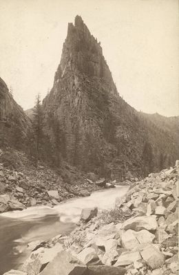
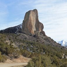
Curecanti Needle, Granite summit in Gunnison County, Colorado.

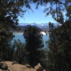
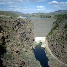
Curecanti Needle is a pointed granite formation rising sharply from the waters of Morrow Point Reservoir in Gunnison Canyon. The spire's light-colored rock contrasts with the surrounding canyon walls, making it stand out distinctly from different viewing angles throughout the recreation area.

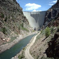
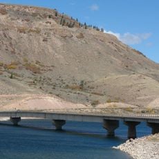
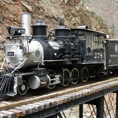
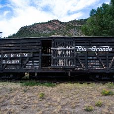
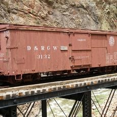
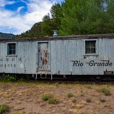
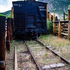
Railroad builders in the late 1800s used the granite spire as a navigational reference while constructing rail lines through the Gunnison River canyon. The Denver & Rio Grande Western Railroad's route hugged the narrow canyon walls, making this natural marker important for surveying and engineering work.

The needle's name reflects connections to the Ute people who inhabited this region for centuries. Today, the formation serves as a focal point for visitors seeking to understand the landscape's geological and cultural layering.

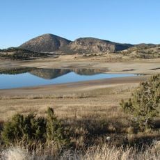
Viewing the needle is best done from designated overlooks around the reservoir or by walking trails that run through the recreation area. The formation appears different throughout the day as light and shadows shift, so spending time at multiple viewpoints rewards patient observation.

The granite spire has resisted erosion for millions of years while softer surrounding rocks were worn away, creating this isolated needle shape. The fine cracks and patterns visible in the stone show how weather continuously works on the rock without ever toppling this resilient formation.

Location: Gunnison County

Made from material: granite

GPS coordinates: 38.44896,-107.41439

Latest update: December 12, 2025 12:04

Photos
Around this place
Blue Mesa Reservoir
United States of America

Blue Mesa Reservoir

17.1 km
Ridgway State Park
United States of America

Ridgway State Park

38.4 km
Gunnison Tunnel
United States of America

Gunnison Tunnel

27.2 km
Morrow Point Dam
United States of America

Morrow Point Dam

10.8 km
Blue Mesa Dam
United States of America

Blue Mesa Dam

7 km
Crawford State Park
United States of America

Crawford State Park

30.9 km
Needle Rock Natural Area
United States of America

Needle Rock Natural Area

32.9 km
D & RG Narrow Gauge Trestle
United States of America

D & RG Narrow Gauge Trestle

11.8 km
Crystal Dam
United States of America

Crystal Dam

19.6 km
Penny Hot Springs
United States of America

Penny Hot Springs

30.7 km
Morrow Point Reservoir
United States of America

Morrow Point Reservoir

10.7 km
West Elk Wilderness
United States of America

West Elk Wilderness

33 km
Ridgway Reservoir
United States of America

Ridgway Reservoir

38.5 km
Crystal Reservoir
United States of America

Crystal Reservoir

15 km
Blue Creek Canyon
United States of America

Blue Creek Canyon

5 km
North Rim Road, Black Canyon of the Gunnison National Park
United States of America

North Rim Road, Black Canyon of the Gunnison National Park

27.8 km
Middle Bridge
United States of America

Middle Bridge

14.1 km
Rio Grande Southern Railroad Derrick Car
United States of America

Rio Grande Southern Railroad Derrick Car

12.3 km
North Rim Road
United States of America

North Rim Road

26.2 km
Painted Wall
United States of America

Painted Wall

31 km
Denver & Rio Grande Western Railroad 278
United States of America

Denver & Rio Grande Western Railroad 278

11.8 km
Denver & Rio Grande Western Railroad Caboose No. 0577
United States of America

Denver & Rio Grande Western Railroad Caboose No. 0577

11.8 km
Denver & Rio Grande Western Railroad Stock Car No. 5620
United States of America

Denver & Rio Grande Western Railroad Stock Car No. 5620

12.3 km
Denver & Rio Grande Western Railroad Boxcar No. 3132
United States of America

Denver & Rio Grande Western Railroad Boxcar No. 3132

11.8 km
Denver & Rio Grande Railroad Box Outfit Car No. 04414
United States of America

Denver & Rio Grande Railroad Box Outfit Car No. 04414

12.3 km
Denver & Rio Grande Western Railroad Stock Car No. 5679D
United States of America

Denver & Rio Grande Western Railroad Stock Car No. 5679D

12.3 km
South Rim Visitor Center
United States of America

South Rim Visitor Center

26.5 km
Cimarron Visitor Center
United States of America

Cimarron Visitor Center

12.3 km
Show the full map
Reviews

Visited this place? Tap the stars to rate it and share your experience / photos with the community! Try now! You can cancel it anytime.

« Curecanti Needle - Granite summit in Gunnison County, Colorado » is provided by Around Us (aroundus.com). Images and texts are derived from Wikimedia project under a Creative Commons license. You are allowed to copy, distribute, and modify copies of this page, under the conditions set by the license, as long as this note is clearly visible.

Discover hidden gems everywhere you go!

From secret cafés to breathtaking viewpoints, skip the crowded tourist spots and find places that match your style. Our app makes it easy with voice search, smart filtering, route optimization, and insider tips from travelers worldwide. Download now for the complete mobile experience.

Around Us App Screenshot

A unique approach to discovering new places

Le Figaro

All the places worth exploring

France Info

A tailor-made excursion in just a few clicks

20 Minutes