Enable Location

We need your location to show you interesting places around you

Discover nearby places

Find interesting locations and hidden gems around you

Precise directions

Get accurate directions and distances to places

Your location is never shared with other users. It's only used when you tap the location button.

Blue Mesa Dam

Log in to your account

Start exploring — it's free

Trusted by 63,022 travelers worldwide

Continue with Google
Continue with Apple
or

We will send you a code to connect

By continuing, you accept our Terms and Conditions and our Privacy Policy

Check your inbox

We've sent a pincode in your inbox. Please enter the code below.

Discussion Reviews 1 Photos
5.1k Popularity

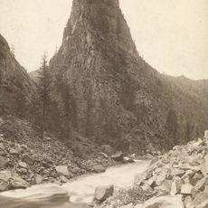
Blue Mesa Dam, Embankment dam and power station in Gunnison County, United States

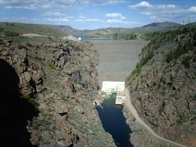
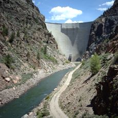
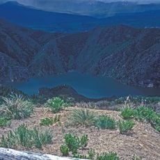
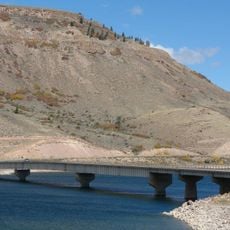
Blue Mesa Dam is an earthen embankment structure that spans 239 meters across the Gunnison River, creating Colorado's largest water storage area. The facility combines water impoundment with a power generation plant that operates from the base of the structure.

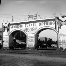
The Bureau of Reclamation completed this dam in 1966 as part of the larger Colorado River Storage Project. Its construction marked a major engineering effort to manage water resources across the western United States.

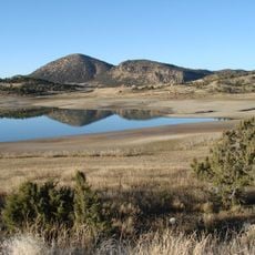
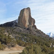
The reservoir plays a central role in regional water management and supports communities that depend on its supply for drinking water and irrigation. The facility has become a defining feature of the local landscape.

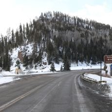
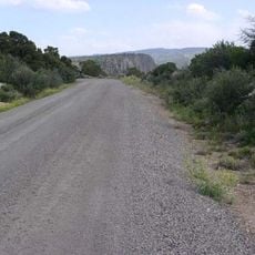
The dam is accessed via State Highway 92, which crosses its top and connects to recreational areas around the reservoir. Weather can change quickly in this mountain location, so visitors should prepare for variable conditions.

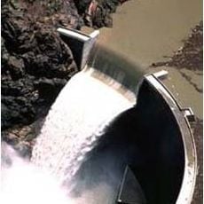
The power plant turbines were upgraded in 1988 to increase output from 60 to about 86 megawatts, making the facility much more efficient. This improvement demonstrates how aging infrastructure can be modernized to meet growing demand.

The community of curious travelers

AroundUs brings together thousands of curated places, local tips, and hidden gems, enriched daily by 60,000 contributors worldwide.

Start exploring
Location
Inception
1962
Length
239 m
GPS coordinates
38.45330,-107.33400
Latest update
December 10, 2025 16:29
Around this place
Blue Mesa Reservoir
United States of America

Blue Mesa Reservoir

10.1 km
Gunnison Tunnel
United States of America

Gunnison Tunnel

34.1 km
Morrow Point Dam
United States of America

Morrow Point Dam

17.8 km
Crawford State Park
United States of America

Crawford State Park

34.6 km
Needle Rock Natural Area
United States of America

Needle Rock Natural Area

35.6 km
D & RG Narrow Gauge Trestle
United States of America

D & RG Narrow Gauge Trestle

18.8 km
Crystal Dam
United States of America

Crystal Dam

26.2 km
Penny Hot Springs
United States of America

Penny Hot Springs

28.1 km
Curecanti Needle
United States of America

Curecanti Needle

7 km
Morrow Point Reservoir
United States of America

Morrow Point Reservoir

17.7 km
West Elk Wilderness
United States of America

West Elk Wilderness

30.5 km
Crystal Reservoir
United States of America

Crystal Reservoir

21.8 km
Blue Creek Canyon
United States of America

Blue Creek Canyon

8.4 km
North Rim Road, Black Canyon of the Gunnison National Park
United States of America

North Rim Road, Black Canyon of the Gunnison National Park

33.8 km
Middle Bridge
United States of America

Middle Bridge

7.2 km
Rio Grande Southern Railroad Derrick Car
United States of America

Rio Grande Southern Railroad Derrick Car

19.3 km
North Rim Road
United States of America

North Rim Road

32.3 km
Edgerton House
United States of America

Edgerton House

36.3 km
Fisher-Zugelder House and Smith Cottage
United States of America

Fisher-Zugelder House and Smith Cottage

37 km
Painted Wall
United States of America

Painted Wall

37.2 km
Denver & Rio Grande Western Railroad 278
United States of America

Denver & Rio Grande Western Railroad 278

18.8 km
Denver & Rio Grande Western Railroad Caboose No. 0577
United States of America

Denver & Rio Grande Western Railroad Caboose No. 0577

18.8 km
Denver & Rio Grande Western Railroad Stock Car No. 5620
United States of America

Denver & Rio Grande Western Railroad Stock Car No. 5620

19.3 km
Denver & Rio Grande Western Railroad Boxcar No. 3132
United States of America

Denver & Rio Grande Western Railroad Boxcar No. 3132

18.8 km
Denver & Rio Grande Railroad Box Outfit Car No. 04414
United States of America

Denver & Rio Grande Railroad Box Outfit Car No. 04414

19.3 km
Denver & Rio Grande Western Railroad Stock Car No. 5679D
United States of America

Denver & Rio Grande Western Railroad Stock Car No. 5679D

19.3 km
South Rim Visitor Center
United States of America

South Rim Visitor Center

32.7 km
Cimarron Visitor Center
United States of America

Cimarron Visitor Center

19.3 km
Show the full map
Reviews
Share your experience

No review yet

Discussions
Start a discussion...

No discussion yet

« Blue Mesa Dam - Embankment dam and power station in Gunnison County, United States » is provided by Around Us (aroundus.com). Images and texts are derived from Wikimedia project under a Creative Commons license. You are allowed to copy, distribute, and modify copies of this page, under the conditions set by the license, as long as this note is clearly visible.

Discover hidden gems everywhere you go!

From secret cafés to breathtaking viewpoints, skip the crowded tourist spots and find places that match your style. Our app makes it easy with voice search, smart filtering, route optimization, and insider tips from travelers worldwide. Download now for the complete mobile experience.

Around Us App Screenshot

A unique approach to discovering new places

Le Figaro

All the places worth exploring

France Info

A tailor-made excursion in just a few clicks

20 Minutes

Around Us
Travel Guide & Maps
Download

Send to your phone

QR Code
1

Open the camera app on your mobile.

2

Point at the QR code with your camera. A notification will appear.

3

Tap the notification to open the link.