Enable Location

We need your location to show you interesting places around you

Discover nearby places

Find interesting locations and hidden gems around you

Precise directions

Get accurate directions and distances to places

Your location is never shared with other users. It's only used when you tap the location button.

Eldorado Mountain

Log in to your account

Start exploring — it's free

Trusted by 63,128 travelers worldwide

Continue with Google
Continue with Apple
or

We will send you a code to connect

By continuing, you accept our Terms and Conditions and our Privacy Policy

Check your inbox

We've sent a pincode in your inbox. Please enter the code below.

Eldorado Mountain
Discussion Reviews 1 Photos
3.4k Popularity

Eldorado Mountain, Mountain summit in Boulder County, Colorado, US

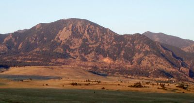
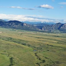
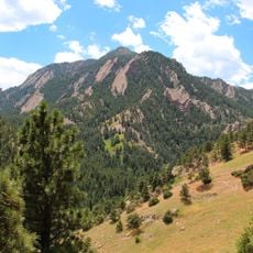
Eldorado Mountain is a summit in Boulder County that reaches approximately 8,344 feet above sea level. The peak features distinctive sandstone rock formations and is topped with radio transmission equipment serving the surrounding region.

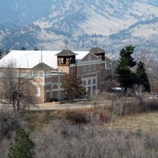
The Crags Hotel operated on the mountain's slopes from 1908 until a fire destroyed it in 1913. Remnants of this early lodging structure remain visible today near the Rattlesnake Gulch Trail.

The mountain shares boundaries with multiple jurisdictions, including Boulder City, Boulder County, Eldorado Canyon State Park, and the Bureau of Land Management.

Reaching the summit involves following informal trails and being aware of property boundaries, particularly around the railroad tracks that cross the slope. Visitors should respect marked restrictions and check local access conditions before heading out.

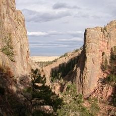
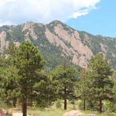
The eastern flank features Mickey Mouse Wall, a distinctive rock formation with shapes resembling mouse ears when viewed from certain angles. This natural formation has become a local landmark that many climbers recognize and navigate by.

The community of curious travelers

AroundUs brings together thousands of curated places, local tips, and hidden gems, enriched daily by 60,000 contributors worldwide.

Start exploring
Location
GPS coordinates
39.91415,-105.29471
Latest update
December 12, 2025 08:01
Around this place
Flatirons
United States of America

Flatirons

7.8 km
Folsom Field
United States of America

Folsom Field

10.9 km
NIST-F1
United States of America

NIST-F1

9.3 km
Golden Gate Canyon State Park
United States of America

Golden Gate Canyon State Park

13.6 km
Boulder Public Library
United States of America

Boulder Public Library

11.2 km
Eldorado Canyon State Park
United States of America

Eldorado Canyon State Park

1.8 km
Mesa Laboratory
United States of America

Mesa Laboratory

7.3 km
Gross Reservoir
United States of America

Gross Reservoir

7.4 km
Rocky Flats National Wildlife Refuge
United States of America

Rocky Flats National Wildlife Refuge

6.9 km
Bear Peak
United States of America

Bear Peak

5.1 km
Green Mountain
United States of America

Green Mountain

7.6 km
Colorado Shakespeare Festival
United States of America

Colorado Shakespeare Festival

10.6 km
Chautauqua Auditorium
United States of America

Chautauqua Auditorium

9.4 km
University of Colorado Museum of Natural History
United States of America

University of Colorado Museum of Natural History

10.5 km
Boulder County Courthouse
United States of America

Boulder County Courthouse

11.7 km
Walker Ranch
United States of America

Walker Ranch

5.6 km
Fairview High School
United States of America

Fairview High School

7.7 km
Highland School
United States of America

Highland School

11.1 km
Norlin Quadrangle Historic District
United States of America

Norlin Quadrangle Historic District

10.7 km
Andrews Arboretum
United States of America

Andrews Arboretum

11 km
Carnegie Library
United States of America

Carnegie Library

11.8 km
Allen House
United States of America

Allen House

9.5 km
Downtown Boulder Historic District
United States of America

Downtown Boulder Historic District

11.8 km
Boulder Creek Bridge
United States of America

Boulder Creek Bridge

11.4 km
Rhoades House
United States of America

Rhoades House

15.5 km
Fox Stone Barn
United States of America

Fox Stone Barn

9.3 km
Boulder Museum of Contemporary Art
United States of America

Boulder Museum of Contemporary Art

11.4 km
Boulder Theatre
United States of America

Boulder Theatre

11.7 km
Show the full map
Reviews
Share your experience

No review yet

Discussions
Start a discussion...

No discussion yet

« Eldorado Mountain - Mountain summit in Boulder County, Colorado, US » is provided by Around Us (aroundus.com). Images and texts are derived from Wikimedia project under a Creative Commons license. You are allowed to copy, distribute, and modify copies of this page, under the conditions set by the license, as long as this note is clearly visible.

Discover hidden gems everywhere you go!

From secret cafés to breathtaking viewpoints, skip the crowded tourist spots and find places that match your style. Our app makes it easy with voice search, smart filtering, route optimization, and insider tips from travelers worldwide. Download now for the complete mobile experience.

Around Us App Screenshot

A unique approach to discovering new places

Le Figaro

All the places worth exploring

France Info

A tailor-made excursion in just a few clicks

20 Minutes

Around Us
Travel Guide & Maps
Download

Send to your phone

QR Code
1

Open the camera app on your mobile.

2

Point at the QR code with your camera. A notification will appear.

3

Tap the notification to open the link.