Chest opened
+${chestReward.xp} XP
Explorer
NOUVEAU ×${chestReward.collectible.quantity}
tapez pour fermer
Chest locked

Open chests in the app

Around Us is built for your phone — chests unlock when you walk, explore and capture nearby places.

Enable Location

We need your location to show you interesting places around you

Discover nearby places

Find interesting locations and hidden gems around you

Precise directions

Get accurate directions and distances to places

Your location is never shared with other users. It's only used when you tap the location button.

Log in to your account

Start exploring — it's free

Trusted by 72,961 travelers worldwide

Continue with Google
Continue with Apple
or

We will send you a code to connect

By continuing, you accept our Terms and Conditions and our Privacy Policy

Check your inbox

We've sent a pincode in your inbox. Please enter the code below.

Jackson County, Jefferson Territory
Discussion Reviews Photo
900+ Popularity

Jackson County, Jefferson Territory, Historical county in Jefferson Territory, United States.

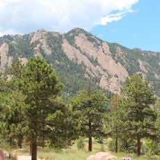
Jackson County was an administrative area in the northeastern section of Jefferson Territory, stretching across mountainous terrain and valleys along the present-day Colorado-Wyoming border. The county encompassed different topographic zones that included both high mountain regions and river valleys.

The county emerged in 1859 during the Pike's Peak Gold Rush when Jefferson Territory created administrative divisions before Colorado Territory formed. These boundaries were drawn to manage the rapidly growing population of settlers and miners.

The region reflected the presence of Ute and Arapaho peoples whose use of the land and settlement patterns shaped the territory before formal administration arrived. These Native American communities maintained deep ties to the mountains and valleys that later became the basis for territorial boundaries.

The region was relatively isolated but required only basic supplies to support the growing population of settlers and miners. Visitors should understand that this historical area today exists only through archived records and geographic landmarks.

The county was the site of gold discoveries that led to the establishment of several settlements supporting the territorial economy. These mining activities attracted thousands of prospectors and made the region a temporary center of gold extraction activity.

The community of curious travelers

AroundUs brings together thousands of curated places, local tips, and hidden gems, enriched daily by 60,000 contributors worldwide.

Start exploring
GPS coordinates
40.09000,-105.36000
Latest update
December 14, 2025 20:03
Around this place
Flatirons
United States of America

Flatirons

13.1 km
Folsom Field
United States of America

Folsom Field

12 km
NIST-F1
United States of America

NIST-F1

13.5 km
Boulder Public Library
United States of America

Boulder Public Library

10.8 km
Mesa Laboratory
United States of America

Mesa Laboratory

14.4 km
Switzerland Trail
United States of America

Switzerland Trail

11.6 km
Hotel Boulderado
United States of America

Hotel Boulderado

10.5 km
Green Mountain
United States of America

Green Mountain

13 km
Colorado Shakespeare Festival
United States of America

Colorado Shakespeare Festival

12.2 km
Chautauqua Auditorium
United States of America

Chautauqua Auditorium

12.3 km
Fiske Planetarium
United States of America

Fiske Planetarium

12.7 km
University of Colorado Museum of Natural History
United States of America

University of Colorado Museum of Natural History

11.9 km
Boulder County Courthouse
United States of America

Boulder County Courthouse

10.6 km
Walker Ranch
United States of America

Walker Ranch

15.3 km
United States of America

Left Hand Canyon

5.1 km
Highland School
United States of America

Highland School

10.7 km
Norlin Quadrangle Historic District
United States of America

Norlin Quadrangle Historic District

11.7 km
Andrews Arboretum
United States of America

Andrews Arboretum

11.2 km
Carnegie Library
United States of America

Carnegie Library

10.3 km
Little Church in the Pines
United States of America

Little Church in the Pines

4.3 km
Wall Street Assay Office
United States of America

Wall Street Assay Office

6.1 km
Allen House
United States of America

Allen House

12.6 km
Downtown Boulder Historic District
United States of America

Downtown Boulder Historic District

10.7 km
Salina School
United States of America

Salina School

4.2 km
Ward Congregational Church
United States of America

Ward Congregational Church

12.8 km
Bunce School
United States of America

Bunce School

13.1 km
Boulder Creek Bridge
United States of America

Boulder Creek Bridge

9 km
Boulder Museum of Contemporary Art
United States of America

Boulder Museum of Contemporary Art

10.9 km
Show the full map
Reviews
Share your experience

No review yet

Discussions
Start a discussion...

No discussion yet

« Jackson County, Jefferson Territory - Historical county in Jefferson Territory, United States » is provided by Around Us (aroundus.com). Images and texts are derived from Wikimedia project under a Creative Commons license. You are allowed to copy, distribute, and modify copies of this page, under the conditions set by the license, as long as this note is clearly visible.

Discover hidden gems everywhere you go!

From secret cafés to breathtaking viewpoints, skip the crowded tourist spots and find places that match your style. Our app makes it easy with voice search, smart filtering, route optimization, and insider tips from travelers worldwide. Download now for the complete mobile experience.

Around Us App Screenshot

A unique approach to discovering new places

Le Figaro

All the places worth exploring

France Info

A tailor-made excursion in just a few clicks

20 Minutes

Around Us
Travel Guide & Maps
Download

Send to your phone

QR Code
1

Open the camera app on your mobile.

2

Point at the QR code with your camera. A notification will appear.

3

Tap the notification to open the link.