Chest opened
+${chestReward.xp} XP
Explorer
NOUVEAU ×${chestReward.collectible.quantity}
tapez pour fermer
Chest locked

Open chests in the app

Around Us is built for your phone — chests unlock when you walk, explore and capture nearby places.

Enable Location

We need your location to show you interesting places around you

Discover nearby places

Find interesting locations and hidden gems around you

Precise directions

Get accurate directions and distances to places

Your location is never shared with other users. It's only used when you tap the location button.

Black Forest

Log in to your account

Start exploring — it's free

Trusted by 72,986 travelers worldwide

Continue with Google
Continue with Apple
or

We will send you a code to connect

By continuing, you accept our Terms and Conditions and our Privacy Policy

Check your inbox

We've sent a pincode in your inbox. Please enter the code below.

Discussion Reviews 1 Photos
16.8k Popularity

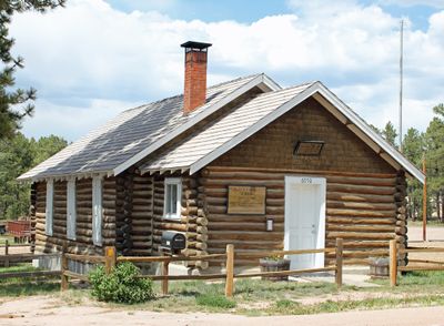
Black Forest, Census-designated place in El Paso County, Colorado

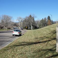
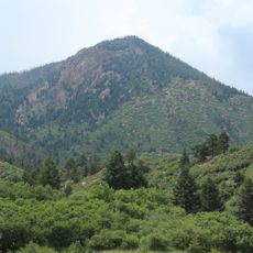
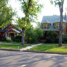
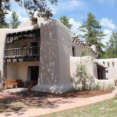
Black Forest is a residential area in El Paso County, Colorado, spread across a large region covered with dense Ponderosa pine forests. Homes sit on spacious properties with direct access to hiking trails and outdoor spaces.

The area was originally home to Native Americans and later became a major timber region in the 1800s. The wood was harvested primarily to supply building materials for nearby towns.

The community gathers for outdoor events and activities that reflect how residents value the forested setting where they live. These gatherings shape daily life and show the strong connection people maintain with nature here.

The area is best explored by car since homes are spread across a large region with limited public transportation options. Plan ahead for hiking routes and consider the season, as weather conditions vary throughout the year.

A major fire in 2013 changed the community and led to stronger fire safety practices that remain in place today. This event brought residents closer together and heightened awareness of wildfire prevention measures.

The community of curious travelers

AroundUs brings together thousands of curated places, local tips, and hidden gems, enriched daily by 60,000 contributors worldwide.

Start exploring
Location
Elevation above the sea
2,246 m
GPS coordinates
39.03670,-104.67800
Latest update
December 7, 2025 19:26
Around this place
Focus on the Family
United States of America

Focus on the Family

12.6 km
United States Air Force Academy Cadet Chapel
United States of America

United States Air Force Academy Cadet Chapel

18.6 km
Falcon Stadium
United States of America

Falcon Stadium

14.9 km
Glen Eyrie
United States of America

Glen Eyrie

24.1 km
Flying W Ranch
United States of America

Flying W Ranch

20.7 km
United States Air Force Academy Cemetery
United States of America

United States Air Force Academy Cemetery

15.6 km
United States Air Force Academy, Cadet Area
United States of America

United States Air Force Academy, Cadet Area

18.6 km
Peterson Air and Space Museum
United States of America

Peterson Air and Space Museum

23.9 km
Monument Valley Park
United States of America

Monument Valley Park

24.3 km
Blodgett Peak
United States of America

Blodgett Peak

21.6 km
Old North End Historic District
United States of America

Old North End Historic District

23.5 km
Tri-Lakes, Colorado
United States of America

Tri-Lakes, Colorado

18 km
Western Museum of Mining & Industry
United States of America

Western Museum of Mining & Industry

13.1 km
Federal Building
United States of America

Federal Building

24.2 km
Black Squirrel Creek Bridge
United States of America

Black Squirrel Creek Bridge

14.7 km
Edgeplain
United States of America

Edgeplain

24.2 km
Black Forest School
United States of America

Black Forest School

3.3 km
Taylor Memorial Chapel
United States of America

Taylor Memorial Chapel

4.8 km
Lennox House
United States of America

Lennox House

24.3 km
Fort Collins Municipal Railway No. 22
United States of America

Fort Collins Municipal Railway No. 22

23.1 km
St. Mark United Presbyterian Church
United States of America

St. Mark United Presbyterian Church

23.8 km
J.G. Evans Barn
United States of America

J.G. Evans Barn

4 km
Inez Johnson Lewis School
United States of America

Inez Johnson Lewis School

17.7 km
Cottonwood Creek Bridge
United States of America

Cottonwood Creek Bridge

16.6 km
Spring Valley School
United States of America

Spring Valley School

15.1 km
Ida M. Rice House
United States of America

Ida M. Rice House

24.3 km
The Country Club at Woodmoor
United States of America

The Country Club at Woodmoor

15.7 km
Banning Lewis Ranch Vista Water Park
United States of America

Banning Lewis Ranch Vista Water Park

11.7 km
Show the full map
Reviews
Share your experience

No review yet

Discussions
Start a discussion...

No discussion yet

« Black Forest - Census-designated place in El Paso County, Colorado » is provided by Around Us (aroundus.com). Images and texts are derived from Wikimedia project under a Creative Commons license. You are allowed to copy, distribute, and modify copies of this page, under the conditions set by the license, as long as this note is clearly visible.

Discover hidden gems everywhere you go!

From secret cafés to breathtaking viewpoints, skip the crowded tourist spots and find places that match your style. Our app makes it easy with voice search, smart filtering, route optimization, and insider tips from travelers worldwide. Download now for the complete mobile experience.

Around Us App Screenshot

A unique approach to discovering new places

Le Figaro

All the places worth exploring

France Info

A tailor-made excursion in just a few clicks

20 Minutes

Around Us
Travel Guide & Maps
Download

Send to your phone

QR Code
1

Open the camera app on your mobile.

2

Point at the QR code with your camera. A notification will appear.

3

Tap the notification to open the link.