Chest opened
+${chestReward.xp} XP
Explorer
NOUVEAU ×${chestReward.collectible.quantity}
tapez pour fermer
Chest locked

Open chests in the app

Around Us is built for your phone — chests unlock when you walk, explore and capture nearby places.

Enable Location

We need your location to show you interesting places around you

Discover nearby places

Find interesting locations and hidden gems around you

Precise directions

Get accurate directions and distances to places

Your location is never shared with other users. It's only used when you tap the location button.

Malheur National Forest

Log in to your account

Start exploring — it's free

Trusted by 72,984 travelers worldwide

Continue with Google
Continue with Apple
or

We will send you a code to connect

By continuing, you accept our Terms and Conditions and our Privacy Policy

Check your inbox

We've sent a pincode in your inbox. Please enter the code below.

Discussion Reviews 1 Photos
21.4k Popularity

Malheur National Forest, National Forest in Oregon, United States.

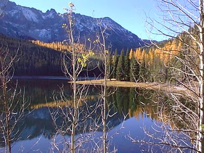
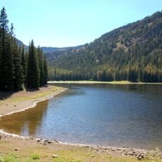
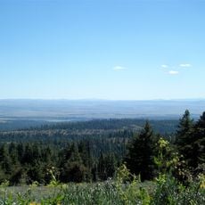
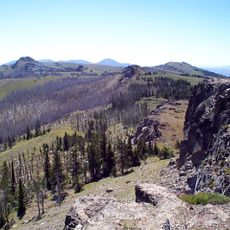
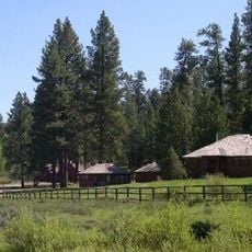
Malheur National Forest spans across the Blue Mountains and displays a mix of high desert grasslands, sagebrush, and several tree species. The terrain shifts between open areas with low vegetation and forested sections filled with juniper, pine, and fir trees.

The forest was established in 1908 under President Theodore Roosevelt and takes its name from the Malheur River. The area had been shaped by human activity long before this formal designation.

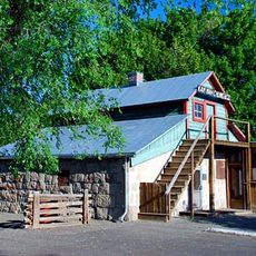
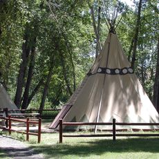
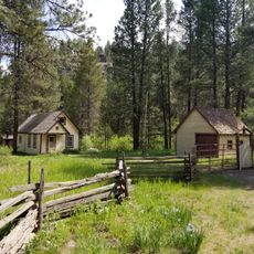
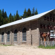
The forest has long supported local communities through traditional land uses that shape how people relate to and work within the landscape. These practices reflect deep connections between residents and their surroundings that remain visible today.

The forest is accessible via U.S. Route 395 running north-south and U.S. Route 26 crossing east-west. Ranger stations throughout the area offer information and guidance to help visitors explore the landscape safely.

The forest contains a colony of Armillaria ostoyae fungus that spreads across hundreds of acres. This interconnected organism network ranks among the largest single living systems on Earth.

The community of curious travelers

AroundUs brings together thousands of curated places, local tips, and hidden gems, enriched daily by 60,000 contributors worldwide.

Start exploring
Location
Operator
United States Forest Service
GPS coordinates
44.28320,-118.78400
Latest update
December 23, 2025 14:58
Around this place
Sumpter Valley Gold Dredge
United States of America

Sumpter Valley Gold Dredge

68.8 km
Kam Wah Chung Company Building
United States of America

Kam Wah Chung Company Building

20.4 km
Strawberry Mountain Wilderness
United States of America

Strawberry Mountain Wilderness

2.3 km
James Cant Ranch
United States of America

James Cant Ranch

74.9 km
Black Canyon Wilderness
United States of America

Black Canyon Wilderness

69.6 km
Monument Rock Wilderness
United States of America

Monument Rock Wilderness

38.7 km
United States of America

Bates State Park

40.7 km
Clyde Holliday State Recreation Site
United States of America

Clyde Holliday State Recreation Site

28.4 km
Antlers Guard Station
United States of America

Antlers Guard Station

56 km
Advent Christian Church
United States of America

Advent Christian Church

20.1 km
Fremont Powerhouse
United States of America

Fremont Powerhouse

61.5 km
Allison Ranger Station
United States of America

Allison Ranger Station

76.2 km
St. Thomas' Episcopal Church
United States of America

St. Thomas' Episcopal Church

17.3 km
Supervisor's House No. 1001
United States of America

Supervisor's House No. 1001

19.8 km
John Day Compound
United States of America

John Day Compound

20.6 km
Superintendent's House
United States of America

Superintendent's House

69.1 km
Thomas Condon Paleontology Center
United States of America

Thomas Condon Paleontology Center

74.8 km
Kam Wah Chung State Heritage Site
United States of America

Kam Wah Chung State Heritage Site

20.4 km
Kam Wah Chung Chinese Heritage Site
United States of America

Kam Wah Chung Chinese Heritage Site

20.2 km
United States of America

Devine Monument

58.1 km
United States of America

Craft Point

56.8 km
United States of America

Cordella Rim

80.3 km
United States of America

Sumpter Valley Dredge State Heritage Area

68.8 km
United States of America

Dahlgren Rim

78.1 km
United States of America

Goose Rock

75.8 km
United States of America

Waqíima Butte

43.8 km
United States of America

Brennan Reservoir

85 km
United States of America

Stockade Point

76 km
Show the full map
Reviews
Share your experience

No review yet

Discussions
Start a discussion...

No discussion yet

« Malheur National Forest - National Forest in Oregon, United States » is provided by Around Us (aroundus.com). Images and texts are derived from Wikimedia project under a Creative Commons license. You are allowed to copy, distribute, and modify copies of this page, under the conditions set by the license, as long as this note is clearly visible.

Discover hidden gems everywhere you go!

From secret cafés to breathtaking viewpoints, skip the crowded tourist spots and find places that match your style. Our app makes it easy with voice search, smart filtering, route optimization, and insider tips from travelers worldwide. Download now for the complete mobile experience.

Around Us App Screenshot

A unique approach to discovering new places

Le Figaro

All the places worth exploring

France Info

A tailor-made excursion in just a few clicks

20 Minutes

Around Us
Travel Guide & Maps
Download

Send to your phone

QR Code
1

Open the camera app on your mobile.

2

Point at the QR code with your camera. A notification will appear.

3

Tap the notification to open the link.