Chest opened
+${chestReward.xp} XP
Explorer
NOUVEAU ×${chestReward.collectible.quantity}
tapez pour fermer
Chest locked

Open chests in the app

Around Us is built for your phone — chests unlock when you walk, explore and capture nearby places.

Enable Location

We need your location to show you interesting places around you

Discover nearby places

Find interesting locations and hidden gems around you

Precise directions

Get accurate directions and distances to places

Your location is never shared with other users. It's only used when you tap the location button.

Lolo Pass

Log in to your account

Start exploring — it's free

Trusted by 72,888 travelers worldwide

Continue with Google
Continue with Apple
or

We will send you a code to connect

By continuing, you accept our Terms and Conditions and our Privacy Policy

Check your inbox

We've sent a pincode in your inbox. Please enter the code below.

Lolo Pass
Discussion Reviews 1 Photos
16.4k Popularity

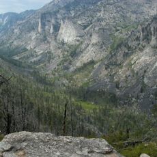
Lolo Pass, Mountain pass in Bitterroot Range, United States

Lolo Pass is a mountain pass in the Bitterroot Range sitting at about 1,595 meters (5,235 feet) elevation between Idaho and Montana. The crossing connects valleys on both sides and serves as a key roadway for vehicle travel between communities on each side.

The Lewis and Clark Expedition crossed this pass in September 1805 with the help of a local guide named Old Toby. The route later became important for fur traders and settlers moving between the eastern and western sides of the mountains.

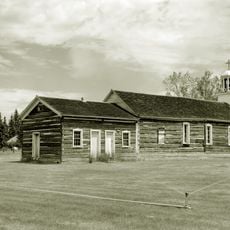
The Nez Perce people traveled regularly through this pass as part of their seasonal movement between regions. The route remains part of the area's cultural memory as a connection between communities on either side of the mountains.

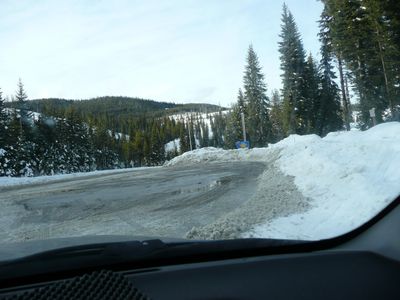
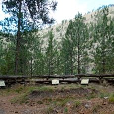
The pass is accessible by vehicle using U.S. Route 12, which connects communities on both sides of the mountains. Travel during warmer months is easier, as snow and weather conditions can close or limit access during winter and early spring.

The name first appeared in the records of fur traders in the early 1800s and referred to the travel route itself. Local place-name history suggests the word comes from early trade languages of the region.

The community of curious travelers

AroundUs brings together thousands of curated places, local tips, and hidden gems, enriched daily by 60,000 contributors worldwide.

Start exploring
Location
Location
Elevation above the sea
1,595 m
Part of
Bitterroot Range
GPS coordinates
46.63540,-114.58030
Latest update
December 7, 2025 19:27
Reviews
Share your experience

No review yet

Discussions
Start a discussion...

No discussion yet

« Lolo Pass - Mountain pass in Bitterroot Range, United States » is provided by Around Us (aroundus.com). Images and texts are derived from Wikimedia project under a Creative Commons license. You are allowed to copy, distribute, and modify copies of this page, under the conditions set by the license, as long as this note is clearly visible.

Discover hidden gems everywhere you go!

From secret cafés to breathtaking viewpoints, skip the crowded tourist spots and find places that match your style. Our app makes it easy with voice search, smart filtering, route optimization, and insider tips from travelers worldwide. Download now for the complete mobile experience.

Around Us App Screenshot

A unique approach to discovering new places

Le Figaro

All the places worth exploring

France Info

A tailor-made excursion in just a few clicks

20 Minutes

Around Us
Travel Guide & Maps
Download

Send to your phone

QR Code
1

Open the camera app on your mobile.

2

Point at the QR code with your camera. A notification will appear.

3

Tap the notification to open the link.