Idaho County

Log in to your account

AroundUs is a community-driven map of interesting places, built by curious explorers like you. It grows with every review, story, and photo you share.
Connect to save your favorite spots, contribute locations, and create personalized routes.
By continuing, you accept our Terms and Conditions and our Privacy Policy
Add to collection
Map
Suggest a change
Share

Idaho County, Administrative region in central Idaho, United States.

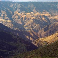
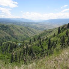
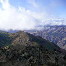
Idaho County is a large administrative region in central Idaho defined by mountains, forests, and rivers that shape its landscape. The area spans 8,485 square miles, making it the largest county by land area in the state.

The county gained its official status in 1864 during the Idaho Territory period, well before Idaho became a state in 1890. This early establishment reflects the region's importance during the settlement era.

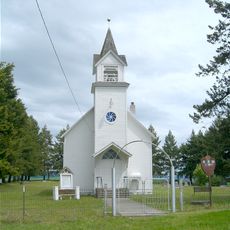
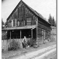
The Nez Perce people have maintained a deep relationship with this land for generations, and that connection shapes how communities here live and interact today. You can sense this influence in local stories and in the respect for nature that appears throughout daily life.

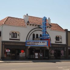
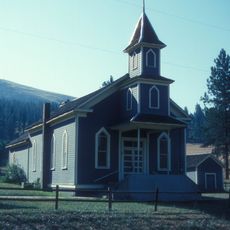
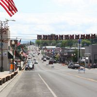
The county seat in Grangeville serves as the main hub for administrative services and regional information. Visitors can stop there to get oriented and learn more about the area before exploring the natural attractions.

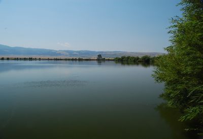
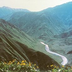
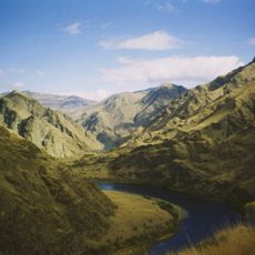
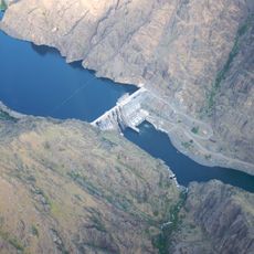
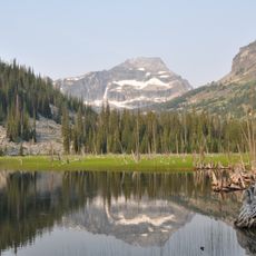
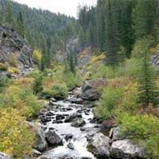
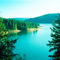
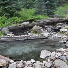
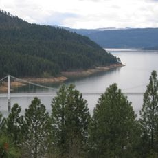
Large sections of the Nez Perce National Forest and the Salmon River are located within this county, offering hiking, fishing, and wildlife watching. These natural features draw people who want to spend time in the wilderness and experience the landscape firsthand.

Location: Idaho

Inception: February 4, 1864

Capital city: Grangeville

Elevation above the sea: 2,877 m

Shares border with: Clearwater County, Valley County, Missoula County, Ravalli County, Lemhi County, Adams County, Wallowa County, Nez Perce County, Lewis County

Website: http://idahocounty.org

GPS coordinates: 45.85000,-115.46000

Latest update: December 7, 2025 10:02

Photos
Around this place
Hells Canyon
United States of America

Hells Canyon

106.1 km
Hells Canyon National Recreation Area
United States of America

Hells Canyon National Recreation Area

85.5 km
Nez Perce National Historic Trail
United States of America

Nez Perce National Historic Trail

76.7 km
Hells Canyon Wilderness
United States of America

Hells Canyon Wilderness

87.6 km
Hells Canyon Dam
United States of America

Hells Canyon Dam

117.7 km
Selway-Bitterroot Wilderness
United States of America

Selway-Bitterroot Wilderness

95.1 km
Gospel Hump Wilderness
United States of America

Gospel Hump Wilderness

40.1 km
Weippe Prairie
United States of America

Weippe Prairie

68.1 km
Polly Bemis House
United States of America

Polly Bemis House

49.2 km
Dworshak State Park
United States of America

Dworshak State Park

103.8 km
Stanley Hot Springs
United States of America

Stanley Hot Springs

54.2 km
Dent Bridge
United States of America

Dent Bridge

100.4 km
Blue Fox Theatre
United States of America

Blue Fox Theatre

51.8 km
Bethany Memorial Chapel
United States of America

Bethany Memorial Chapel

127.3 km
Sheep Rock
United States of America

Sheep Rock

119.6 km
American Women's League Chapter House
United States of America

American Women's League Chapter House

101.7 km
First Presbyterian Church
United States of America

First Presbyterian Church

57.8 km
Pierce Courthouse
United States of America

Pierce Courthouse

75.9 km
Thomas Kirby House
United States of America

Thomas Kirby House

124.8 km
College Creek Ranger Station
United States of America

College Creek Ranger Station

113 km
Lochsa Historical Ranger Station
United States of America

Lochsa Historical Ranger Station

55.3 km
Gold Point Mill
United States of America

Gold Point Mill

9.2 km
Arctic Point Fire Lookout
United States of America

Arctic Point Fire Lookout

53.1 km
Gardiner Peak Lookout
United States of America

Gardiner Peak Lookout

55.3 km
Orofino Historic District
United States of America

Orofino Historic District

92.6 km
Deep Creek Ranger Station
United States of America

Deep Creek Ranger Station

59.9 km
James V. and Sophia Baker House
United States of America

James V. and Sophia Baker House

72.3 km
Cooper's Ferry
United States of America

Cooper's Ferry

74.2 km
Show the full map
Reviews

Visited this place? Tap the stars to rate it and share your experience / photos with the community! Try now! You can cancel it anytime.

Administrative divisions
« Idaho County - Administrative region in central Idaho, United States » is provided by Around Us (aroundus.com). Images and texts are derived from Wikimedia project under a Creative Commons license. You are allowed to copy, distribute, and modify copies of this page, under the conditions set by the license, as long as this note is clearly visible.

Discover hidden gems everywhere you go!

From secret cafés to breathtaking viewpoints, skip the crowded tourist spots and find places that match your style. Our app makes it easy with voice search, smart filtering, route optimization, and insider tips from travelers worldwide. Download now for the complete mobile experience.

Around Us App Screenshot

A unique approach to discovering new places

Le Figaro

All the places worth exploring

France Info

A tailor-made excursion in just a few clicks

20 Minutes