Hells Canyon Wilderness, Protected wilderness area in northeastern Oregon and western Idaho, United States
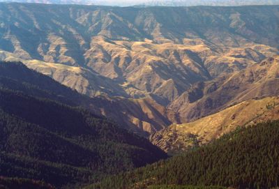
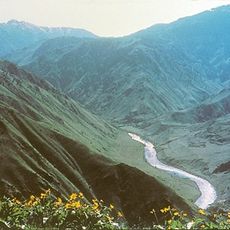
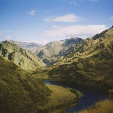
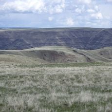
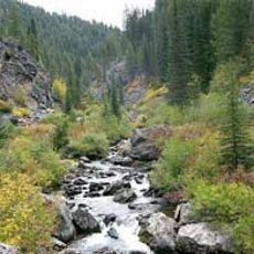
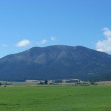
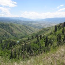
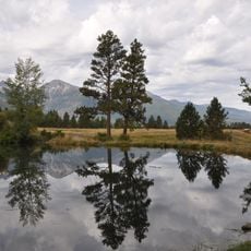
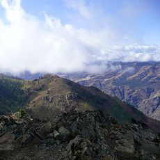
Hells Canyon Wilderness is a protected area spanning northeastern Oregon and western Idaho, bisected by the Snake River into two distinct sections. The landscape features steep canyons, rocky slopes, grassland benches, and groves of Douglas fir that create a varied and rugged terrain.
The United States Congress established this wilderness in 1975 to protect a section of North America's deepest river gorge. The designation reflected a broader effort to safeguard wild river landscapes across the western United States.
The Nez Perce people developed deep ties to this land, using the canyons for grazing their herds for generations. Traces of their settlement patterns remain visible across the terrain today.
The southern sections are accessible via the Copper Creek trailhead, located a short distance north of Oxbow, with primitive camping available at no charge. Visitors should prepare for rugged terrain and steep trails that require good physical fitness.
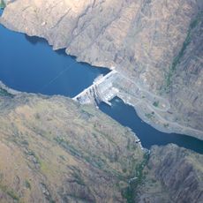
Three rivers with national protection flow through the area: the Snake, Imnaha, and Rapid rivers. These waterways represent some of the last free-flowing river sections remaining in the region.
Location: Oregon
Location: Idaho
Inception: December 31, 1975
GPS coordinates: 45.54990,-116.50100
Latest update: December 8, 2025 19:55
Hells Canyon
22.6 km
Hells Canyon National Recreation Area
5.6 km
Hells Canyon Dam
37.3 km
Zumwalt Prairie
45.9 km
Wallowa Lake Tramway
62 km
Wallowa Lake State Park
63.8 km
Gospel Hump Wilderness
56.5 km
Mount Howard
62 km
White Bird Grade
35.4 km
Blue Fox Theatre
51.3 km
Iwetemlaykin State Heritage Site
61 km
Billy Meadows Guard Station
52.3 km
Sheep Rock
42 km
Wallowa County Courthouse
62.1 km
OK Theatre
62.3 km
Kirkland Lookout Ground House
58.6 km
College Creek Ranger Station
25.7 km
William P. Warnock House
61.6 km
First Bank of Joseph
61 km
Enterprise Public Library
62 km
Dr. J. W. Barnard Building and First National Bank of Joseph
60.9 km
Lick Creek Guard Station
59.8 km
Alvin M. and Betty Josephy Library of Western History and Culture
60.9 km
James V. and Sophia Baker House
56.6 km
Cooper's Ferry
41.4 km
Enterprise I.O.O.F. Hall
62 km
Matterhorn Village
63 km
Hat Point Fire Lookout Tower
17.7 kmVisited this place? Tap the stars to rate it and share your experience / photos with the community! Try now! You can cancel it anytime.
Discover hidden gems everywhere you go!
From secret cafés to breathtaking viewpoints, skip the crowded tourist spots and find places that match your style. Our app makes it easy with voice search, smart filtering, route optimization, and insider tips from travelers worldwide. Download now for the complete mobile experience.
A unique approach to discovering new places❞
— Le Figaro
All the places worth exploring❞
— France Info
A tailor-made excursion in just a few clicks❞
— 20 Minutes