Hells Canyon Dam

Log in to your account

AroundUs is a community-driven map of interesting places, built by curious explorers like you. It grows with every review, story, and photo you share.
Connect to save your favorite spots, contribute locations, and create personalized routes.
Continue with Google
Continue with Apple
Continue with X
Continue with Facebook
Continue with email
By continuing, you accept our Terms and Conditions and our Privacy Policy
Create an account
Add to collection
Map
Suggest a change
Share

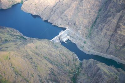
Hells Canyon Dam, Hydroelectric station and gravity dam at Snake River, Oregon and Idaho

Hells Canyon Dam is a concrete barrier across the Snake River between Oregon and Idaho, built to hold back water and generate power. The structure spans 277 meters and contains turbines that convert the river's flow into electricity.

Idaho Power Company finished building this dam in 1967 as the final part of a three-dam project on the Snake River. It came after Brownlee Dam and represented the completion of a major hydroelectric development effort.

The dam's construction modified the natural flow of Snake River, affecting the traditional salmon fishing practices of Native American tribes in the region.

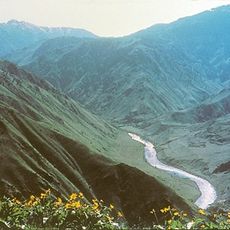
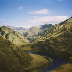
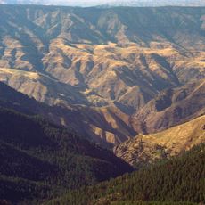
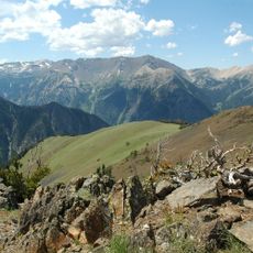
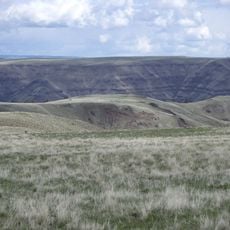
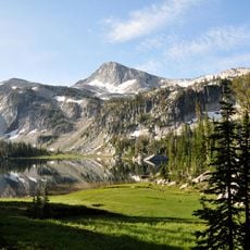
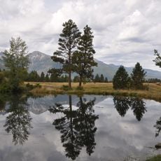
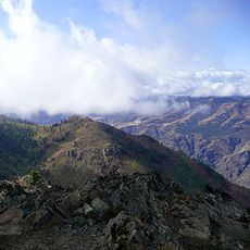
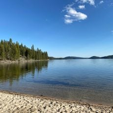
This location sits deep in Hells Canyon, one of North America's deepest river gorges, so reaching viewpoints requires hiking through rugged terrain. Visit from late spring through early fall when trails are open and weather is stable.

The dam has no fish passages, so salmon cannot reach their spawning grounds upstream. This has made the site a focal point in discussions about river management and restoring fish populations in the region.

Location: Oregon

Location: Idaho

Inception: 1967

Length: 277 m

GPS coordinates: 45.24470,-116.69800

Latest update: December 8, 2025 20:02

Photos
Around this place
Hells Canyon
United States of America

Hells Canyon

14.9 km
Wallowa Mountains
United States of America

Wallowa Mountains

47.2 km
Hells Canyon National Recreation Area
United States of America

Hells Canyon National Recreation Area

42.5 km
Hells Canyon Wilderness
United States of America

Hells Canyon Wilderness

37.3 km
Sacajawea Peak
United States of America

Sacajawea Peak

46.7 km
Zumwalt Prairie
United States of America

Zumwalt Prairie

44.9 km
Wallowa Lake Tramway
United States of America

Wallowa Lake Tramway

37.9 km
Wallowa Lake State Park
United States of America

Wallowa Lake State Park

40.4 km
Eagle Cap
United States of America

Eagle Cap

48.2 km
Mount Howard
United States of America

Mount Howard

37.7 km
Iwetemlaykin State Heritage Site
United States of America

Iwetemlaykin State Heritage Site

42.6 km
Sheep Rock
United States of America

Sheep Rock

6.3 km
Wallowa County Courthouse
United States of America

Wallowa County Courthouse

49.6 km
OK Theatre
United States of America

OK Theatre

49.7 km
Cornucopia Jailhouse
United States of America

Cornucopia Jailhouse

47.3 km
College Creek Ranger Station
United States of America

College Creek Ranger Station

22 km
William P. Warnock House
United States of America

William P. Warnock House

48.8 km
First Bank of Joseph
United States of America

First Bank of Joseph

43.2 km
Enterprise Public Library
United States of America

Enterprise Public Library

49.5 km
Flora School
United States of America

Flora School

51.3 km
Dr. J. W. Barnard Building and First National Bank of Joseph
United States of America

Dr. J. W. Barnard Building and First National Bank of Joseph

43.2 km
Lick Creek Guard Station
United States of America

Lick Creek Guard Station

27.7 km
Col. E. M. Heigho House
United States of America

Col. E. M. Heigho House

44.7 km
Alvin M. and Betty Josephy Library of Western History and Culture
United States of America

Alvin M. and Betty Josephy Library of Western History and Culture

43.5 km
Enterprise I.O.O.F. Hall
United States of America

Enterprise I.O.O.F. Hall

49.5 km
Matterhorn Village
United States of America

Matterhorn Village

40.1 km
Hat Point Fire Lookout Tower
United States of America

Hat Point Fire Lookout Tower

21.7 km
North Beach
United States of America

North Beach

56.9 km
Show the full map
Reviews

Visited this place? Tap the stars to rate it and share your experience / photos with the community! Try now! You can cancel it anytime.

« Hells Canyon Dam - Hydroelectric station and gravity dam at Snake River, Oregon and Idaho » is provided by Around Us (aroundus.com). Images and texts are derived from Wikimedia project under a Creative Commons license. You are allowed to copy, distribute, and modify copies of this page, under the conditions set by the license, as long as this note is clearly visible.

Discover hidden gems everywhere you go!

From secret cafés to breathtaking viewpoints, skip the crowded tourist spots and find places that match your style. Our app makes it easy with voice search, smart filtering, route optimization, and insider tips from travelers worldwide. Download now for the complete mobile experience.

Around Us App Screenshot

A unique approach to discovering new places

Le Figaro

All the places worth exploring

France Info

A tailor-made excursion in just a few clicks

20 Minutes