Enable Location

We need your location to show you interesting places around you

Discover nearby places

Find interesting locations and hidden gems around you

Precise directions

Get accurate directions and distances to places

Your location is never shared with other users. It's only used when you tap the location button.

Sacajawea Peak

Log in to your account

Start exploring — it's free

Trusted by 61,495 travelers worldwide

Continue with Google
Continue with Apple
or

We will send you a code to connect

By continuing, you accept our Terms and Conditions and our Privacy Policy

Check your inbox

We've sent a pincode in your inbox. Please enter the code below.

Sacajawea Peak

Sacajawea Peak, Mountain summit in Wallowa County, United States.

Description

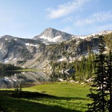
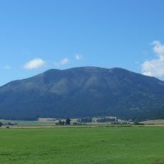
Sacajawea Peak is a mountain summit in Wallowa County rising to approximately 9,800 feet with a dramatic eastern face of layered marble. This striking rock formation comes from the Martin Bridge Formation and defines the peak's distinctive appearance.

History

The peak was named after a Shoshone woman from the early 1800s who became famous as a guide for the Lewis and Clark expedition. The geographic name was officially confirmed and preserves the memory of this historical figure.

Culture

The peak bears the name of a Shoshone woman who guided the Lewis and Clark expedition through the Rocky Mountains. Her name reflects her important role in early exploration history.

Practical

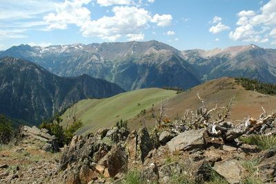
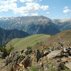
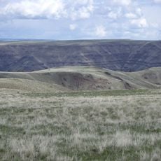
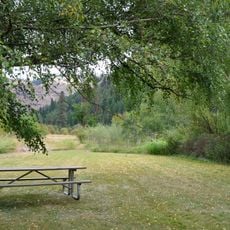
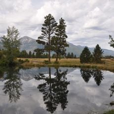
The climb starts from Thorp Creek Meadows via an east ridge route with views across typical mountain terrain. Along the way, mountain goats can be spotted moving across the rocky slopes.

Did you know?

The peak ranks as one of Oregon's most topographically prominent mountains, standing second only to Mount Hood in this regard. Its high prominence of around 6,400 feet makes it a notably distinctive landmark in the region.

Location
GPS coordinates
45.24492,-117.29320
Latest update
December 10, 2025 16:01

AroundUs brings together thousands of curated places, local tips, and hidden gems, enriched daily by 60,000 contributors worldwide. Discover all places nearby (Wallowa County).

Around this place
Wallowa Mountains
United States of America

Wallowa Mountains

764 m
Eagle Cap Wilderness
United States of America

Eagle Cap Wilderness

11.7 km
Hells Canyon Dam
United States of America

Hells Canyon Dam

46.7 km
Zumwalt Prairie
United States of America

Zumwalt Prairie

36.5 km
Wallowa Lake Tramway
United States of America

Wallowa Lake Tramway

9 km
Wallowa Lake State Park
United States of America

Wallowa Lake State Park

6.9 km
Catherine Creek State Park
United States of America

Catherine Creek State Park

36.3 km
Eagle Cap
United States of America

Eagle Cap

9.1 km
Mount Howard
United States of America

Mount Howard

9.1 km
Wallowa River Rest Area
United States of America

Wallowa River Rest Area

47.9 km
Cove Hot Springs Pool
United States of America

Cove Hot Springs Pool

41.1 km
Iwetemlaykin State Heritage Site
United States of America

Iwetemlaykin State Heritage Site

12.1 km
Thief Valley Reservoir
United States of America

Thief Valley Reservoir

46.6 km
Wallowa County Courthouse
United States of America

Wallowa County Courthouse

20.1 km
OK Theatre
United States of America

OK Theatre

20.1 km
Abel E. Eaton House
United States of America

Abel E. Eaton House

45 km
Wallowa Ranger Station
United States of America

Wallowa Ranger Station

40.8 km
Ascension Episcopal Church
United States of America

Ascension Episcopal Church

41.1 km
College Creek Ranger Station
United States of America

College Creek Ranger Station

45 km
William P. Warnock House
United States of America

William P. Warnock House

19.7 km
First Bank of Joseph
United States of America

First Bank of Joseph

12.8 km
Enterprise Public Library
United States of America

Enterprise Public Library

20.2 km
Flora School
United States of America

Flora School

18.9 km
Dr. J. W. Barnard Building and First National Bank of Joseph
United States of America

Dr. J. W. Barnard Building and First National Bank of Joseph

13 km
Lick Creek Guard Station
United States of America

Lick Creek Guard Station

22.4 km
Alvin M. and Betty Josephy Library of Western History and Culture
United States of America

Alvin M. and Betty Josephy Library of Western History and Culture

13.3 km
Enterprise I.O.O.F. Hall
United States of America

Enterprise I.O.O.F. Hall

20.2 km
Hunter–Morelock House
United States of America

Hunter–Morelock House

40.4 km
Show the full map
« Sacajawea Peak - Mountain summit in Wallowa County, United States » is provided by Around Us (aroundus.com). Images and texts are derived from Wikimedia project under a Creative Commons license. You are allowed to copy, distribute, and modify copies of this page, under the conditions set by the license, as long as this note is clearly visible.

Discover hidden gems everywhere you go!

From secret cafés to breathtaking viewpoints, skip the crowded tourist spots and find places that match your style. Our app makes it easy with voice search, smart filtering, route optimization, and insider tips from travelers worldwide. Download now for the complete mobile experience.

Around Us App Screenshot

A unique approach to discovering new places

Le Figaro

All the places worth exploring

France Info

A tailor-made excursion in just a few clicks

20 Minutes

Around Us
Travel Guide & Maps
Download

Send to your phone

QR Code
1

Open the camera app on your mobile.

2

Point at the QR code with your camera. A notification will appear.

3

Tap the notification to open the link.