Eagle Cap Wilderness

Log in to your account

AroundUs is a community-driven map of interesting places, built by curious explorers like you. It grows with every review, story, and photo you share.
Connect to save your favorite spots, contribute locations, and create personalized routes.
By continuing, you accept our Terms and Conditions and our Privacy Policy
Add to collection
Map
Suggest a change
Share

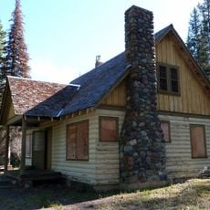
Eagle Cap Wilderness, Wilderness area in Wallowa Mountains, Oregon.

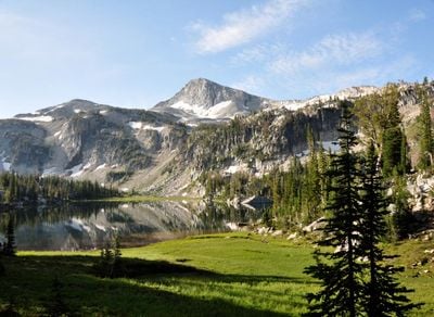
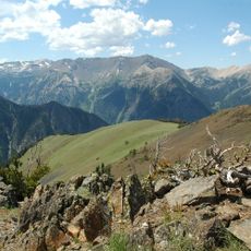
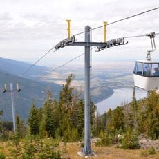
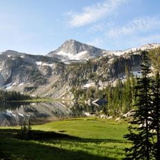
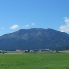
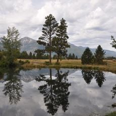
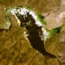
Eagle Cap Wilderness is a protected mountain region spanning 363,000 acres of granite peaks, alpine lakes, and forested valleys in the Wallowa-Whitman National Forest. The area contains over 53 high mountain lakes nestled in interconnected basins, with peaks reaching toward 9,573 feet and dense forest coverage in lower elevations.

The area received wilderness designation in 1984 to protect this section of the Wallowa Mountains with its long human heritage. Before formal protection, indigenous peoples had relied on the region for hunting and gathering for countless generations.

The trails follow routes that Native American tribes, particularly the Nez Perce, established over generations while hunting and gathering resources throughout these mountains. Visitors walking these paths connect with landscapes that held deep meaning for the people who lived here.

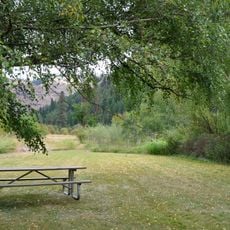
Over 500 miles of trails crisscross the region through multiple access points, with the town of Joseph offering supplies and lodging as a base. Visitors should prepare for changing mountain weather and bring adequate water and provisions for days spent on foot.

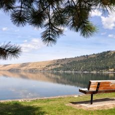
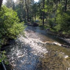
The wilderness features a network of over 53 high alpine lakes connected by natural streams and runoff channels throughout its basins. These lakes were carved by glaciers during the ice age and now form an interconnected system of water bodies that catch mountain light.

Location: Oregon

Operator: United States Forest Service

GPS coordinates: 45.24220,-117.44200

Latest update: December 7, 2025 20:46

Photos
Around this place
Show the full map
Wallowa Mountains
United States of America

Wallowa Mountains

11.1 km
Hot Lake Hotel
United States of America

Hot Lake Hotel

40.3 km
Sacajawea Peak
United States of America

Sacajawea Peak

11.7 km
Zumwalt Prairie
United States of America

Zumwalt Prairie

43.1 km
Wallowa Lake Tramway
United States of America

Wallowa Lake Tramway

20.6 km
Wallowa Lake State Park
United States of America

Wallowa Lake State Park

18.3 km
Catherine Creek State Park
United States of America

Catherine Creek State Park

25.2 km
Eagle Cap
United States of America

Eagle Cap

14 km
Mount Howard
United States of America

Mount Howard

20.7 km
Wallowa River Rest Area
United States of America

Wallowa River Rest Area

43 km
Cove Hot Springs Pool
United States of America

Cove Hot Springs Pool

29.6 km
Iwetemlaykin State Heritage Site
United States of America

Iwetemlaykin State Heritage Site

20.4 km
Thief Valley Reservoir
United States of America

Thief Valley Reservoir

37 km
Wallowa County Courthouse
United States of America

Wallowa County Courthouse

24.1 km
OK Theatre
United States of America

OK Theatre

24 km
Abel E. Eaton House
United States of America

Abel E. Eaton House

33.4 km
Wallowa Ranger Station
United States of America

Wallowa Ranger Station

37.2 km
Ascension Episcopal Church
United States of America

Ascension Episcopal Church

29.6 km
Cornucopia Jailhouse
United States of America

Cornucopia Jailhouse

32.5 km
William P. Warnock House
United States of America

William P. Warnock House

24.1 km
First Bank of Joseph
United States of America

First Bank of Joseph

20.6 km
Enterprise Public Library
United States of America

Enterprise Public Library

24.2 km
Flora School
United States of America

Flora School

21.9 km
Dr. J. W. Barnard Building and First National Bank of Joseph
United States of America

Dr. J. W. Barnard Building and First National Bank of Joseph

20.7 km
Lick Creek Guard Station
United States of America

Lick Creek Guard Station

33.3 km
Alvin M. and Betty Josephy Library of Western History and Culture
United States of America

Alvin M. and Betty Josephy Library of Western History and Culture

20.8 km
Enterprise I.O.O.F. Hall
United States of America

Enterprise I.O.O.F. Hall

24.2 km
Hunter–Morelock House
United States of America

Hunter–Morelock House

37 km
Show the full map
Reviews

Visited this place? Tap the stars to rate it and share your experience / photos with the community! Try now! You can cancel it anytime.

« Eagle Cap Wilderness - Wilderness area in Wallowa Mountains, Oregon » is provided by Around Us (aroundus.com). Images and texts are derived from Wikimedia project under a Creative Commons license. You are allowed to copy, distribute, and modify copies of this page, under the conditions set by the license, as long as this note is clearly visible.

Discover hidden gems everywhere you go!

From secret cafés to breathtaking viewpoints, skip the crowded tourist spots and find places that match your style. Our app makes it easy with voice search, smart filtering, route optimization, and insider tips from travelers worldwide. Download now for the complete mobile experience.

Around Us App Screenshot

A unique approach to discovering new places

Le Figaro

All the places worth exploring

France Info

A tailor-made excursion in just a few clicks

20 Minutes