Enable Location

We need your location to show you interesting places around you

Discover nearby places

Find interesting locations and hidden gems around you

Precise directions

Get accurate directions and distances to places

Your location is never shared with other users. It's only used when you tap the location button.

Iwetemlaykin State Heritage Site

Log in to your account

Start exploring — it's free

Trusted by 62,307 travelers worldwide

Continue with Google
Continue with Apple
or

We will send you a code to connect

By continuing, you accept our Terms and Conditions and our Privacy Policy

Check your inbox

We've sent a pincode in your inbox. Please enter the code below.

Iwetemlaykin State Heritage Site

Iwetemlaykin State Heritage Site, state park near La Grande, Oregon, United States

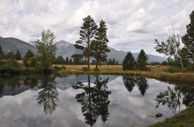
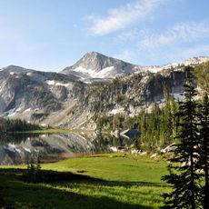
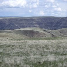
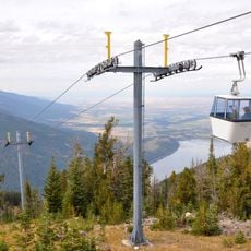
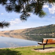
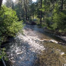
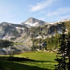
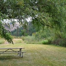
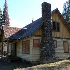
Iwetemlaykin State Heritage Site is a 62-acre heritage park located on the northern shore of Wallowa Lake in Oregon. The site features well-maintained walking trails, wetland areas including Knight's Pond, and expansive views of the surrounding Wallowa Mountains.

The land was purchased in 2007 using state lottery funds and officially opened to the public in 2009, with the Nez Perce and other tribes helping to finance the acquisition. Nearby stands the grave of Chief Joseph, a prominent leader of the Nez Perce who guided his people in this region for many years.

The name Iwetemlaykin comes from the Nez Perce language and means "at the edge of the lake". The land has held cultural meaning for the tribe across generations and continues to serve as a place where their connection to this territory remains visible today.

The site is open only during daylight hours and camping is not permitted; fires and fireworks are forbidden. Dogs must be kept on leash while bicycles, horses, and off-road vehicles are not allowed to protect the fragile landscape.

The Nez Perce originally bred the Appaloosa horse, recognized for its distinctive spotted coat pattern that can still be seen in the region today. These horses played a significant role in the tribe's history and remain a living connection to their cultural heritage.

The community of curious travelers

AroundUs brings together thousands of curated places, local tips, and hidden gems, enriched daily by 60,000 contributors worldwide.

Start exploring
Location
Inception
2009
GPS coordinates
45.34170,-117.22400
Latest update
February 9, 2026 07:40
Around this place
Hells Canyon
United States of America

Hells Canyon

46 km
Wallowa Mountains
United States of America

Wallowa Mountains

12.8 km
Eagle Cap Wilderness
United States of America

Eagle Cap Wilderness

20.4 km
Sacajawea Peak
United States of America

Sacajawea Peak

12.1 km
Hells Canyon Dam
United States of America

Hells Canyon Dam

42.6 km
Zumwalt Prairie
United States of America

Zumwalt Prairie

24.4 km
Wallowa Lake Tramway
United States of America

Wallowa Lake Tramway

9.3 km
Wallowa Lake State Park
United States of America

Wallowa Lake State Park

8.2 km
Catherine Creek State Park
United States of America

Catherine Creek State Park

45.4 km
Eagle Cap
United States of America

Eagle Cap

20.8 km
Mount Howard
United States of America

Mount Howard

9.7 km
Wallowa River Rest Area
United States of America

Wallowa River Rest Area

43.1 km
Wallowa County Courthouse
United States of America

Wallowa County Courthouse

10.2 km
OK Theatre
United States of America

OK Theatre

10.3 km
Wallowa Ranger Station
United States of America

Wallowa Ranger Station

35.1 km
Ascension Episcopal Church
United States of America

Ascension Episcopal Church

46.3 km
Cornucopia Jailhouse
United States of America

Cornucopia Jailhouse

37.3 km
College Creek Ranger Station
United States of America

College Creek Ranger Station

35.9 km
William P. Warnock House
United States of America

William P. Warnock House

9.5 km
First Bank of Joseph
United States of America

First Bank of Joseph

1.1 km
Enterprise Public Library
United States of America

Enterprise Public Library

10.2 km
Flora School
United States of America

Flora School

10.4 km
Dr. J. W. Barnard Building and First National Bank of Joseph
United States of America

Dr. J. W. Barnard Building and First National Bank of Joseph

1.2 km
Lick Creek Guard Station
United States of America

Lick Creek Guard Station

24.9 km
Alvin M. and Betty Josephy Library of Western History and Culture
United States of America

Alvin M. and Betty Josephy Library of Western History and Culture

1.6 km
Enterprise I.O.O.F. Hall
United States of America

Enterprise I.O.O.F. Hall

10.2 km
Hunter–Morelock House
United States of America

Hunter–Morelock House

34.6 km
Matterhorn Village
United States of America

Matterhorn Village

7.2 km
Show the full map
« Iwetemlaykin State Heritage Site - state park near La Grande, Oregon, United States » is provided by Around Us (aroundus.com). Images and texts are derived from Wikimedia project under a Creative Commons license. You are allowed to copy, distribute, and modify copies of this page, under the conditions set by the license, as long as this note is clearly visible.

Discover hidden gems everywhere you go!

From secret cafés to breathtaking viewpoints, skip the crowded tourist spots and find places that match your style. Our app makes it easy with voice search, smart filtering, route optimization, and insider tips from travelers worldwide. Download now for the complete mobile experience.

Around Us App Screenshot

A unique approach to discovering new places

Le Figaro

All the places worth exploring

France Info

A tailor-made excursion in just a few clicks

20 Minutes

Around Us
Travel Guide & Maps
Download

Send to your phone

QR Code
1

Open the camera app on your mobile.

2

Point at the QR code with your camera. A notification will appear.

3

Tap the notification to open the link.