Mount Howard

Log in to your account

AroundUs is a community-driven map of interesting places, built by curious explorers like you. It grows with every review, story, and photo you share.
Connect to save your favorite spots, contribute locations, and create personalized routes.
Continue with Google
Continue with Apple
Continue with X
Continue with Facebook
Continue with email
By continuing, you accept our Terms and Conditions and our Privacy Policy
Create an account
Add to collection
Map
Suggest a change
Share

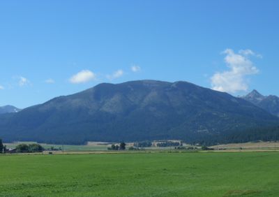
Mount Howard, National Natural Landmark mountain in Wallowa County, Oregon

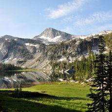
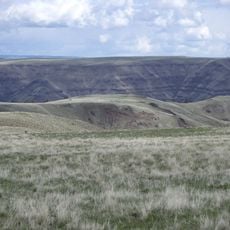
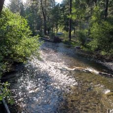
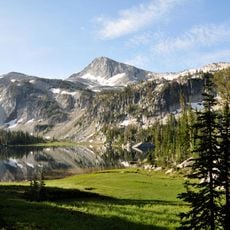
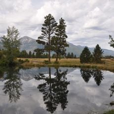
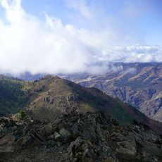
Mount Howard rises to 8,261 feet and is defined by montane grasslands that shelter plant species found only in this location. The entire area spans roughly 1,084 acres and displays varied natural habitats across its terrain.

The mountain received its name from Civil War General Oliver O. Howard, who was active in the region. In 2016, the area gained National Natural Landmark status due to its ecological importance.

The mountain holds deep meaning for the Nez Perce people, and remains a place where connection to the land is evident today. Visitors and locals use the peak as a space to understand and respect the surrounding environment.

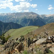
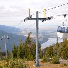
The Wallowa Lake Tramway carries visitors to the summit in minutes, climbing 3,700 feet of elevation. Hiking is possible but requires significantly more time and physical effort than riding the tram.

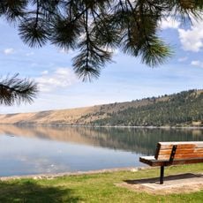
The peak houses a grill restaurant and alpine patio where visitors can dine while gazing at the Eagle Cap Wilderness and Wallowa Valley below. This combination of food and views creates a memorable experience where you enjoy comfort and scenery together.

Location: Oregon

GPS coordinates: 45.26065,-117.17878

Latest update: December 9, 2025 12:22

Photos
Around this place
Hells Canyon
United States of America

Hells Canyon

44.1 km
Wallowa Mountains
United States of America

Wallowa Mountains

9.8 km
Eagle Cap Wilderness
United States of America

Eagle Cap Wilderness

20.7 km
Sacajawea Peak
United States of America

Sacajawea Peak

9.1 km
Hells Canyon Dam
United States of America

Hells Canyon Dam

37.7 km
Zumwalt Prairie
United States of America

Zumwalt Prairie

31.9 km
Wallowa Lake Tramway
United States of America

Wallowa Lake Tramway

362 m
Wallowa Lake State Park
United States of America

Wallowa Lake State Park

2.8 km
Catherine Creek State Park
United States of America

Catherine Creek State Park

45.4 km
Eagle Cap
United States of America

Eagle Cap

14.5 km
Iwetemlaykin State Heritage Site
United States of America

Iwetemlaykin State Heritage Site

9.7 km
Sheep Rock
United States of America

Sheep Rock

40.5 km
Wallowa County Courthouse
United States of America

Wallowa County Courthouse

19.9 km
OK Theatre
United States of America

OK Theatre

19.9 km
Wallowa Ranger Station
United States of America

Wallowa Ranger Station

44.3 km
Ascension Episcopal Church
United States of America

Ascension Episcopal Church

49.8 km
Cornucopia Jailhouse
United States of America

Cornucopia Jailhouse

28.3 km
College Creek Ranger Station
United States of America

College Creek Ranger Station

36.3 km
William P. Warnock House
United States of America

William P. Warnock House

19.2 km
First Bank of Joseph
United States of America

First Bank of Joseph

10.8 km
Enterprise Public Library
United States of America

Enterprise Public Library

19.9 km
Flora School
United States of America

Flora School

19.8 km
Dr. J. W. Barnard Building and First National Bank of Joseph
United States of America

Dr. J. W. Barnard Building and First National Bank of Joseph

10.9 km
Lick Creek Guard Station
United States of America

Lick Creek Guard Station

15.8 km
Alvin M. and Betty Josephy Library of Western History and Culture
United States of America

Alvin M. and Betty Josephy Library of Western History and Culture

11.3 km
Enterprise I.O.O.F. Hall
United States of America

Enterprise I.O.O.F. Hall

19.9 km
Hunter–Morelock House
United States of America

Hunter–Morelock House

43.7 km
Matterhorn Village
United States of America

Matterhorn Village

3 km
Show the full map
Reviews

Visited this place? Tap the stars to rate it and share your experience / photos with the community! Try now! You can cancel it anytime.

« Mount Howard - National Natural Landmark mountain in Wallowa County, Oregon » is provided by Around Us (aroundus.com). Images and texts are derived from Wikimedia project under a Creative Commons license. You are allowed to copy, distribute, and modify copies of this page, under the conditions set by the license, as long as this note is clearly visible.

Discover hidden gems everywhere you go!

From secret cafés to breathtaking viewpoints, skip the crowded tourist spots and find places that match your style. Our app makes it easy with voice search, smart filtering, route optimization, and insider tips from travelers worldwide. Download now for the complete mobile experience.

Around Us App Screenshot

A unique approach to discovering new places

Le Figaro

All the places worth exploring

France Info

A tailor-made excursion in just a few clicks

20 Minutes