Enable Location

We need your location to show you interesting places around you

Discover nearby places

Find interesting locations and hidden gems around you

Precise directions

Get accurate directions and distances to places

Your location is never shared with other users. It's only used when you tap the location button.

Zumwalt Prairie

Log in to your account

Start exploring — it's free

Trusted by 62,284 travelers worldwide

Continue with Google
Continue with Apple
or

We will send you a code to connect

By continuing, you accept our Terms and Conditions and our Privacy Policy

Check your inbox

We've sent a pincode in your inbox. Please enter the code below.

Zumwalt Prairie, National Natural Landmark grassland in Wallowa County, US

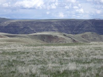
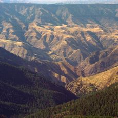
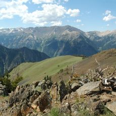
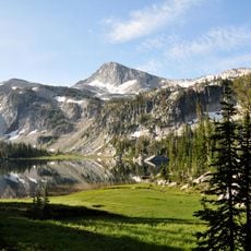
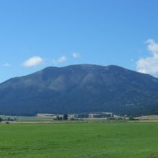
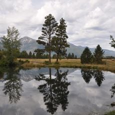
Zumwalt Prairie is a vast grassland covering roughly 330,000 acres situated on a basalt plateau in northeastern Oregon between 3,500 and 5,500 feet in elevation. Native bunchgrasses and wildflowers make up most of the vegetation across this open landscape.

This land served as home and hunting grounds for the Chief Joseph band of the Nez Perce until Euro-American settlers arrived in the 1850s. Their arrival led to the displacement of the Native American tribes from these territories.

The Nature Conservancy manages part of this grassland while working alongside local ranchers who maintain cattle herds across the prairie. This partnership shapes how the landscape looks today and shows how farming and conservation coexist in this region.

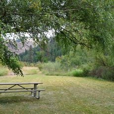
Four marked hiking trails cross this grassland and let you explore on foot through the open terrain. Bring your own water and food since this remote location has no services or facilities.

This grassland hosts one of North America's highest concentrations of hunting birds, including Ferruginous Hawks, Swainson Hawks, Golden Eagles, and Prairie Falcons. Birders and nature watchers find exceptional opportunities to spot these raptors throughout the open terrain.

The community of curious travelers

AroundUs brings together thousands of curated places, local tips, and hidden gems, enriched daily by 60,000 contributors worldwide.

Start exploring
Location
GPS coordinates
45.54000,-117.09000
Latest update
December 8, 2025 19:47
Around this place
Hells Canyon
United States of America

Hells Canyon

40 km
Wallowa Mountains
United States of America

Wallowa Mountains

37.2 km
Eagle Cap Wilderness
United States of America

Eagle Cap Wilderness

43.1 km
Hells Canyon Wilderness
United States of America

Hells Canyon Wilderness

45.9 km
Sacajawea Peak
United States of America

Sacajawea Peak

36.5 km
Hells Canyon Dam
United States of America

Hells Canyon Dam

44.9 km
Wallowa Lake Tramway
United States of America

Wallowa Lake Tramway

31.6 km
Wallowa Lake State Park
United States of America

Wallowa Lake State Park

31.7 km
Eagle Cap
United States of America

Eagle Cap

45.1 km
Mount Howard
United States of America

Mount Howard

31.9 km
Wallowa River Rest Area
United States of America

Wallowa River Rest Area

42.6 km
Iwetemlaykin State Heritage Site
United States of America

Iwetemlaykin State Heritage Site

24.4 km
Billy Meadows Guard Station
United States of America

Billy Meadows Guard Station

32.4 km
Wallowa County Courthouse
United States of America

Wallowa County Courthouse

19.4 km
OK Theatre
United States of America

OK Theatre

19.5 km
Wallowa Ranger Station
United States of America

Wallowa Ranger Station

34.8 km
Kirkland Lookout Ground House
United States of America

Kirkland Lookout Ground House

33.3 km
College Creek Ranger Station
United States of America

College Creek Ranger Station

26.7 km
William P. Warnock House
United States of America

William P. Warnock House

19.2 km
First Bank of Joseph
United States of America

First Bank of Joseph

23.7 km
Enterprise Public Library
United States of America

Enterprise Public Library

19.3 km
Flora School
United States of America

Flora School

22 km
Dr. J. W. Barnard Building and First National Bank of Joseph
United States of America

Dr. J. W. Barnard Building and First National Bank of Joseph

23.5 km
Lick Creek Guard Station
United States of America

Lick Creek Guard Station

42.2 km
Alvin M. and Betty Josephy Library of Western History and Culture
United States of America

Alvin M. and Betty Josephy Library of Western History and Culture

23.3 km
Enterprise I.O.O.F. Hall
United States of America

Enterprise I.O.O.F. Hall

19.3 km
Hunter–Morelock House
United States of America

Hunter–Morelock House

34 km
Hat Point Fire Lookout Tower
United States of America

Hat Point Fire Lookout Tower

35.3 km
Show the full map
« Zumwalt Prairie - National Natural Landmark grassland in Wallowa County, US » is provided by Around Us (aroundus.com). Images and texts are derived from Wikimedia project under a Creative Commons license. You are allowed to copy, distribute, and modify copies of this page, under the conditions set by the license, as long as this note is clearly visible.

Discover hidden gems everywhere you go!

From secret cafés to breathtaking viewpoints, skip the crowded tourist spots and find places that match your style. Our app makes it easy with voice search, smart filtering, route optimization, and insider tips from travelers worldwide. Download now for the complete mobile experience.

Around Us App Screenshot

A unique approach to discovering new places

Le Figaro

All the places worth exploring

France Info

A tailor-made excursion in just a few clicks

20 Minutes

Around Us
Travel Guide & Maps
Download

Send to your phone

QR Code
1

Open the camera app on your mobile.

2

Point at the QR code with your camera. A notification will appear.

3

Tap the notification to open the link.