Enable Location

We need your location to show you interesting places around you

Discover nearby places

Find interesting locations and hidden gems around you

Precise directions

Get accurate directions and distances to places

Your location is never shared with other users. It's only used when you tap the location button.

Gospel Hump Wilderness

Log in to your account

Start exploring — it's free

Trusted by 63,359 travelers worldwide

Continue with Google
Continue with Apple
or

We will send you a code to connect

By continuing, you accept our Terms and Conditions and our Privacy Policy

Check your inbox

We've sent a pincode in your inbox. Please enter the code below.

Gospel Hump Wilderness
Discussion Reviews 1 Photos 1 Collections
3.5k Popularity

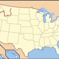
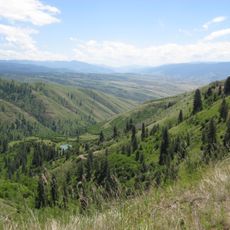
Gospel Hump Wilderness, Protected wilderness area in Idaho County, US

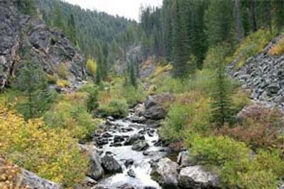
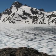
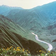
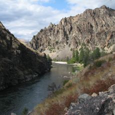
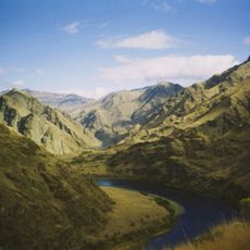
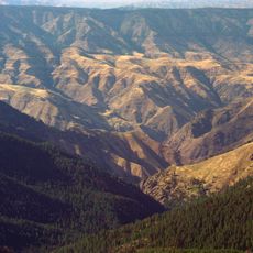
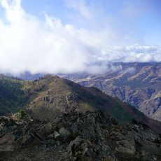
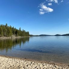
Gospel Hump Wilderness is a protected area in Idaho County that covers diverse terrain ranging from river valleys to mountain ridges. The land remains roadless, accessible only by foot or horseback, with no vehicle access permitted.

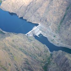
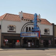
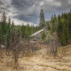
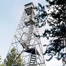
Gold was discovered nearby in the mid-1800s, drawing miners to work in the region. Mining activity continued for several decades before eventually ending as operations became less viable.

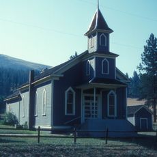
The Nez Perce people have deep roots here, having used these lands for hunting and gathering across many centuries. Names and stories of this heritage remain visible in how local communities speak about the landscape today.

Bring detailed maps and navigation tools since the terrain is unmarked and remote. The warmer months offer the best conditions for travel, as snow and water crossings can be challenging during other seasons.

This area connects to an even larger neighboring wilderness, together forming one of the vast roadless spaces in western America. The combined protected lands offer continuous country where machines never go.

The community of curious travelers

AroundUs brings together thousands of curated places, local tips, and hidden gems, enriched daily by 60,000 contributors worldwide.

Start exploring
Location
Inception
1978
GPS coordinates
45.56580,-115.77600
Latest update
December 6, 2025 17:43
Hidden gems in Idaho : remote lakes, volcanic landscapes, historic mining towns

Idaho's remote locations offer access to diverse landscapes ranging from alpine lakes nestled in mountain ranges to volcanic formations and high desert terrain. The state contains geological features formed over thousands of years, including lava tubes that preserve ice year-round, sand dunes rising...

Around this place
Hells Canyon
United States of America

Hells Canyon

70.7 km
Frank Church–River of No Return Wilderness
United States of America

Frank Church–River of No Return Wilderness

85.1 km
Hells Canyon National Recreation Area
United States of America

Hells Canyon National Recreation Area

56.5 km
Nez Perce National Historic Trail
United States of America

Nez Perce National Historic Trail

78.5 km
Hells Canyon Wilderness
United States of America

Hells Canyon Wilderness

56.5 km
Hells Canyon Dam
United States of America

Hells Canyon Dam

80.4 km
Ponderosa State Park
United States of America

Ponderosa State Park

74.2 km
Weippe Prairie
United States of America

Weippe Prairie

90 km
Polly Bemis House
United States of America

Polly Bemis House

16.9 km
White Bird Grade
United States of America

White Bird Grade

46.4 km
Blue Fox Theatre
United States of America

Blue Fox Theatre

48.1 km
Sheep Rock
United States of America

Sheep Rock

81.4 km
First Presbyterian Church
United States of America

First Presbyterian Church

73.3 km
College Creek Ranger Station
United States of America

College Creek Ranger Station

80 km
Gold Point Mill
United States of America

Gold Point Mill

38.3 km
Arctic Point Fire Lookout
United States of America

Arctic Point Fire Lookout

58.4 km
Col. E. M. Heigho House
United States of America

Col. E. M. Heigho House

76.9 km
Deep Creek Ranger Station
United States of America

Deep Creek Ranger Station

83.8 km
Elo School
United States of America

Elo School

78.9 km
James V. and Sophia Baker House
United States of America

James V. and Sophia Baker House

69.7 km
Cooper's Ferry
United States of America

Cooper's Ferry

63 km
James F. Bridwell House
United States of America

James F. Bridwell House

76.2 km
Matt Ruatsale Homestead
United States of America

Matt Ruatsale Homestead

84.8 km
Sue McBeth Cabin
United States of America

Sue McBeth Cabin

73.4 km
Gust Laituri Homestead
United States of America

Gust Laituri Homestead

81.9 km
Nickolai Wargelin Homestead
United States of America

Nickolai Wargelin Homestead

79.3 km
Hat Point Fire Lookout Tower
United States of America

Hat Point Fire Lookout Tower

70.6 km
North Beach
United States of America

North Beach

67.6 km
Show the full map
Reviews
Share your experience

No review yet

Discussions
Start a discussion...

No discussion yet

« Gospel Hump Wilderness - Protected wilderness area in Idaho County, US » is provided by Around Us (aroundus.com). Images and texts are derived from Wikimedia project under a Creative Commons license. You are allowed to copy, distribute, and modify copies of this page, under the conditions set by the license, as long as this note is clearly visible.

Discover hidden gems everywhere you go!

From secret cafés to breathtaking viewpoints, skip the crowded tourist spots and find places that match your style. Our app makes it easy with voice search, smart filtering, route optimization, and insider tips from travelers worldwide. Download now for the complete mobile experience.

Around Us App Screenshot

A unique approach to discovering new places

Le Figaro

All the places worth exploring

France Info

A tailor-made excursion in just a few clicks

20 Minutes

Around Us
Travel Guide & Maps
Download

Send to your phone

QR Code
1

Open the camera app on your mobile.

2

Point at the QR code with your camera. A notification will appear.

3

Tap the notification to open the link.