Enable Location

We need your location to show you interesting places around you

Discover nearby places

Find interesting locations and hidden gems around you

Precise directions

Get accurate directions and distances to places

Your location is never shared with other users. It's only used when you tap the location button.

Ponderosa State Park

Log in to your account

Start exploring — it's free

Trusted by 66,360 travelers worldwide

Continue with Google
Continue with Apple
or

We will send you a code to connect

By continuing, you accept our Terms and Conditions and our Privacy Policy

Check your inbox

We've sent a pincode in your inbox. Please enter the code below.

Ponderosa State Park
Discussion Reviews 1 Photos
5.5k Popularity

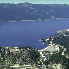
Ponderosa State Park, State park on Payette Lake in Valley County, US.

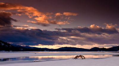
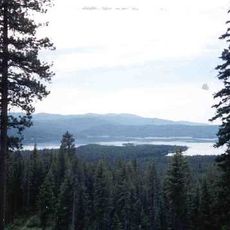
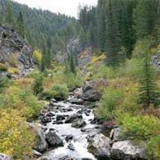
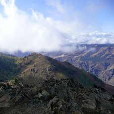
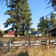
Ponderosa State Park is a state park set on a forested peninsula that juts into Payette Lake in Valley County, Idaho. The land is covered in tall ponderosa pines and the trails wind through several distinct forest types as the terrain rises and falls across the peninsula.

The park was established in 1973 by the Idaho Department of Parks and Recreation to protect the peninsula's natural resources and open them to the public. The decision came during a period when protecting wild land while keeping it accessible had become a growing priority across the American West.

The forests around Payette Lake have long been part of the homeland of the Nez Perce and Shoshone-Bannock peoples, who hunted and gathered here across generations. Walking through the old pine groves today, visitors move along routes that carried meaning long before the park existed.

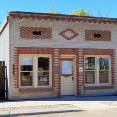
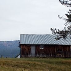
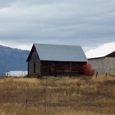
The park has campgrounds and cabins along the lakeshore, and reserving a spot well ahead of your visit is a good idea, particularly in summer when demand is high. The main entrance is near the town of McCall and is easy to find from the main road.

In winter, the park's trail network is groomed for Nordic skiing, turning the same paths that hikers use in summer into a system of cross-country ski routes. The park is one of the few in Idaho where this seasonal shift makes it genuinely usable and enjoyable across all four seasons.

The community of curious travelers

AroundUs brings together thousands of curated places, local tips, and hidden gems, enriched daily by 60,000 contributors worldwide.

Start exploring
Location
Inception
1973
GPS coordinates
44.93450,-116.07800
Latest update
March 3, 2026 10:08
Around this place
Hells Canyon
United States of America

Hells Canyon

65.6 km
Frank Church–River of No Return Wilderness
United States of America

Frank Church–River of No Return Wilderness

89.7 km
Lake Cascade
United States of America

Lake Cascade

37.4 km
Hells Canyon National Recreation Area
United States of America

Hells Canyon National Recreation Area

81.1 km
Hells Canyon Wilderness
United States of America

Hells Canyon Wilderness

76.1 km
Hells Canyon Dam
United States of America

Hells Canyon Dam

59.7 km
Wallowa Lake Tramway
United States of America

Wallowa Lake Tramway

94.1 km
Deadwood Reservoir
United States of America

Deadwood Reservoir

79.1 km
Gospel Hump Wilderness
United States of America

Gospel Hump Wilderness

74.2 km
Polly Bemis House
United States of America

Polly Bemis House

64.1 km
Lake Cascade State Park
United States of America

Lake Cascade State Park

46 km
Mount Howard
United States of America

Mount Howard

93.8 km
Sheep Rock
United States of America

Sheep Rock

54.7 km
North Fork Payette River Bridge
United States of America

North Fork Payette River Bridge

67.8 km
Salubria Lodge No. 31
United States of America

Salubria Lodge No. 31

62.1 km
College Creek Ranger Station
United States of America

College Creek Ranger Station

78.4 km
Council Ranger Station
United States of America

Council Ranger Station

35.9 km
Adams County Courthouse
United States of America

Adams County Courthouse

36.6 km
Lick Creek Guard Station
United States of America

Lick Creek Guard Station

79.2 km
Col. E. M. Heigho House
United States of America

Col. E. M. Heigho House

16.5 km
Elo School
United States of America

Elo School

5.6 km
Wilson House
United States of America

Wilson House

62.2 km
Cambridge News Office
United States of America

Cambridge News Office

62 km
Matt Ruatsale Homestead
United States of America

Matt Ruatsale Homestead

12.1 km
Gust Laituri Homestead
United States of America

Gust Laituri Homestead

8.2 km
Nickolai Wargelin Homestead
United States of America

Nickolai Wargelin Homestead

5.7 km
Hat Point Fire Lookout Tower
United States of America

Hat Point Fire Lookout Tower

72.4 km
Heavens Gate Lookout
United States of America

Heavens Gate Lookout

58.4 km
Show the full map
Reviews
Share your experience

No review yet

Discussions
Start a discussion...

No discussion yet

« Ponderosa State Park - State park on Payette Lake in Valley County, US » is provided by Around Us (aroundus.com). Images and texts are derived from Wikimedia project under a Creative Commons license. You are allowed to copy, distribute, and modify copies of this page, under the conditions set by the license, as long as this note is clearly visible.

Discover hidden gems everywhere you go!

From secret cafés to breathtaking viewpoints, skip the crowded tourist spots and find places that match your style. Our app makes it easy with voice search, smart filtering, route optimization, and insider tips from travelers worldwide. Download now for the complete mobile experience.

Around Us App Screenshot

A unique approach to discovering new places

Le Figaro

All the places worth exploring

France Info

A tailor-made excursion in just a few clicks

20 Minutes

Around Us
Travel Guide & Maps
Download

Send to your phone

QR Code
1

Open the camera app on your mobile.

2

Point at the QR code with your camera. A notification will appear.

3

Tap the notification to open the link.