Little Pend Oreille National Wildlife Refuge

Log in to your account

AroundUs is a community-driven map of interesting places, built by curious explorers like you. It grows with every review, story, and photo you share.
Connect to save your favorite spots, contribute locations, and create personalized routes.
Continue with Google
Continue with Apple
Continue with X
Continue with Facebook
Continue with email
By continuing, you accept our Terms and Conditions and our Privacy Policy
Create an account

Little Pend Oreille National Wildlife Refuge

Add to collection
Map
Suggest a change
Share

Little Pend Oreille National Wildlife Refuge, National wildlife refuge in Pend Oreille County, United States.

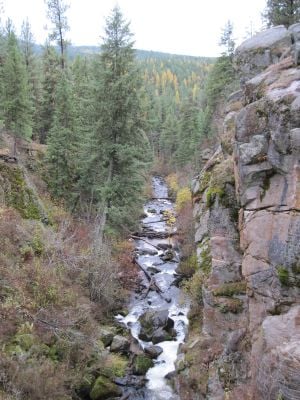
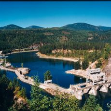
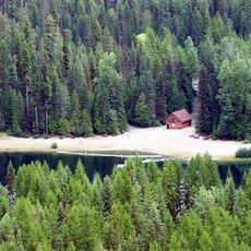
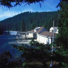
Little Pend Oreille National Wildlife Refuge is a protected area with mixed conifer forests, meadows, lakes, and rivers in the mountains of Washington state. The landscape includes several forest types and water habitats, each supporting different plants and animals.

The refuge was established in 1939 to protect the area's diverse wildlife. It has served as an important sanctuary for species in a mountainous forest setting that is uncommon elsewhere in the region.

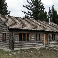
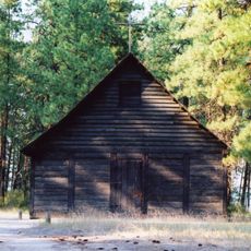
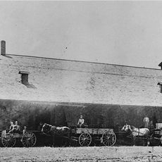
An auto tour with twelve stops lets visitors learn about the area's past, including how early settlers and logging shaped the landscape. The route weaves together the land and its history in a way that unfolds naturally as you drive through.

Visitors can hike, fish, camp, and watch wildlife along various routes, with certain areas set aside for specific activities. Rules change by season, so checking conditions before your visit helps you plan better.

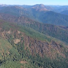
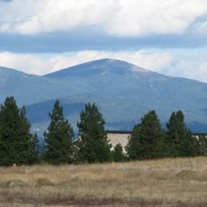
Within the refuge are six different forest types that change with elevation, each hosting different tree and animal species. This variety exists because different conditions at different heights support different life.

Location: Pend Oreille County

Inception: 1939

Website: https://fws.gov/refuge/little_pend_oreille

GPS coordinates: 48.48330,-117.61700

Latest update: December 12, 2025 12:01

Photos
Around this place
Kettle Falls
United States of America

Kettle Falls

40.2 km
Salmo-Priest Wilderness
United States of America

Salmo-Priest Wilderness

59.3 km
Colville National Forest
United States of America

Colville National Forest

22.8 km
Albeni Falls Dam
United States of America

Albeni Falls Dam

56.8 km
Mount Spokane State Park
United States of America

Mount Spokane State Park

72.4 km
Metaline Falls-Nelway Border Crossing
Canada

Metaline Falls-Nelway Border Crossing

62.1 km
Fort Colvile
United States of America

Fort Colvile

21 km
Crawford State Park Heritage Site
United States of America

Crawford State Park Heritage Site

59.8 km
Box Canyon Dam
United States of America

Box Canyon Dam

36.3 km
St. Paul's Mission
United States of America

St. Paul's Mission

39.5 km
Laurier-Cascade Border Crossing
Canada

Laurier-Cascade Border Crossing

72.8 km
Mount Kit Carson
United States of America

Mount Kit Carson

72.2 km
Champion Lakes Provincial Park
Canada

Champion Lakes Provincial Park

78.1 km
Kettle Falls Bridges
United States of America

Kettle Falls Bridges

40.1 km
Kettle Falls Railroad Bridge
United States of America

Kettle Falls Railroad Bridge

40.1 km
Old Apple Warehouse
United States of America

Old Apple Warehouse

35.3 km
Metaline Falls Bridge
United States of America

Metaline Falls Bridge

46.1 km
Spokane River Bridge at Long Lake Dam
United States of America

Spokane River Bridge at Long Lake Dam

73.8 km
Northport Bridge
United States of America

Northport Bridge

50.3 km
Colville Opera House and Odd Fellows Hall
United States of America

Colville Opera House and Odd Fellows Hall

22.4 km
Orient Bridge
United States of America

Orient Bridge

60.3 km
Box Canyon Bridge
United States of America

Box Canyon Bridge

36.4 km
Dr. John and Viola Phillips House and Office
United States of America

Dr. John and Viola Phillips House and Office

54.1 km
Columbia River Skywalk
Canada

Columbia River Skywalk

68.3 km
Mount Spokane Vista House
United States of America

Mount Spokane Vista House

72.7 km
St. Andrew's United Church (Rossland, British Columbia)
Canada

St. Andrew's United Church (Rossland, British Columbia)

67.5 km
Rossland Court House
Canada

Rossland Court House

67.4 km
United States Border Station
United States of America

United States Border Station

62 km
Show the full map
Reviews

Visited this place? Tap the stars to rate it and share your experience / photos with the community! Try now! You can cancel it anytime.

« Little Pend Oreille National Wildlife Refuge - National wildlife refuge in Pend Oreille County, United States » is provided by Around Us (aroundus.com). Images and texts are derived from Wikimedia project under a Creative Commons license. You are allowed to copy, distribute, and modify copies of this page, under the conditions set by the license, as long as this note is clearly visible.

Discover hidden gems everywhere you go!

From secret cafés to breathtaking viewpoints, skip the crowded tourist spots and find places that match your style. Our app makes it easy with voice search, smart filtering, route optimization, and insider tips from travelers worldwide. Download now for the complete mobile experience.

Around Us App Screenshot

A unique approach to discovering new places

Le Figaro

All the places worth exploring

France Info

A tailor-made excursion in just a few clicks

20 Minutes