Enable Location

We need your location to show you interesting places around you

Discover nearby places

Find interesting locations and hidden gems around you

Precise directions

Get accurate directions and distances to places

Your location is never shared with other users. It's only used when you tap the location button.

Box Canyon Dam

Log in to your account

Start exploring — it's free

Trusted by 63,552 travelers worldwide

Continue with Google
Continue with Apple
or

We will send you a code to connect

By continuing, you accept our Terms and Conditions and our Privacy Policy

Check your inbox

We've sent a pincode in your inbox. Please enter the code below.

Discussion Reviews 1 Photos
2.6k Popularity

Box Canyon Dam, Hydroelectric power station in Pend Oreille County, Washington, United States.

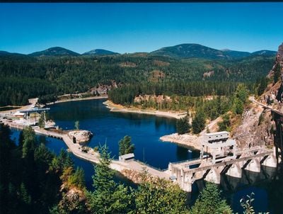
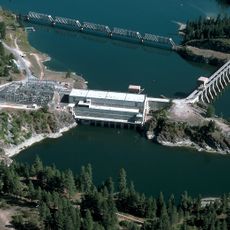
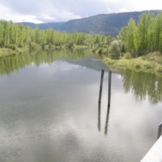
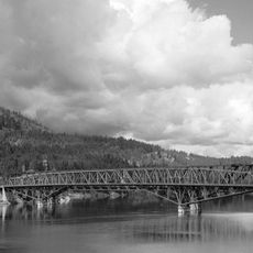
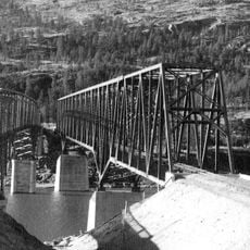
Box Canyon Dam is a hydroelectric facility on the Pend Oreille River in Washington that converts flowing water into electricity using four Kaplan turbines. The structure spans approximately 160 feet and generates power continuously from the river's natural current.

This facility was completed in 1952 by the Pend Oreille Public Utility District as an independent project without government funding. The dam represented a local effort to develop hydroelectric power in the region.

The facility demonstrates the Pacific Northwest region's commitment to clean energy production through hydroelectric infrastructure development.

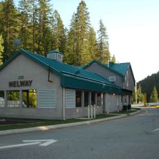
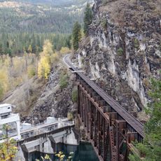
The site provides access to learning about hydroelectric production, particularly during warmer months when guided tours operate from the information center. Visitors should allow time to explore the river area and surrounding grounds.

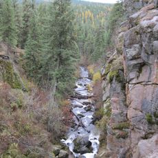
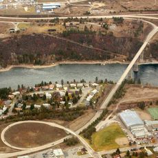
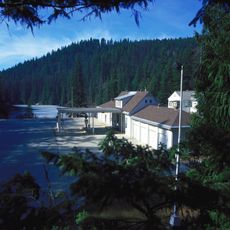
The facility manages about 750 acres of wild habitat along the river and operates fish net pens there to manage trout populations. This combination of power generation and fish farming on the same site is visible to visitors.

The community of curious travelers

AroundUs brings together thousands of curated places, local tips, and hidden gems, enriched daily by 60,000 contributors worldwide.

Start exploring
Inception
1952
Length
49 m
GPS coordinates
48.78030,-117.41200
Latest update
December 12, 2025 16:40
Around this place
Kettle Falls
United States of America

Kettle Falls

53.6 km
Salmo-Priest Wilderness
United States of America

Salmo-Priest Wilderness

24.1 km
Colville National Forest
United States of America

Colville National Forest

24.5 km
Albeni Falls Dam
United States of America

Albeni Falls Dam

73.5 km
Metaline Falls-Nelway Border Crossing
Canada

Metaline Falls-Nelway Border Crossing

25.8 km
Fort Colvile
United States of America

Fort Colvile

44.5 km
Little Pend Oreille National Wildlife Refuge
United States of America

Little Pend Oreille National Wildlife Refuge

36.3 km
Crawford State Park Heritage Site
United States of America

Crawford State Park Heritage Site

24.1 km
Kootenai National Wildlife Refuge
United States of America

Kootenai National Wildlife Refuge

74.1 km
St. Paul's Mission
United States of America

St. Paul's Mission

53.9 km
Laurier-Cascade Border Crossing
Canada

Laurier-Cascade Border Crossing

64.3 km
Brilliant Suspension Bridge
Canada

Brilliant Suspension Bridge

61.9 km
Champion Lakes Provincial Park
Canada

Champion Lakes Provincial Park

47.6 km
Kettle Falls Bridges
United States of America

Kettle Falls Bridges

54.6 km
Kinnaird Bridge
Canada

Kinnaird Bridge

60 km
Kettle Falls Railroad Bridge
United States of America

Kettle Falls Railroad Bridge

54.6 km
Old Apple Warehouse
United States of America

Old Apple Warehouse

50.9 km
Metaline Falls Bridge
United States of America

Metaline Falls Bridge

9.9 km
Northport Bridge
United States of America

Northport Bridge

31 km
Colville Opera House and Odd Fellows Hall
United States of America

Colville Opera House and Odd Fellows Hall

44.9 km
Orient Bridge
United States of America

Orient Bridge

58.4 km
Salmo railway station
Canada

Salmo railway station

47.1 km
Box Canyon Bridge
United States of America

Box Canyon Bridge

136 m
Dr. John and Viola Phillips House and Office
United States of America

Dr. John and Viola Phillips House and Office

72 km
Columbia River Skywalk
Canada

Columbia River Skywalk

40.9 km
St. Andrew's United Church (Rossland, British Columbia)
Canada

St. Andrew's United Church (Rossland, British Columbia)

43.5 km
Rossland Court House
Canada

Rossland Court House

43.4 km
United States Border Station
United States of America

United States Border Station

25.7 km
Show the full map
Reviews
Share your experience

No review yet

Discussions
Start a discussion...

No discussion yet

« Box Canyon Dam - Hydroelectric power station in Pend Oreille County, Washington, United States » is provided by Around Us (aroundus.com). Images and texts are derived from Wikimedia project under a Creative Commons license. You are allowed to copy, distribute, and modify copies of this page, under the conditions set by the license, as long as this note is clearly visible.

Discover hidden gems everywhere you go!

From secret cafés to breathtaking viewpoints, skip the crowded tourist spots and find places that match your style. Our app makes it easy with voice search, smart filtering, route optimization, and insider tips from travelers worldwide. Download now for the complete mobile experience.

Around Us App Screenshot

A unique approach to discovering new places

Le Figaro

All the places worth exploring

France Info

A tailor-made excursion in just a few clicks

20 Minutes

Around Us
Travel Guide & Maps
Download

Send to your phone

QR Code
1

Open the camera app on your mobile.

2

Point at the QR code with your camera. A notification will appear.

3

Tap the notification to open the link.